I have been on a quest to activate 100 parks to earn my Arizona Agave activator certificate and, as a benefit, generate material for PN&R. It involved a few long roves, including one down into the Carolinas. Mt. Tom was the first place I revisited after hitting 100 unique parks, which should tell you something about its appeal. It wasn’t even that I’d been there early in the quest and had a twinge of nostalgia — I’d been up on top doing a combined SOTA and POTA op just a few weeks before — it was that I just couldn’t wait to get back on the trail there.
The hill has always been popular. It rises up along the Connecticut River, part of the Metacomet ridge that includes nearby Mt. Holyoke and Mt. Skinner. Just like Skinner, there was a hotel / retreat situated near the top in the late 1800s offering broad views of the river valley, and more recently a ski slope graced one side. On the south you’ll find a large quarry where basalt was blasted and crushed to be used for things like railway beds. Until the 1940s a cog railway would take visitors up to the summit to enjoy the view, and a small amusement park operated at the base, near the railway. The ski slope was closed in 1998.

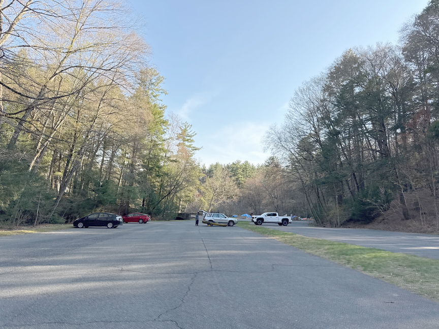
This is a large site, nearly 2,000 acres, and there are dozens of places to park. Cutouts along the roads that wind through the park can accommodate small numbers of cars, two or three at most, and you’ll find them every quarter of a mile or so. A quick search around the parking spot will yield a trailhead. The two primary parking areas, though, are along Reservation Road. On the west you’ll find a Visitor Center with restrooms, information about the park, maps, and the like. There’s a play area for kids opposite the center with slides, jungle gyms, and other activities styled around the outdoorsy vibe. Take note that there are gates on Reservation Road on both ends, and they can close pretty early. Prior to May that’s 4:00pm, and on my most recent visit right at the start of May it was 6:00pm.
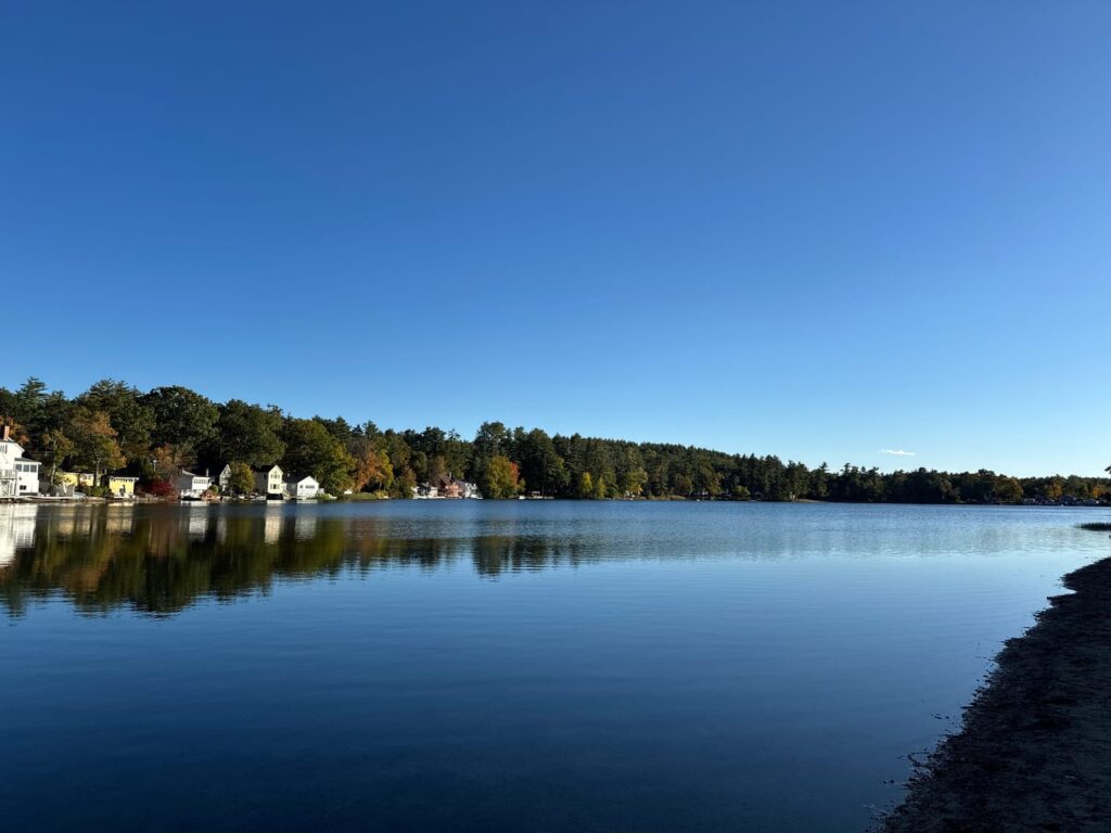
On the east side of the park, also on Reservation Road, you’ll find a very large parking area near Lake Bray. Of the two, this is by far the largest spot, and if I were going to do an activation from a picnic table or near my car, this is the place I’d stop to do it. The lake is easily accessible, too, so if you like kayaking maybe try a little maritime-mobile POTA. Just off of the west side of the lake you’ll find a trail (as I recall it’s marked Universal Access) that acts as a feeder for several of the popular trails in the park.
The trails here are for the most part gradual climbs along a line of elevation followed by a short ascent to the next one, and you can dial in the level of activity that you want fairly easily. Loop trails around the lake are flat and broad, or you can opt for some of the more ‘interesting’ routes up to the top. US-4556 Appalachian Trail National Scenic Trail crosses the reserve on the southeast, so there’s an opportunity for a two-fer with it if you are so inclined. You’ll also find connections to the Metacomet Trail and the New England Trail. The trails are very well marked with blazes and intersection signs, and you can pick up a paper map at several locations throughout the park. I always carry a paper map with me, even though I primarily use my iPhone and GaiaGPS app to navigate around. More than once I’ve pulled out the phone to discover a dead battery, and having a paper backup is just common sense.

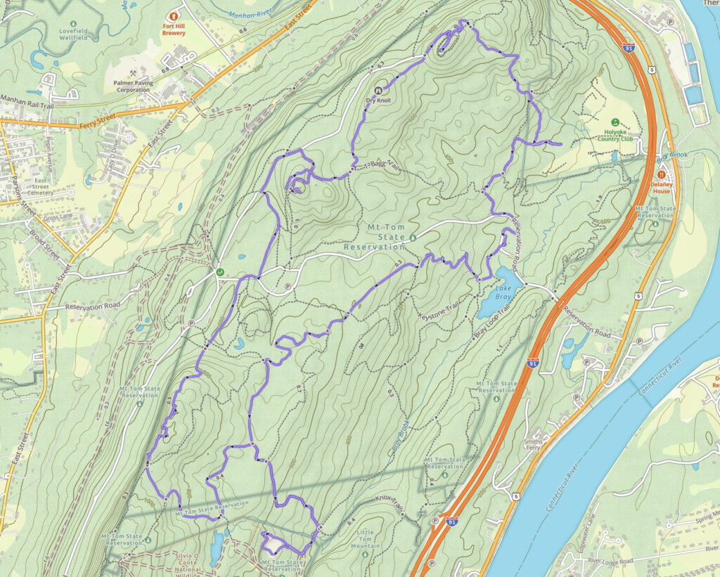
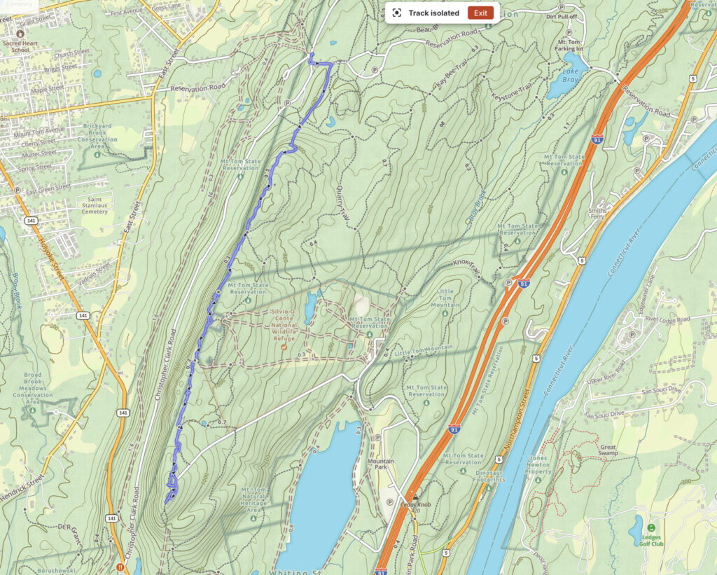
The route that I took from Lake Bray to the quarry, and then up to the western ridge line are shown on the topo map below, starting at lake Bray and then heading south. The quarry itself is the white blob at the bottom. Once you’ve climbed the eastern side of the ridge the path is relatively easy down to the quarry, and you’ll be walking through a typical New England forest. This side of the mountain is quite different from the opposite, it’s gentler, there are fewer basalt outcroppings, and you’ll catch the occasional glimpse of the Connecticut River as it meanders to the east. If you happen to be in the park when the leaves are off the trees, you’ll have better views in this section.
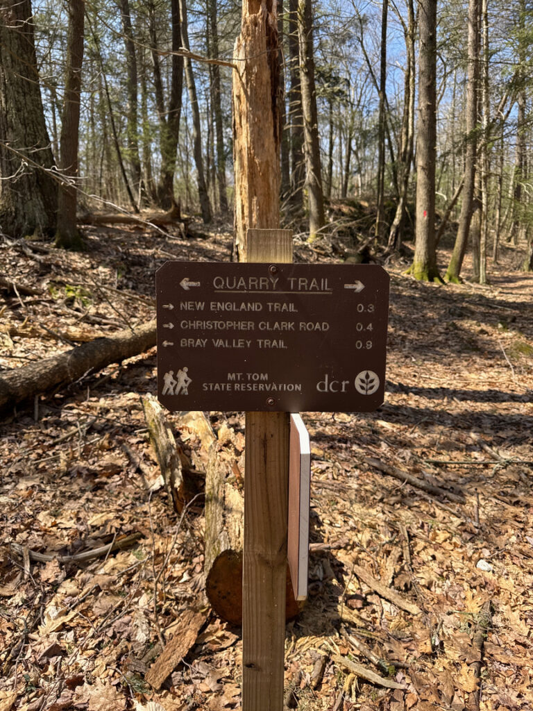
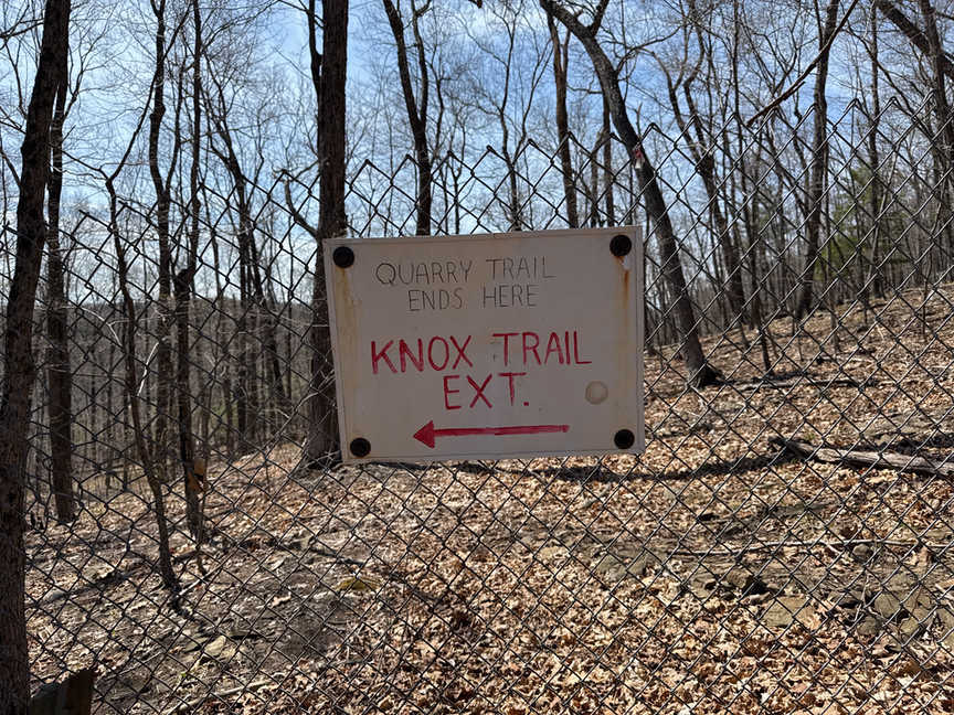
The quarry comes as a bit of a surprise, and the Quarry Trail ends abruptly, with a sign directing you around.
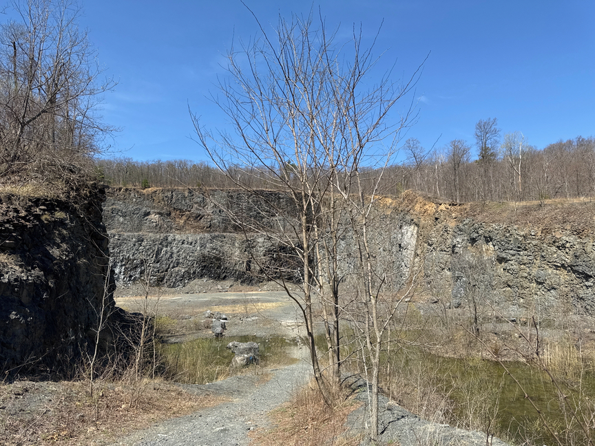
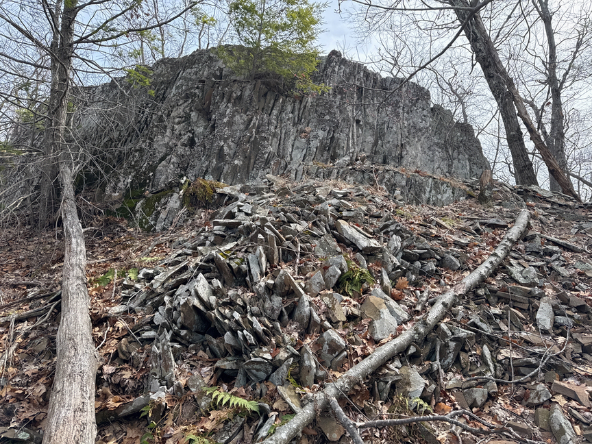
The quarry itself is a recent acquisition by the state, and it was a working site not that long ago, blasting and crushing the traprock basalt that the mountain is primarily made up of. You can walk around the short fence in the photo and over to the edge of the pit, something that I didn’t do this time out but plan to on the next trip. As a recent addition to the state’s property, there’s no signage, and technically it is off limits to visitors, though there are no barriers or fencing. I took the Knox trail around, and then up a short path to the quarry entrance, which was jaw-dropping. You come around a little bend and across a short access road, and then right in front of you is about a 20-acre pit with 200-foot faces all around.
I’ve been in a fair number of quarries, but for the most part they were small, human- or steam- powered operations pulling ore or slates and granites off of cliff faces. This one was a full-on commercial operation, with stone crushers, a coal-fired power plant, and lots and lots of explosives. The scale is tough to see in the photos — the walls are very high and nearly vertical. On the north side there’s a waterfall which was just trickling when I visited, but I’m thinking after a solid rain or earlier in the spring it’d be a spectacular 150-foot falls.
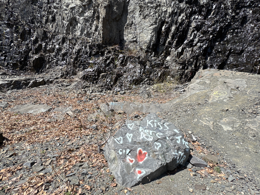
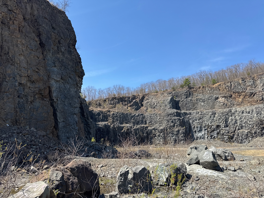
The state of Massachusetts is currently trying to decide what to do with the quarry. An early idea was to fill it in with clean fill from other projects around the state, but the scale and environmental impact quickly became impediments. This was successfully done at Quincy Quarry near Boston, but that was a much smaller operation. The main concern here is safety. I’m on the side of leaving it as it sits — I find a lot of beauty in the exposed faces, and wildlife like Peregrine falcons are already moving in. I was surprised to see little evidence of rock-climbing activity, but maybe that will come, as it has only been a few years since the excavators and blasting rigs moved out.
One final note on the quarry, which is that I don’t believe it is included in the boundaries of US-8417, being a recent acquisition. It just means that there’s no POTA reference at the site of the quarry itself. It’s worth checking a recent map if a quarry op is something that you had in mind.
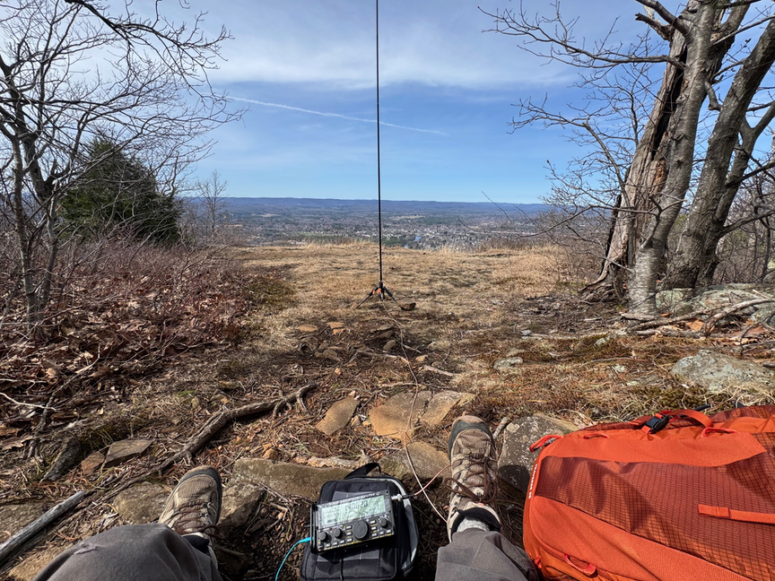
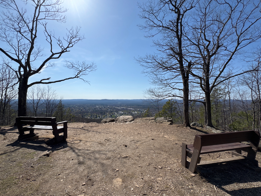
I reluctantly headed back north to pick up a short trail running along and then up a slope to connect to the main north-south ridgeline trail, which in this area is both the Metacomet and the New England Trail, running along the western part of the park. I’d hiked the length of the ridge a few weeks prior and for this hike decided not to summit Mt. Tom itself. Instead, I headed for Whiting Peak, which is a few hundred feet lower. There are some beautiful vistas here, and I set up shop at the top of an outcrop in the shade of a young pine.
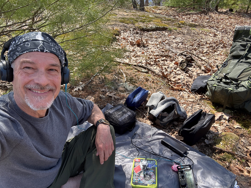
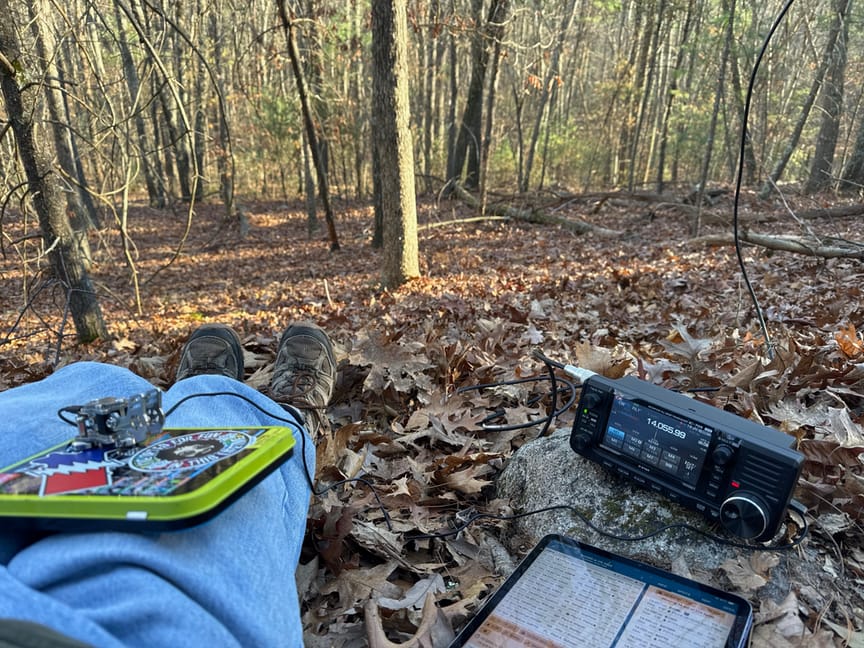
Yes, I like to operate barefoot, after a few hours on the trail it’s a treat to air everything out. I always carry a set of dry socks in the pack, it’s one of those small things that makes a big difference. The bands were in fair shape, and I logged 14 CW QSOs in about half an hour on the KX2 and a 17-foot whip.
This side of the park is quite different from the east side. You are standing in a fascinating spot here, geologically speaking. The valley is a rift valley, formed when the land masses that would form North America and Africa started to tear apart and separate during the Triassic and Jurassic eras. Imagine taking a big wad of pizza dough and stretching it apart. The rift here was the small one…a much larger rift a few hundred miles to the east would become the Atlantic ocean. In Massachusetts and Connecticut, though, lava flows and volcanoes triggered by the enormous amounts of energy being released created broad lakes of lava which subsequently cooled and crystallized, forming the basalt that makes up most of the ridges in this area.
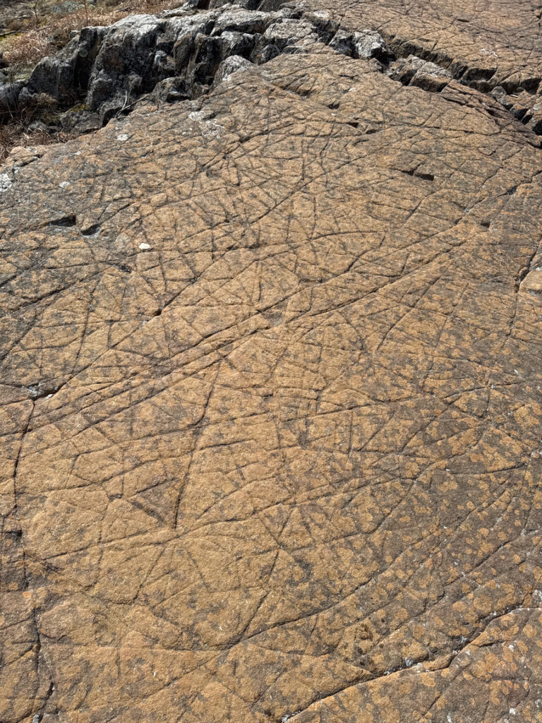
The photo above is a typical section of basalt that shows patterns of stress fractures. You can think of basalt a little like glass — it was laid down in sheets as magma flowed over older deposits, and it crystallized as it cooled. The crystal structure is evident in the way the rock fractures along clean lines rather than coming apart in chucks the way a sediment-based rock would. Also, a piece of basalt will ring out like ceramic or porcelain when it is struck. The stress came from layer and layers and layers of rock over millions of years.
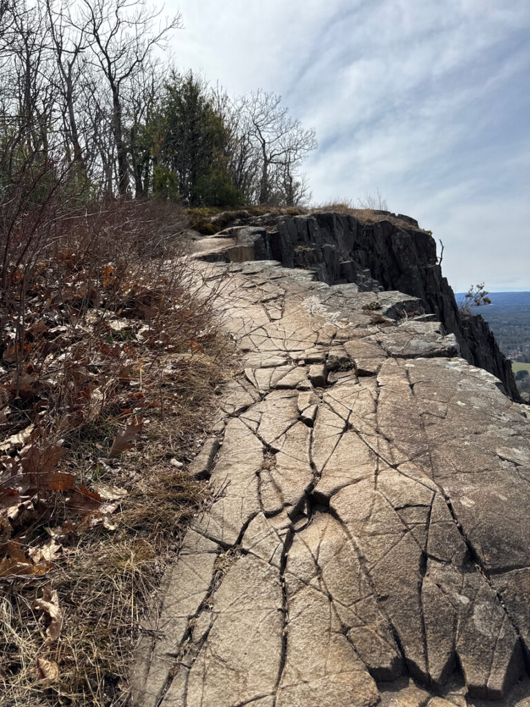
The two pictures above on the right and below show what’s going on inside the rock. It fractures along the lines of crystallization, and then as the rock erodes it starts to come apart. Notice that these outcrops look nearly vertical — that’s not how they were originally formed. These are basalt sheets that have been pushed up by tectonic activity — the movement of the crust — and have been rotated to be nearly vertical in places. The softer sedimentary rock eroded away to create these dramatic, thrusting basalt features.
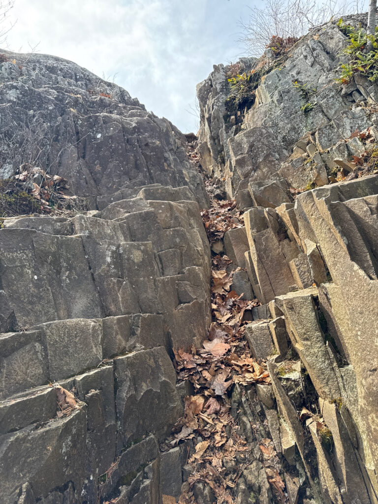
This is classic Holyoke basalt, and you’ll find it along the edges of the massive rift that extends down in the New York and Connecticut valleys. It also known as Traprock basalt, because the Swedish word for ‘step’ is ‘trappa’, and as you can see below it does indeed come apart in what seem to be steps in some cases. That’s the Metacomet trail heading up over an outcropping.
You would think that the summit of Mt. Tom would be inside Mt. Tom State Reservation, but in fact it isn’t, instead it’s about a half a mile away. For this trip, which I did a few weeks before the quarry visit, I intended to do both a POTA and a SOTA activation. Practically speaking it meant that I set up and activated the POTA site, took everything down, hiked another half mile to the actual summit, and set it all back up again for the SOTA. Here’s the map from that trip, you can see that I parked on the north / west end of Reservation Road and hiked all the way down the ridge to the south.
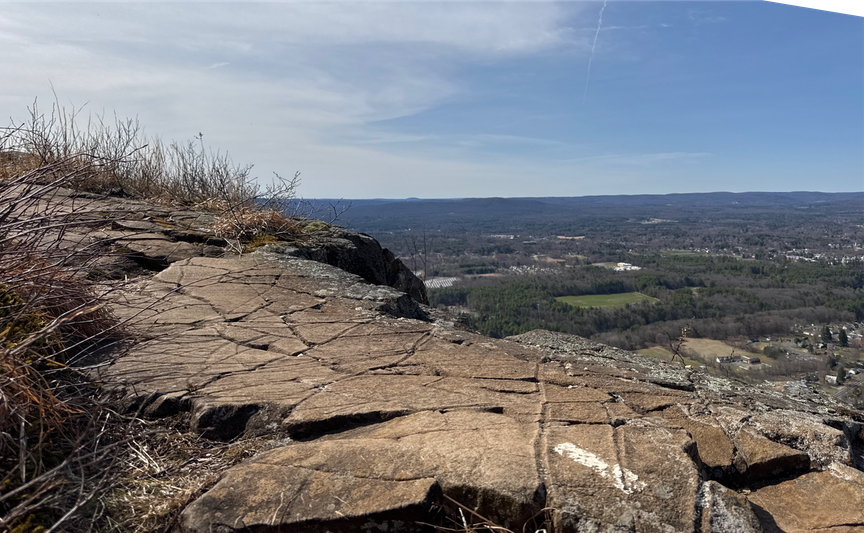
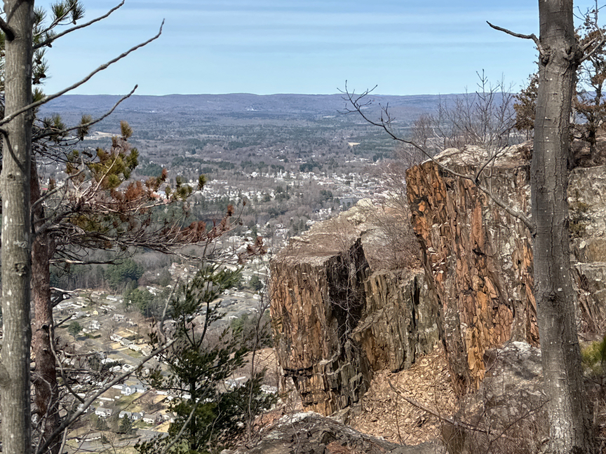
Of the two recent trips, I enjoyed the hike along the Metacomet trail to be the prettier. Once you get up on the ridge outside the parking lot, the views just keep getting better and better as you work your way south toward the peak. On the east side you are walking on the slope, and to be fair there are lovely views of the Connecticut River along the way, but on the west side it is much more spectacular. I’ll note that there are several spots that are a little close to the edge — you can see one in an earlier photo — but there’s always a gentler way to go around. I’ll confess to crawling across one or two spots, and I’m so happy that I didn’t run into a couple of young hikers who would’ve seen an old man with a large pack slithering along the ground.
So, what’s at the top?
Mt. Tom was a popular ski area, and one of the first to employ snowmaking. It closed for good in 1998, and the chalet, accommodations, lifts, and other structures have been either removed or destroyed by fires over the years since. You’ll still see plenty of evidence of what used to be there, and the slopes themselves are still used by locals during ski season. And, of course, being a high spot in New England means that there are plenty of communications towers and antennas up top.
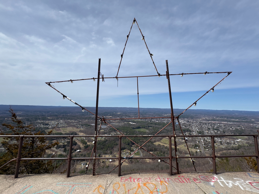
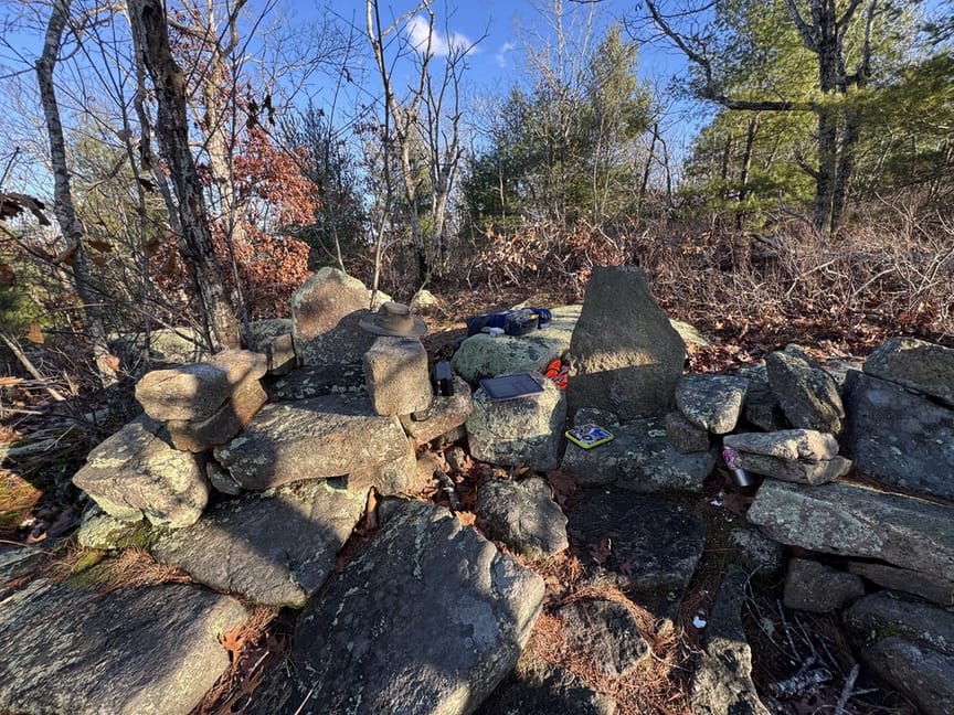
There’s not much supporting that concrete in the picture, by the way. And, like most peaks around here, someone has stolen the survey marker, although you can still see the divot that it used to live in. For the SOTA I moved down from the peak a touch and set up in a spot with a nice view.
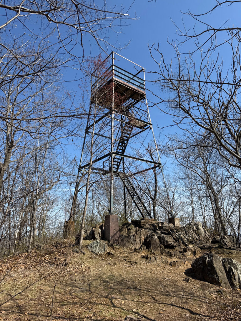
From this spot on the Metacomet trail you can hike north along the ridge, across Whiting and up toward Goat Peak. I happened to be hiking during the spring hawk migration and it was nice to catch glimpses of them gliding along the ridge. Up on Goat is a rarity, an unattended lookout tower. Normally when you run into one of these it is surrounded by fences and locked six different ways lest someone fling themselves from the top, but this one is maintained as a spot to watch hawks from.
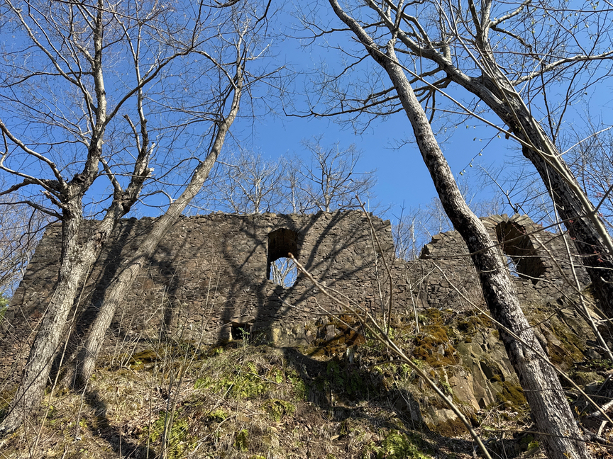
Hills like Mt. Tom have been popular with people ever since there were people, and just to the north of Goat Peak you will find the remains of Eyrie House, a lodge that was active in the late 1800s and into the early 1900s. Guests enjoyed fine dining, views of the valley, drinks in the gardens, and games for the kids. All that is left now are foundations and a few standing walls, but there’s a self-guided tour of the grounds that has a bit of description and a photo of what used to be there at several locations, which I found to be very cool.
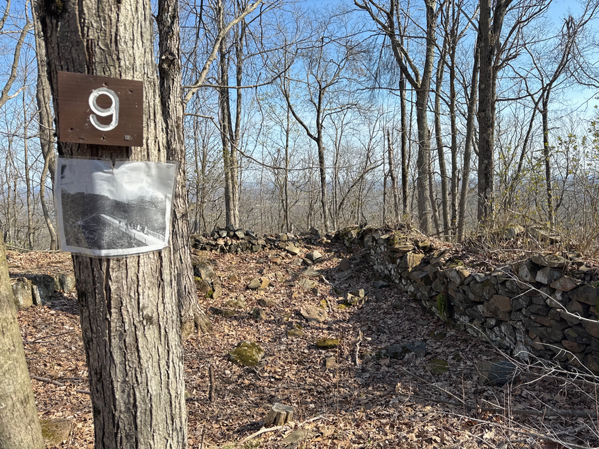
One feature I found both poignant and funny is on a low wall near the benches in the photo on the right. There was a spot for some chairs here overlooking the valley, and at some point around the turn of the 20th century two people pushed their hands into soft cement on the wall. To my eye it looks like a mother and daughter, sitting on Adirondacks and enjoying the view and a sip of lemonade on a bright summer day. What I love even more is that when they left to go inside and freshen up for the afternoon’s events, a squirrel decided to do exactly the same thing!
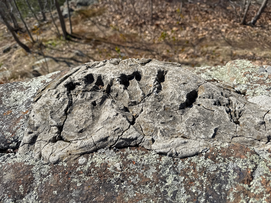
Speaking of handprints, there’s one more spot to visit on your day at Mt. Tom. At the base of the hill, along the Connecticut River, just off of Route 5 you’ll find a small Trustees of Reservations sign next to a cutout that offers parking for four or five cars. Park, walk a very short distance down the embankment at the side of the road, and you will be standing on a section of mudstone that hold hundreds and hundreds of dinosaur tracks.
They are just out in the open, and you can walk on them, touch them, or, like I did, roll around on them and giggle like a five-year-old.
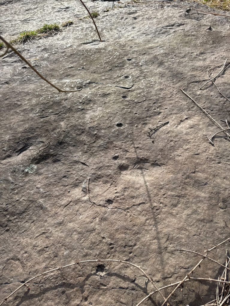
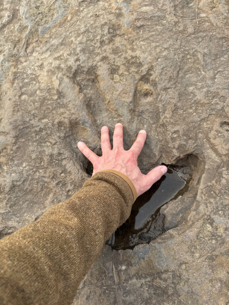
On the left, a small three-toed creature walked away from the river. You can see that it was raining that day from the raindrop impressions on the stone. On the right is a print left by a much larger Eubrontes, a 20-foot-tall ancestor of T. Rex. These tracks were laid down on a rainy Tuesday about 200 million years ago, and today the 8-acre site is managed by the Trustees of Reservations.
There’s a much larger, better-preserved track site in Middletown, Connecticut at Dinosaur State Park, which ALSO happens to be a POTA reference, so if you like dinos you know what you have to do. The tracks, thousands of them, are exposed and preserved under a dome along with fossils found nearby. It’s well worth a trip, but you aren’t going to get to roll around on those the way you can here in Holyoke!

One Response
Wow, that’s some really exciting geology! Great shots