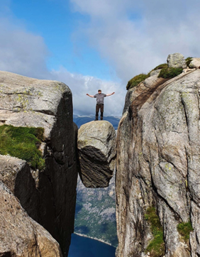
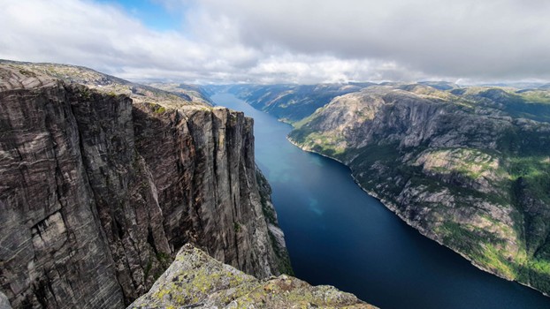
When people think about Norwegian nature, they usually think about deep fjords surrounded by tall snow-capped mountains. A perfect example of that is Frafjordheiane landscape reserve, located in Western Norway. Frafjordheiane is more than just mountains though, in the lower parts you’ll find rivers, lakes and lush forests, and in the higher parts you find the world-famous Kjerag boulder, where you can stand on a boulder suspended 975 meters (3 200 feet) above the fjords
Frafjordheiane covers 419 km² (~104 k acres) and is like most nature in Norway accessible and free to access for everyone. The easiest way to get here is through Stavanger, which has both an international airport and a lot of cruise ship visitors. I’ve activated Frafjordheiane ten times over the last years, and in this article, I’ll tell you about a few of the ways you can get into this nature reserve.
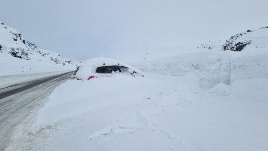
The easiest way into Frafjordheiane is from the south-east, with a very short hike from the closest road. This is the easiest place to get into the area during winter, but it can also be a very challenging drive in severe weather conditions, with the road closing several times each winter due to blizzard conditions. The views are great, but you are far from the more amazing scenery you get in the harder to reach areas.
The most common way to go into Frafjordheiane is from the east, near Kjerag, which is a very popular tourist destination in summer. It’s important to know that the hike to Kjerag is a severe / black level hike, which will take you anything from four to six hours, so it’s not a trip for everyone. There are many ways to get here. You can take a bus, ferry or drive yourself. The road to the starting area for Kjerag is closed in winter and usually gets cleared of snow in late May and stays open until October / November, depending on weather conditions.
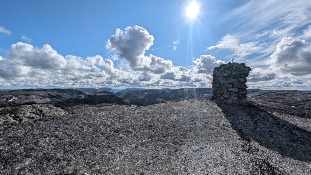
Throughout the area you’ll find a large network of trails and cabins operated and maintained by the Norwegian tourist association (DNT). The trails vary from well marked to almost invisible. Most of the major ones are marked with signposts, painted red T’s and small cairns, while the lesser travelled ones are only visible as tracks in the scarce vegetation. Weather can change fast, and the fog being so high up is frequent. Having good maps, a compass and a GPS with the correct maps installed is critical, especially when travelling alone. In some of the cabins you’ll find emergency rations or simple foods you can purchase in an app, so depending on where you’re going you may not need to bring much food. You’ll find water in creeks and small lakes throughout the area, but since there’s a lot of animals around it can be a safe choice to bring water filtration options, or to boil the water before drinking it.
I’ve visited a cabin named Langavatn on three of my trips, as it’s easily accessible with only an hour’s hike or so. The cabins are placed roughly half a day’s march between and are very popular by hikers that go for several days. The cabin is also placed relatively close to Kjerag.
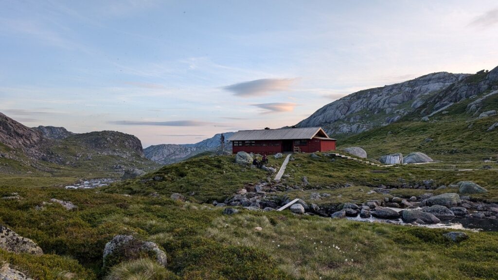
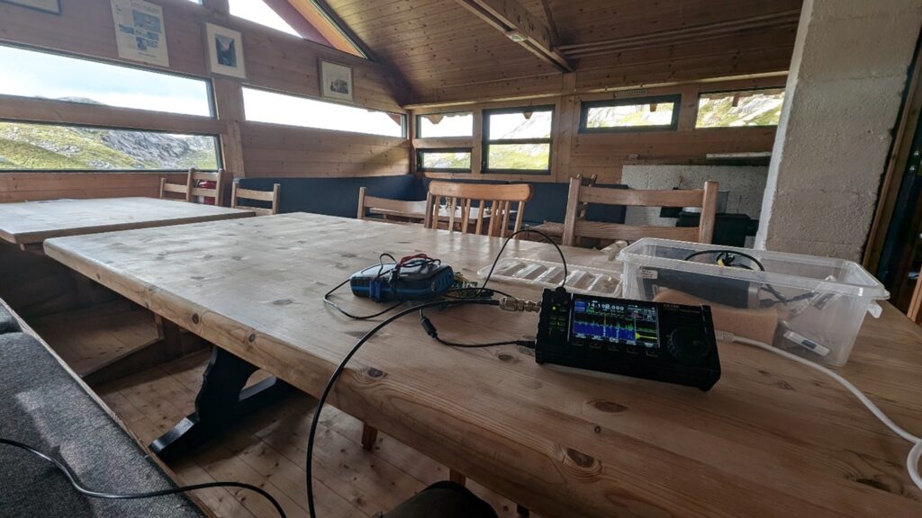
Inside the cabin’s you’ll find simple accommodation and cooking options. You can either pre-book or just do it as a drop-in, although you’re not guaranteed to get a spot if you just drop in.
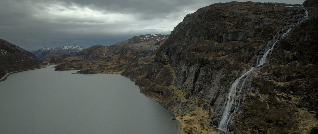
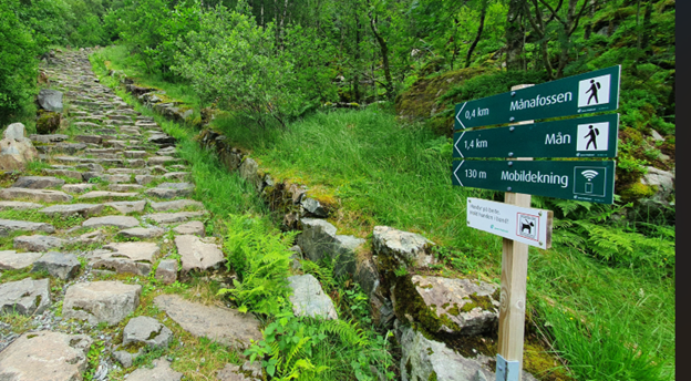
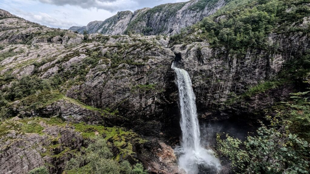
Another common access is from the south, near the amazing Månafossen waterfall. This is a large open waterfall with a free fall of 92 meters (300 feet) and is a short and very steep hike away from the parking lot. From the waterfall you can continue into a lush and green valley surrounded by steep mountains, and here you’ll also find a cabin where you can rent rooms.
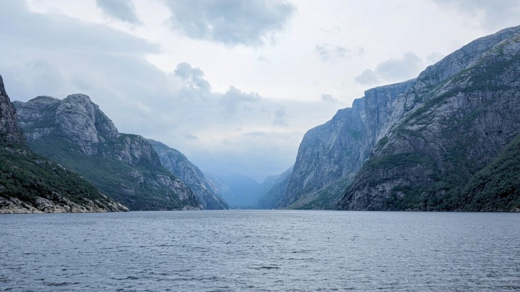
On the northern part of Frafjordheiane you find the amazing Lysefjorden fjord. One of my most scenic trips to Frafjordheiane was on a ferry from nearby Sandnes to Lysebotn, which takes about two hours. This brings you below the famous Pulpit rock and close to Kjerag. The ferry stops at a place called Flørli, where you can walk one of the world’s longest continuous staircases 4444 steps up to the plateau 741 meters (2 400 feet) above.
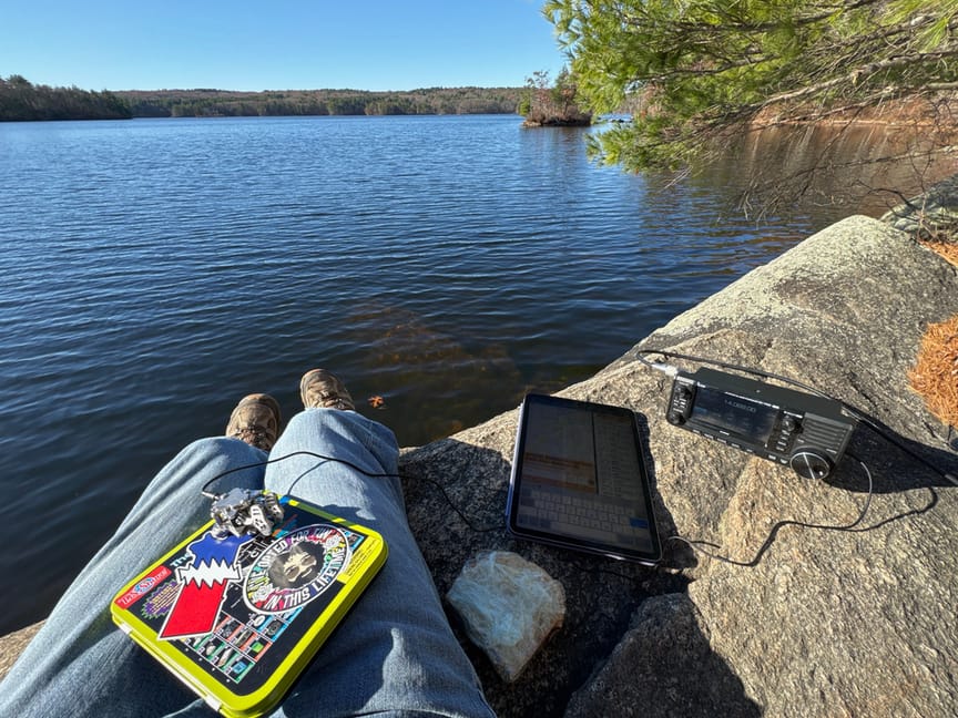
Radio wise you can set up pretty much anywhere in the nature reserve. Access is on foot or skis; all motorized traffic is illegal, including the use of bikes and drones. It’s important to note that mobile coverage is spotty or totally absent throughout most of the landscape reserve, unless you get high up in the terrain. If you do enjoy heights, there are 15 SOTA summits to choose from, most of which have never been activated before. Due to the great distances HF is the only decent choice if you want to be sure to get contacts.
If you want to see more I’ve created several videos showing my operations in the different parts of the park.

One Response
Cracking great pics Bob, a lovely read and very informative, well done Tony