US-1726 Wadsworth Falls SP
When spring beckons, even in February and you know it's just a sultry tease, what can you do but answer the call?
When spring beckons, even in February and you know it's just a sultry tease, what can you do but answer the call? The forecast was for 55ºF and I packed the gear into my bag and headed for Connecticut. Wadsworth Falls was the middle of a six-park POTA rove across two days in the Nutmeg State.
Wadsworth is a moderately sized park situated along a central rift, a geological feature created when the tectonic plates that would become Africa and North America started to pull apart starting about 250 million years ago. We think of this as being the Connecticut River Valley, but the rift itself is a much larger feature. A similar rift opened up around the same time to the east – that one expanded to become the Atlantic ocean. The entire area developed into enormous, shallow lakes and supported a variety of plant and animal life that thrived in the Triassic and Jurassic periods. Nearby US-1663 Dinosaur State Park features thousands of footprints and tracks left by these animals.
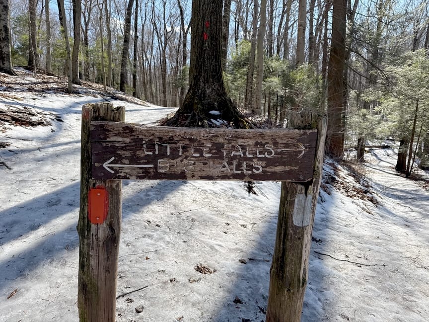
There are two ways to get to Big Falls, a 30-foot cascade along the Coginchaug River. The easy way is to drive down Main Street to Cherry Hill Road on the southwest corner and park directly in front of the falls. From there you can walk about 90 seconds down a small ramp to the bottom, along the river, and enjoy the scenery. There are several spots here to set up a station, whether car-based or not, and two trailheads emanate from the spot, one on each side of the river.
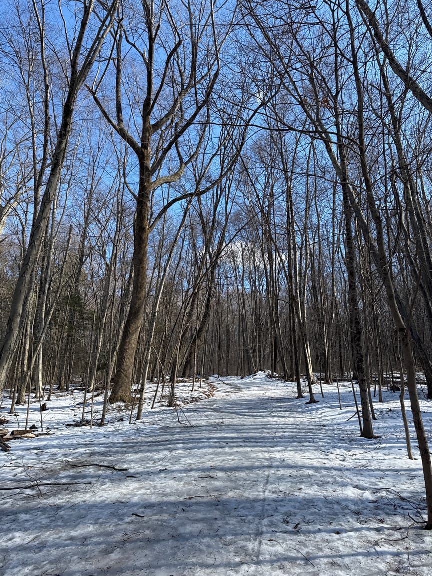
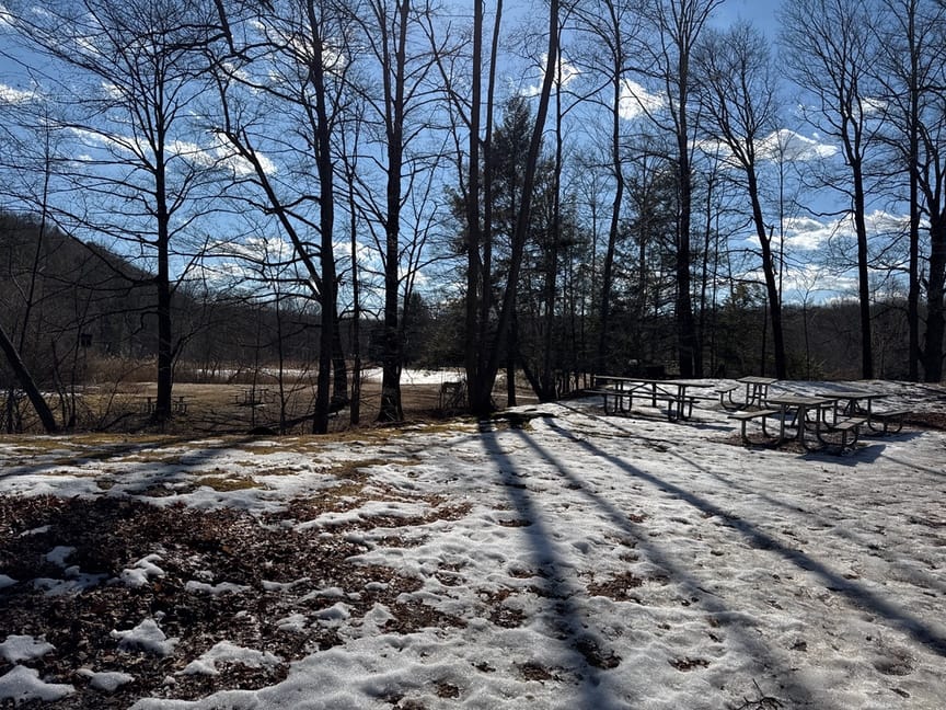
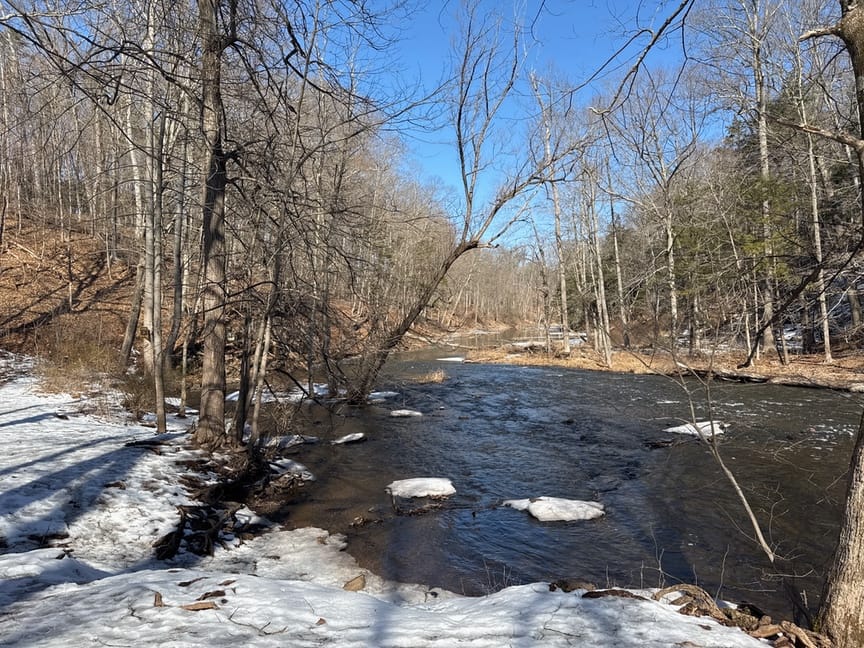
Instead, I chose to hike to the falls from the north side of the park, roughly four miles round-trip. I'm someone who added POTA to an active hiking hobby, so many of my trips are more about the place that I'm in and exploring a new area than they are about operating radios. I tend to do a long hike – this one ran a little over three hours – with a stop for a POTA operation when I see an inviting spot. Trail conditions were not ideal, as you can see from the photos, but for the most part the icy slush was passable with only the occasional excursion into the tree line to get past a nasty ice patch or two.
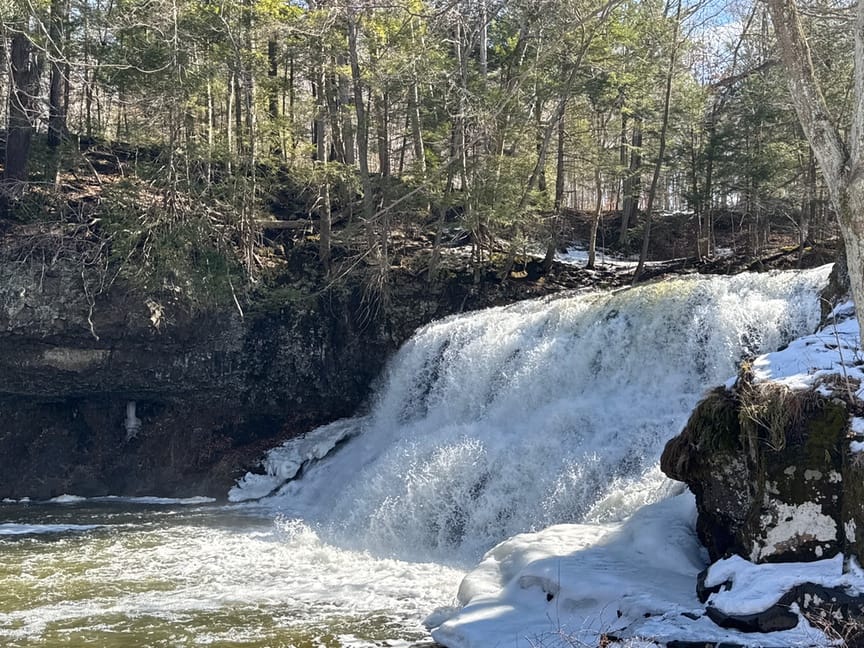
I made a side trip to look at Little Falls at roughly the halfway mark in my walk, and to my eye it's a little prettier than Big Falls – it's smaller but cascades down a 30-foot drop in lovely ribbons into waiting Wadsworth Brook. Big Falls is slightly more impressive, being larger and louder, and meltwater was swelling the stream, pushing water out and down in icy sheets. A handful of sightseers and dog walkers were gathered to watch and enjoy the February sunshine, and I got the impression that it was a popular spot in town to spend a few minutes on a busy day.
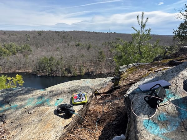
I still hadn't set up the radio, but it was too loud near the falls to operate and I hiked downstream slightly and put the station together on a hill overlooking the water.
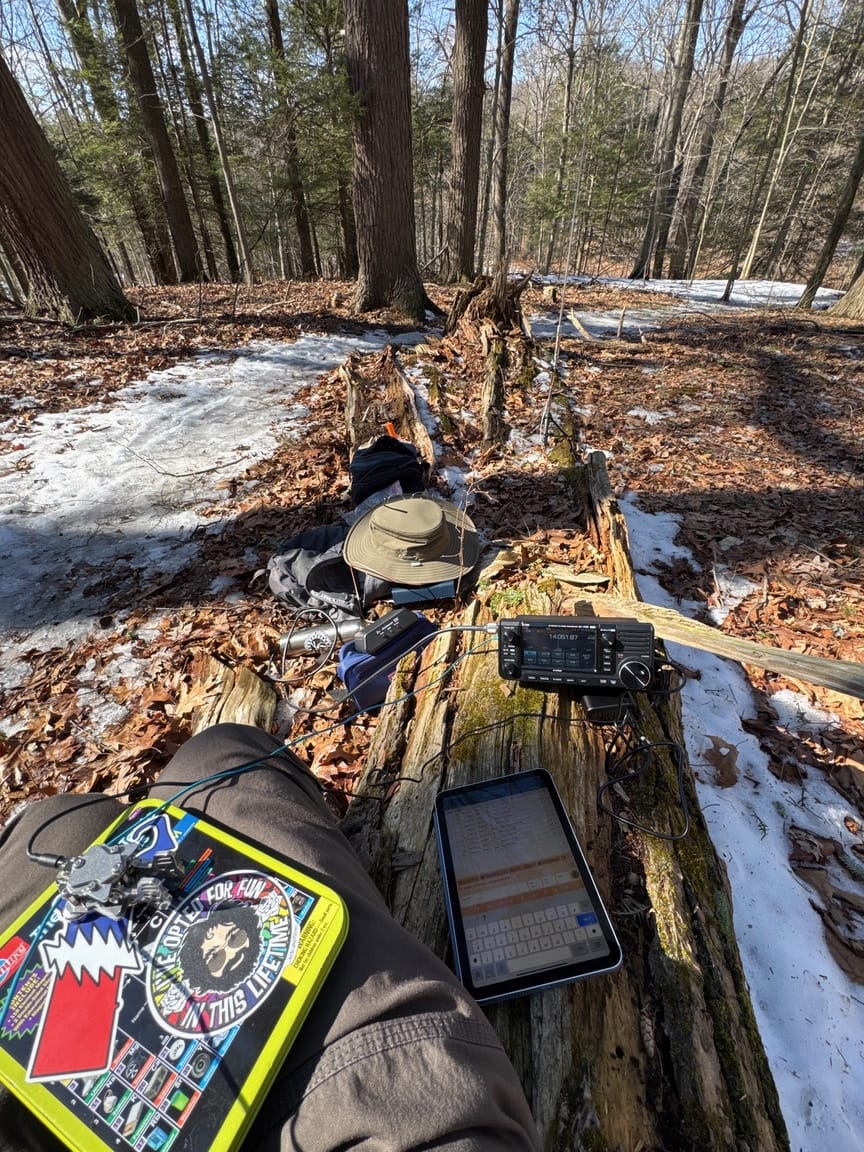
W1GRD set up on the hill to the right with an IC-705 and an AX1.
This trip was partly a test bed for equipment that I'm considering on using next month during an expedition to Vermont, especially around power and antennas. The IC-705 has an internal battery that will run the radio for several hours, but with a power limit of 5W. I've had great success with that setup over nearly a hundred activations, but I want to put out out a little louder signal from Vermont. Thomas WN1C recommended a portable battery pack / device charger, the POWERADD Pro 130W Power Bank. I also picked up a set of 12V trigger cables to provide power to the IC-705, and the rig will run a full 10W output in this configuration.
The power pack worked flawlessly on this trip. It provides two USB-C and one USB-A ports and can deliver a good range of voltages at a decent amperage, plenty of juice for the IC-705 at 12V and 3A. I did three park activations on a single charge, and the pack was down to about 80% capacity at the end of the day. And, at the end of the day, you can plug your laptop, phone, and tablet in for a quick charge. It weighs one pound. I was carrying two since I hadn't characterized them yet, but clearly just one is fine for an entire day's operation, at least on CW.
I also was carrying two antennas, my standard EFHW with its ropes and weights, and an Elecraft AX1 vertical. The EFHW doesn't weigh all that much but it is bulky, especially when I add ropes to elevate it and enough coax to reach a feedpoint 25 feet in the air. The AX1 is exactly the opposite, it weighs just ounces, uses a short run of coax, and I can just mount it to a small tripod and place it right on the ground. I'm using two radials that just sit on the ground.
I'll write a longer review soon of the AX1, comparing it to a Gabil GRA-7350T, but the short story is that I've seen not a lot of difference in the reach of the EFHW versus the vertical, and the vertical is so much easier to deploy.
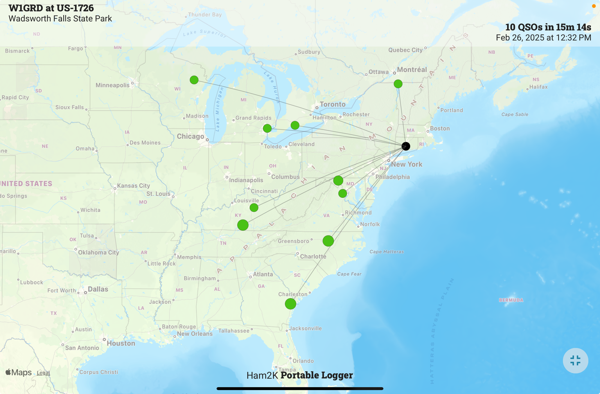
I feel like the vertical better matches my POTA style, which is to hike in somewhere, make a quick dozen contacts, and then get back to hiking. I'm not looking for lots of QSOs on multiple bands or to fill my log with DX, just a dozen and done is fine and I'm on my way.
The hike out was quick, but I did pause to admire the Giant Laurel, the only marked attraction on this particular trail.
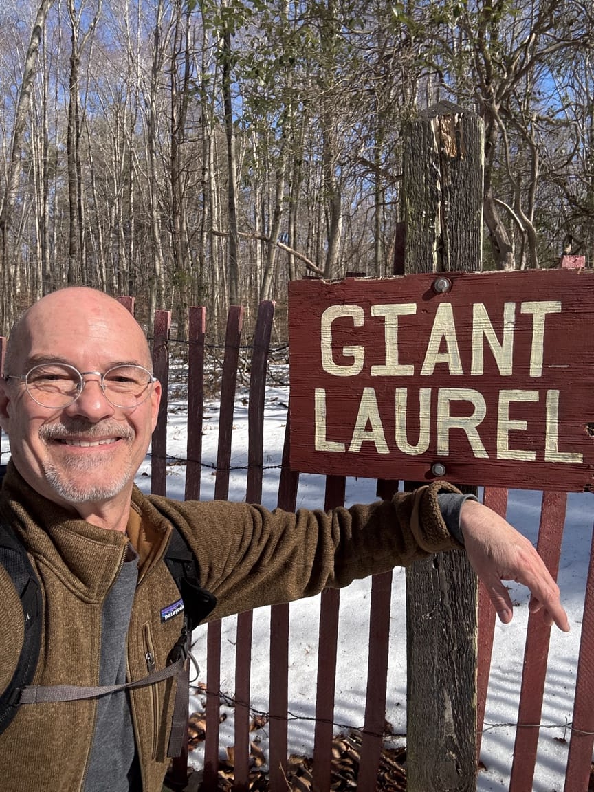
At the parking lot I ran into a couple who were just starting out toward the falls, and they asked me if I'd made it that far and what the trail conditions were. I gave them my best assessment and reminded them not to miss the giant laurel, just a mile ahead.