
In the late 1800s the boundary between Massachusetts and Rhode Island was in dispute, as were many in the area at the time, and a formal commission was set up to conduct a survey and come to an agreement on the exact spot that Massachusetts, Rhode Island, and neighboring Connecticut met. You can see the spot under question in the map below.
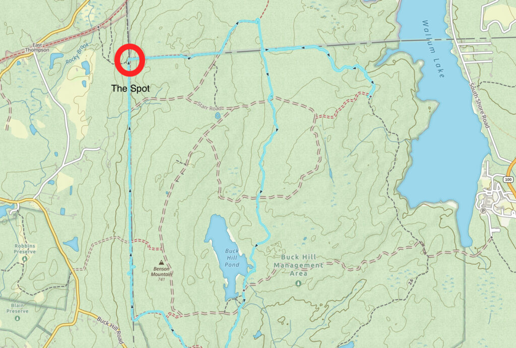
Much of the problem was in the language used in charters and treaties from the 1600s and later — they used phrases such as ‘two miles east of the bend in Nahuntuk Creek’ and ‘sixteen paces past the mill stone’ as geographical markers, and by the late 1800s the precise border mattered quite a bit, not in the least so that citizens could be taxed by the appropriate state.
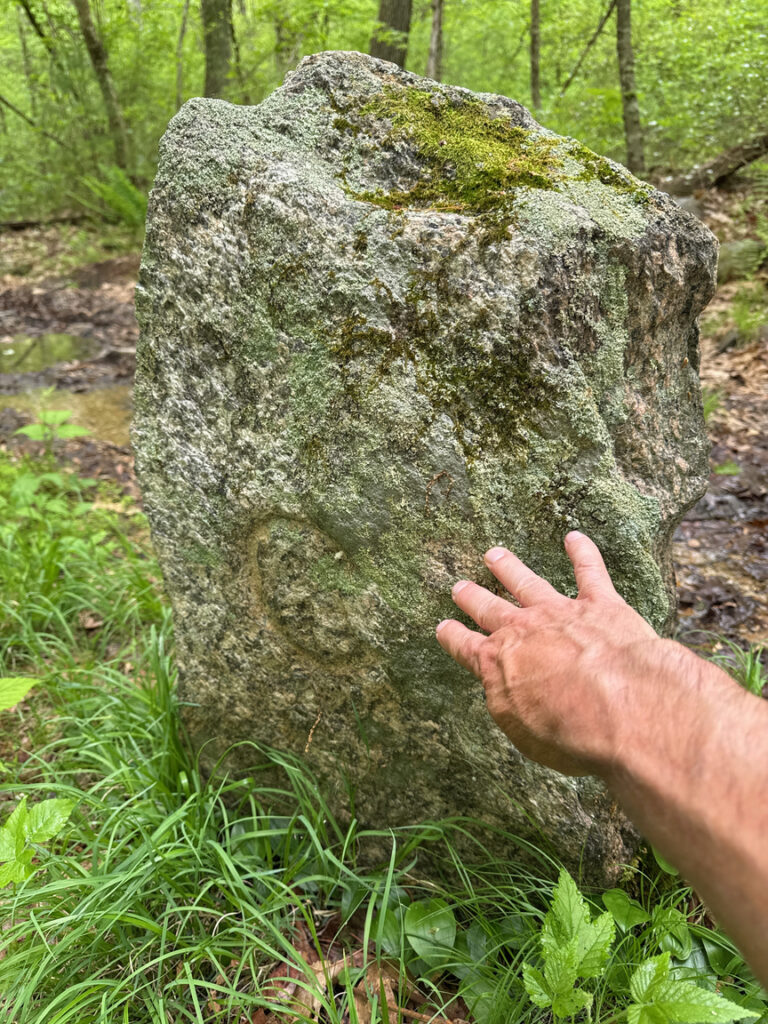
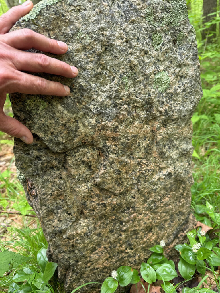
The border between Connecticut and Rhode Island had been a source of contention since almost the beginning. A series of legal battles unfolded in the late 1700s in the newly formed federal district, with literally the Naragansett nation on one side and the Mohegan nation on the other. An ongoing set of commissions worked on the problem until the Supreme Court took up the case in 1840 and established the legal border. The Border Trail at Buck Hill runs for a distance along this line — it’s the trail on the left of the map above going straight up and down — and you can hike along with one foot in Connecticut and one in Rhode Island for quite a distance. Most of the markers you will spot are from colonial times into the late 1700s, like the one in the photo below, but there are also more modern markers along each border.
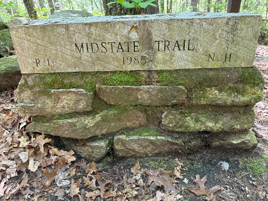
There still was a problem with the intersection of Rhode Island and Massachusetts, and in 1883 a new commission was established to survey and mark the ‘tri-state point’ where the two met with Connecticut. Surveys were made, land was cleared, and later that year the two parties signed a treaty establishing the spot. A four-foot granite obelisk was placed at the location, and it is a pretty easy hike to get to it from any of the three states.
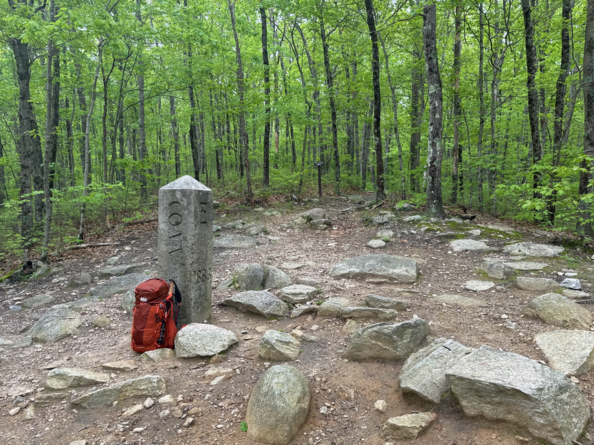
Connecticut wasn’t part of this particular dispute, and so the obelisk is marked RI 1883 on one side, MASS 1883 on another, and just CT on a third, since the state wasn’t a signatory but still acknowledged the location of the spot.
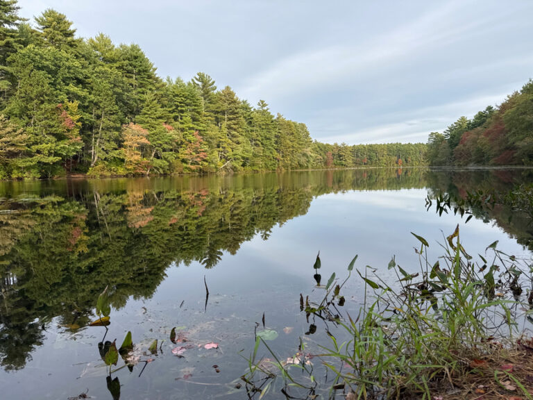
Buck Hill is one of several large wildlife management areas (WMAs) in Rhode Island and, while not as large as the massive Arcadia WMA at 14,000 acres, it is still respectable at around 2,000 acres. There’s a lot of diversity in the ecosystem here, and you’ll see hay fields, marshes, ponds, young hardwood stands, gravelly hills, and plenty of trails to keep things interesting. It’s a popular spot for quail and pheasant hunting, and Buck Pond, the largest in the park, is occasionally stocked with rainbow and brook trout, and you might also find a pickerel or a perch hiding under a stump. It’s open to just about every type of outdoor recreation, although camping isn’t allowed (but is in several nearby forests).
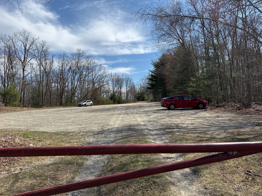
Most folks park on the south side of Buck Hill where a large area can accommodate quite a few vehicles. Most of the major trails have heads here, with the exception of the Midstate which has its southern terminus a few miles to the east on Buck Hill Road. Don’t forget to wear an orange blaze during hunting season!
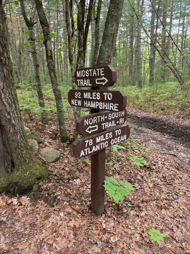
Speaking of the Midstate trail, here at Buck Hill you are at the southern end, where it connects with the popular RI North-South trail. The Midstate runs north though Massachusetts up to its northern terminus at Mt. Watatic in Ashburnham, just under 100 miles, and includes some of the Monadnock group as well as Mt Wachusett. It’s a low-key trail, unlike the A-T, but still well-maintained and popular enough that you might run into a through-hiker or two.
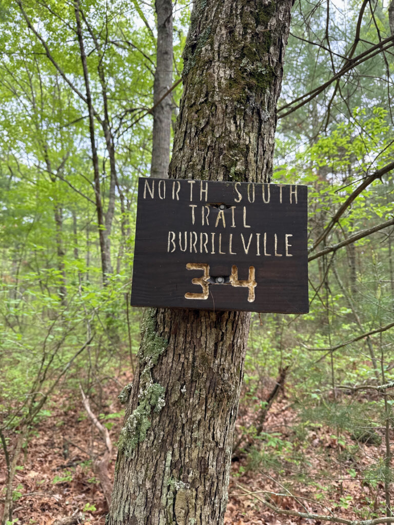
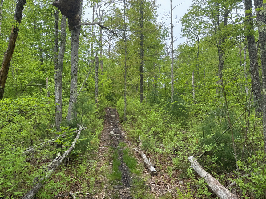
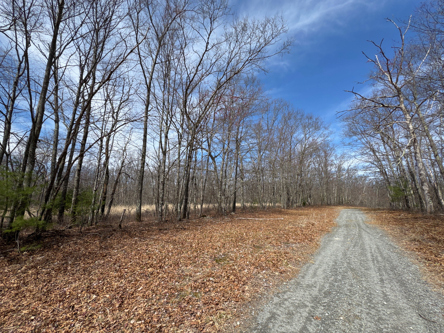
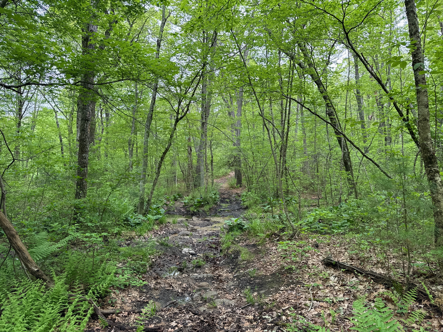
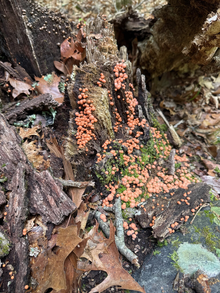
The trails are for the most part marked well, either by posted signs or blazes. In the wet season, especially spring, expect to find some of them wet, but not impassible. A few of the trails coming off of the peaks tend to be more stream-like at those times of year!
Here’s a look at some of the trail conditions…
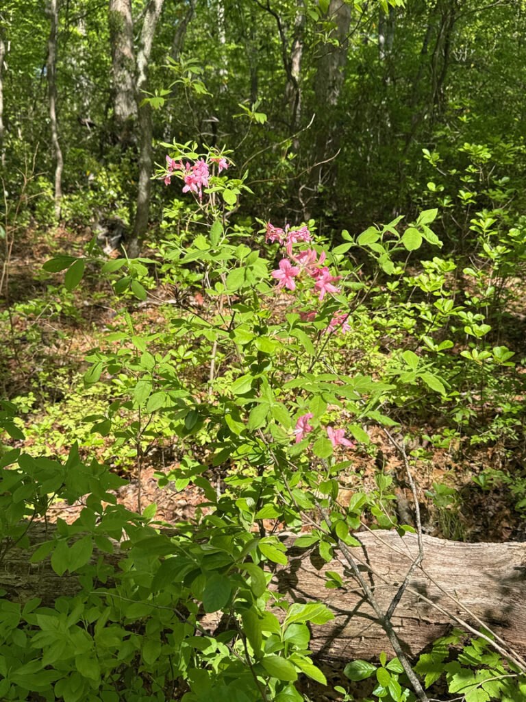
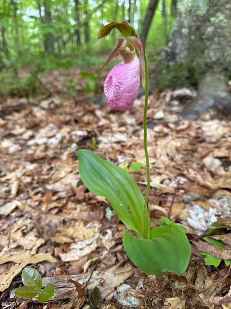
Springtime is also wildflower season, and in late May you can be treated to lady’s slipper, blue-bead lily, azalea and other delights!
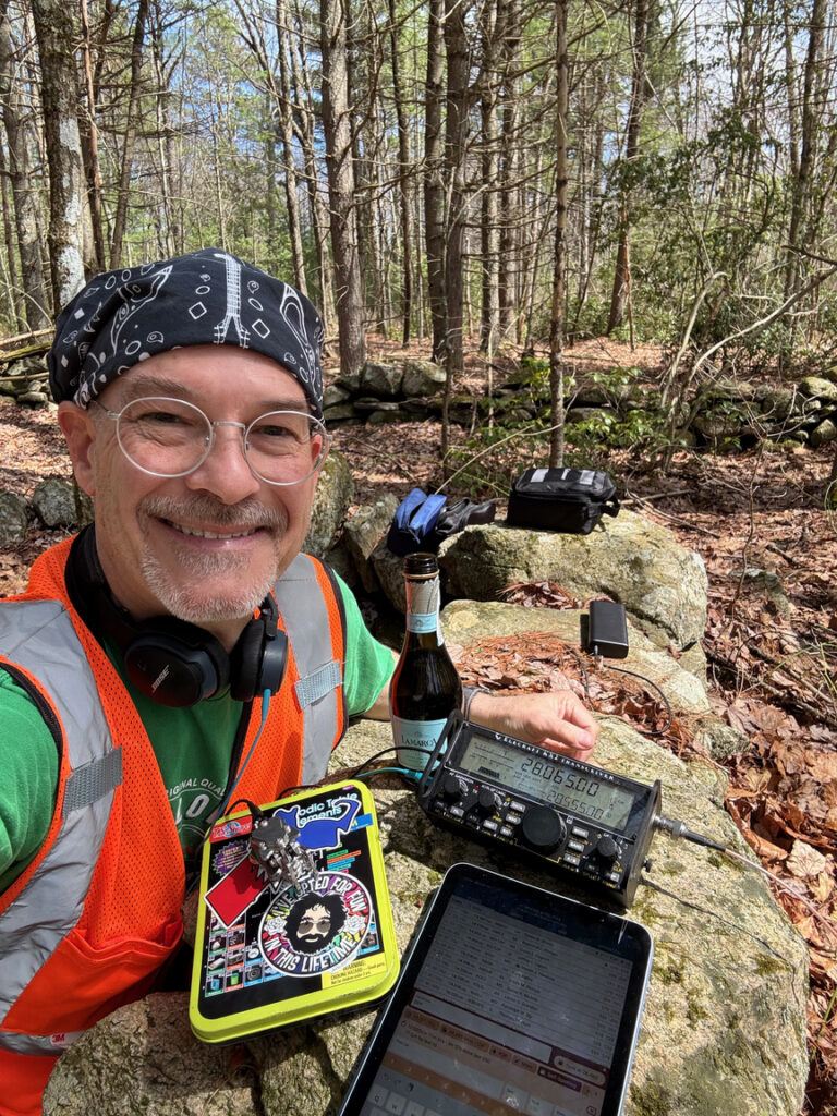
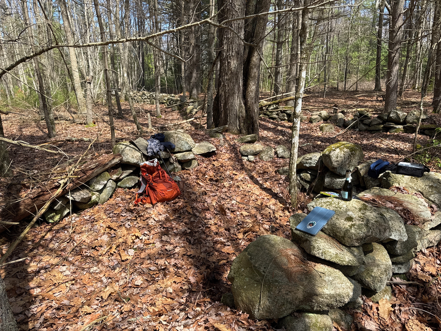
Buck Hill was the location I chose for my 100th unique park activation. It was quite a journey, I started in July of 2024 and hit the 100th in May of 2025, a total of 309 days that spanned eleven states. There’s just so much going on at Buck Hill on so many levels, and if you are into geology, history, ecology, and hiking it checks all those boxes. It seemed an obvious place to celebrate.
I set up my 40m EFHW for this operation since I figured I’d linger. I’m one of those who is there more for the hike, even though it’s POTA that got me into the park, and I very often do a dozen-and-done activation, sometimes in just minutes after getting a signal on the air. This time, though, I wanted to savor the moment, and the prosecco, a bit and I took my time, logging 18 QSOs in 12 states, mainly on 20m CW.
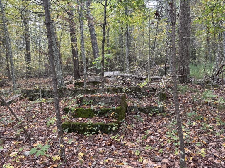
I’d set up near a large stone foundation, one of many that you’ll find in the central portion of the park. This part of Rhode Island has been occupied for a long time, first by indigenous people, and then colonists. There’s a stream here that supported mills, and much of the land is good for pasture. There’s not much left apart from the stones but with some imagination you can see how the buildings might have been laid out and guess their purposes.
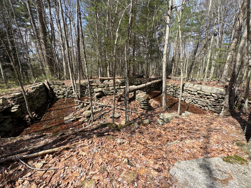
All of these walls are another great reason to visit Buck Hill, there was some serious history happening in this area and the bones are all laid out for you to see. What’s a bit confusing is that colonists and 19-century millers were not the only occupants of this land. It’s an ancestral homeland of the Nipmuc people, starting from around 12,000 years ago, and likely much longer than that. The Nipmuc lived, and still live, in the areas around northern Rhode Island, south-central Massachusetts, and eastern Connecticut. They are ‘cousins’ of the neighboring Narragansett, who tended to live more along the shorelines of the rivers and ocean. Both speak dialects of Algonquian.
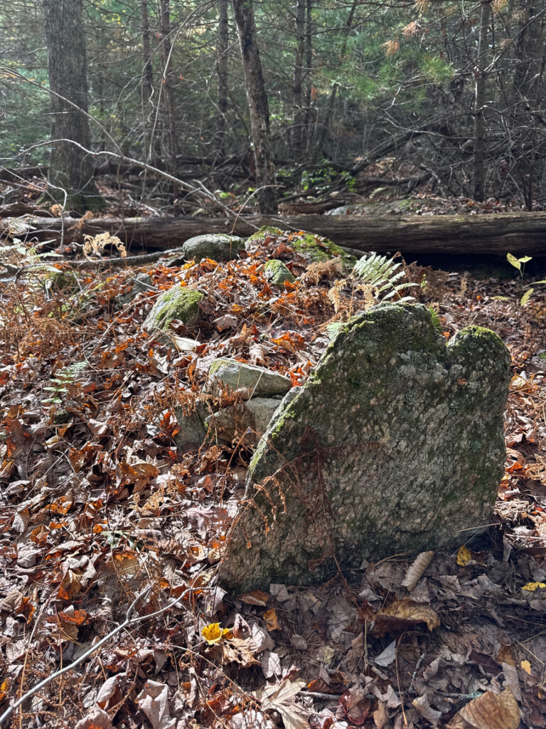
I can sense that I am in Nipmuc territory when I start seeing cairns, or mounds, of stone in specific types of spots. They tend to be roughly human sized, oblong, and can be as simple as a pile of rocks or more elaborate like a sarcophagus with head and foot stones. Once you’ve seen them they are hard not to see, and you’l get a sense of where to look. I once found a large installation because I was walking along the edge of a marsh, at the foot of a small hill, and I knew there would be one at the top of the hill. Sure enough, there it was when I went to look. Here’s what they look like:
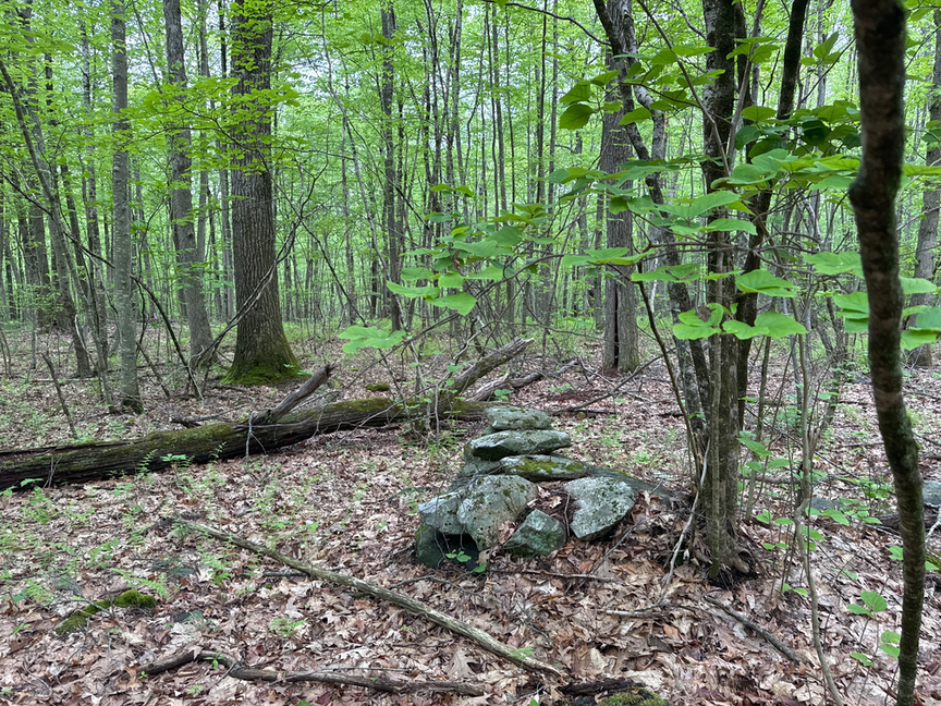
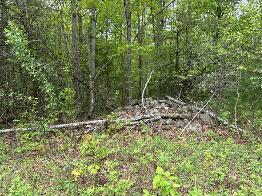
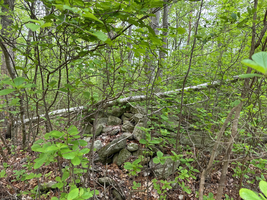
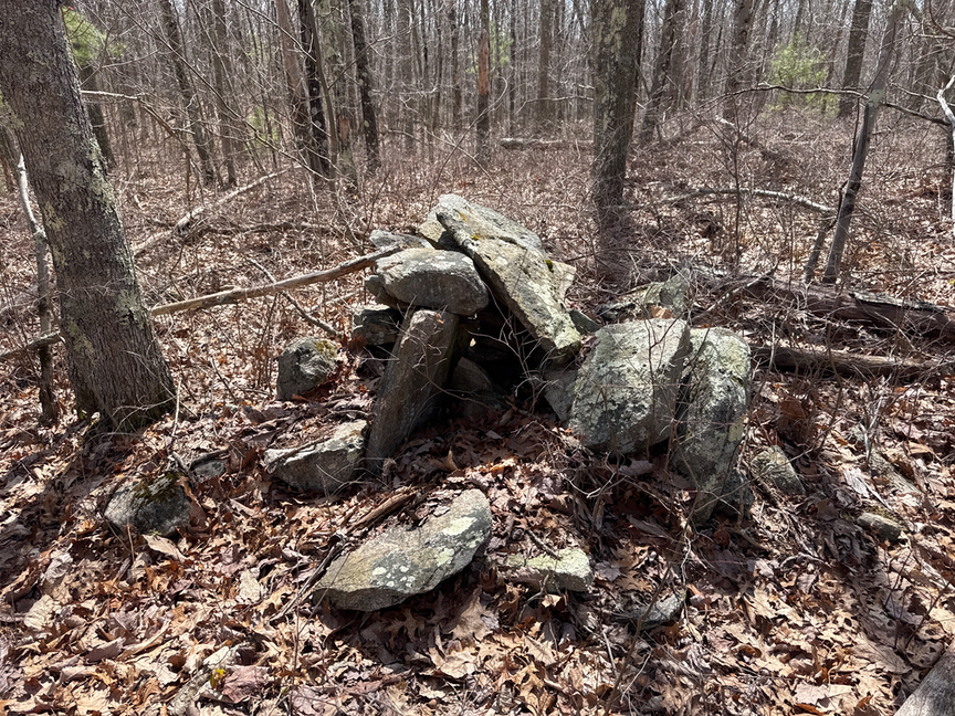
The cairn in the bottom image has come apart a bit, showing some structure, it likely held an object inside. Some of the less structured piles might be tributes, where individuals would place one stone in memory of a person or event as they passed by. Others could have been waymarks. Unfortunately we just don’t know a lot about the history of these artifacts, even down to when they were made. The New England Antiquities Research Association (NEARA) sponsored a study recently utilizing optically stimulated luminescence (OSL) dating, which looks at properties of quartz that has been buried. At the site under study, stone structures similar to those at Buck Hill were determined to have been set in place around 1500-1600 AD, in the pre-colonial period. But that’s just one mound in one location!
The trouble, of course, is that a LOT of people have lived in and worked this area, and there’s a mix of 20th, 19th, 18th, and even earlier artifacts, sometimes right next to each other. I tend to categorize things into buckets like ‘newish’, ‘old’, ‘really old’ and the like — you start to get a sense after seeing so many sites of who made what and when. There are certain kinds of areas — springs, marshes and so on — that are more likely to have mounds, and I keep that in mind, too. The Nipmuc tended to align their structures east-west, so that’s sometimes a clue.
The mounds and other stone artifacts and structures left by the Nipmuc still have significance to the tribe, so please don’t disturb them in any way, and treat them with respect. Take only measurements and leave only footsteps, as they say. I’m still learning about these people and their early history — it’s fascinating, and the woods in this area are an open workshop.
When I first visited Buck Hill a few months ago, I made a note in my log: “need to come back here”. I think Arcadia gets all the accolades in Rhode Island because it is just so large, but Buck Hill packs a lot of history, hiking, and variety into a relatively small space. You easily can spend an entire day here, come back and spend another day and not see the same trails. As a bonus, as you walk the trail from the Tri-State Obelisk east along the Rhode Island / Massachusetts border, immediately, and I mean inches, to your left is US-4701 Douglas State Forest in Massachusetts. It isn’t a two-fer but it’s an easy two-activation trip. Unfortunately there’s not a POTA reference on the Connecticut side or you could do a three-state activation right at the obelisk.
Just don’t forget that your rig AND your antenna have to be in the same state!


One Response
Fantastic Story as usual, and a Big Congrats for getting your Agave Award, nice place to get it aswell. keep up the good work, I have a lot of pressure with my next report, following this one!! best 73 Tony