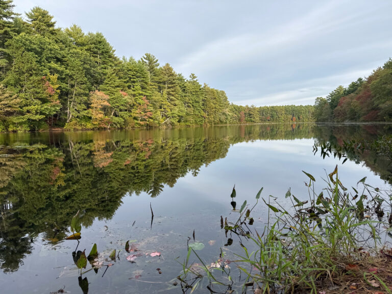
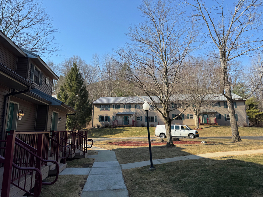
I have such mixed feelings about Beartown State Forest, located near Lee, Massachusetts, in the southwest corner of the state. I’ve been there twice now, once on a chilly March day, and again on a spectacular fall day in mid-September. I stay at the Holiday Inn Oak -n- Spruce Resort, a vacation time-share that also rents rooms by the night. I love it there, you can get a full-on townhouse style condo for under $90 per night (2025 prices) on Priceline. It’s just a few miles from groceries and a little downtown area with an outstanding cafe, The Starving Artist, and the kind of quaint shops you’d expect to see here in the Berkshires.
Even better, the resort abuts US-4711 Beartown SF. On my visit in March I woke up in the morning, packed the gear, and walked out the door and onto the trail. On the second visit I drove up Bear Mountain Road a bit, which is closed in the winter, to pick up the Appalachian Trail on the east side of the mountain.
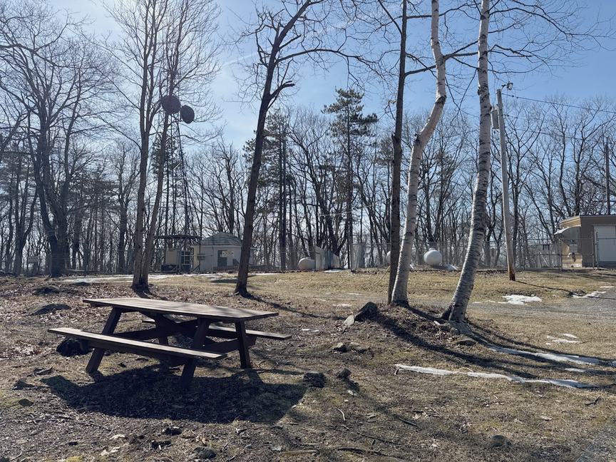
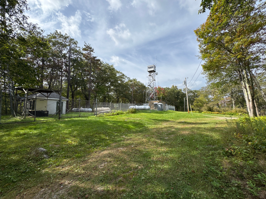
My mixed feelings come from the park itself. I’ve spent two full days now working my way across nearly 20 miles of trails, and I’ve summited twice. The trails are pretty enough, even in the snow, but I haven’t caught that spark of excitement that I often feel, especially when I’m heading uphill. There aren’t really many views, even from the top, and the summit itself is something of a letdown, kind of bleak and occupied by commercial transmitter buildings and a few towers. That picnic table is where I operate from.
But, I’m getting ahead of myself. This is a very large park, somewhere between 10,000 and 12,000 acres, depending on who you are asking. A section of the Appalachian Trail runs through the park, but oddly doesn’t cross the summit as many other sections do. The AT goes out of its way, literally, to avoid crossing the summit for some reason, circling it instead.
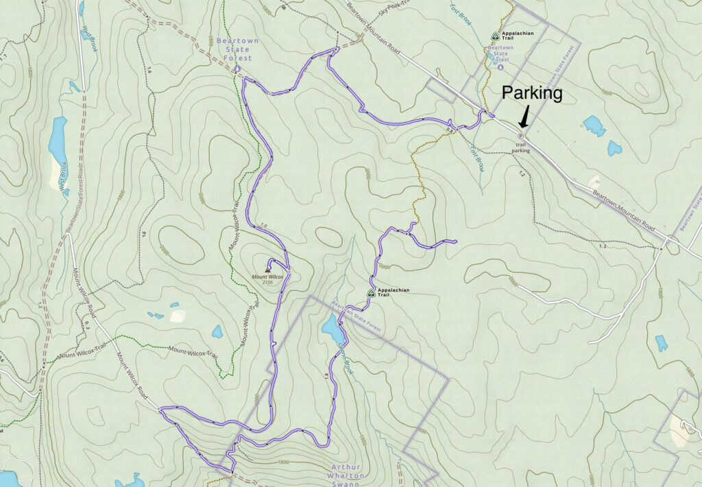
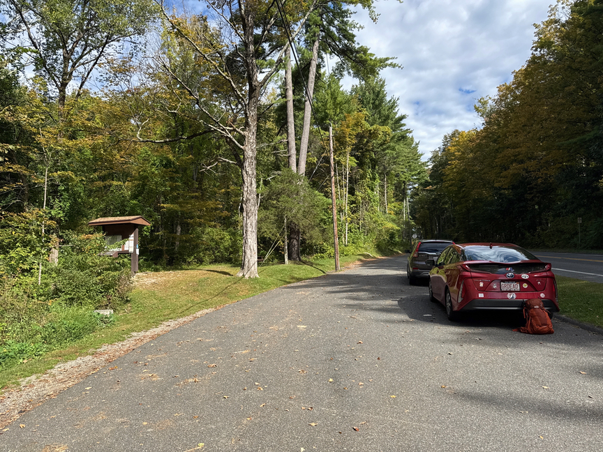
I was here in September as part of a three-day rove that included Mt. Everett State Park and Mt. Race, the second and ninth-highest peaks in the state. I wanted a relatively short hike up to Mt. Wilcox for a combined SOTA / POTA activation and decided to drive a few miles up Beartown Mountain Road and park where the AT crosses the road. It’s about a seven-mile loop the way I did it, but there are so many trails that cross each other that you can very easily tailor the distance. Walking up from the resort would’ve added about 4 miles to what was a 7-mile hike from the AT parking lot.
During my earlier trip in March I’d wanted to hike the Beartown section of the AT, but I’d come in from the opposite side of the park and ran out of time. That hike had come in at about 8 hours on the trail and well over 13 miles, much of it in icy conditions. I ran out of sunlight and had to work my way back down Beartown Mountain Road with a flashlight in the cold. The images below are from the March trip.
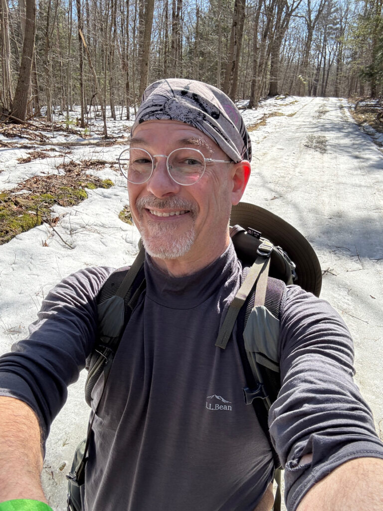
Even though Wilcox is not my favorite place to hike, I have a deep relationship with this park. On that March trip I was completely unprepared for the hike. It wasn’t inexperience, I’ve been hiking most of my adult life, in fact POTA was an add-on to my hiking hobby and I still only spend enough time activating to grab a dozen contacts before I’m packed up and back on the trail. This time, for some reason, I just hadn’t thought much about the hike. Wilcox seemed like a pretty doable climb based on what I’d read, and the topo map didn’t show anything all that challenging. I pretty much just showed up with some radios and a sandwich.
Mainly it was just much slower than I’d anticipated. I started hitting slush, then snow, then ice as I ascended, and the trails above about 1,200 feet were in pretty bad shape. I’d just bought a new Gregory 30L backpack and wasn’t really used to where things were in the load, and it also was just not fitting well, so I was constantly fussing with it. I actually returned the pack to REI after this trip and replaced it with REI’s Traverse 35L, which I like a lot. I also have their Traverse 60L for larger loads.
Coming off of the peak I was already rationing water and had run out of food. I took a bad fall crossing a sheet of ice, injuring my left knee, and I still had about 5 miles to go. I was extremely lucky, the knee was swollen and bleeding a bit and hurt pretty badly, but I hadn’t broken or dislocated anything. It slowed me down on an already slow path. I hadn’t paid much attention to the distance I’d be hiking and simply hadn’t prepared properly. It got really cold after the sun dipped below the mountain, what I call Arboreal Twilight, and I hadn’t packed the right clothing, either.
I spent a lot of time after that March trip rethinking my approach to POTA hikes. I now plan much more rigorously and have a pretty good feel for what I am walking into and what I need to bring. I upgraded my tiny medical kit from a couple of bandaids to a full two-person, two-day package, and I added a 3L water bladder to the pack. That water is heavy — a liter weighs just over two pounds, and I carry 2.5L — but you know what? On long hikes that bladder ends up with maybe half a liter in it, and I don’t have to think about how much water I’m consuming. I also now estimate the number of calories I’m going to need for the hike and pack accordingly. On the clothing side I now pack layers for top and bottom, wool or cotton depending on the season, and a pair of dry socks. There’s often a lightweight fleece in the pack, too. My load for a full-day hike with a POTA activation is around 32 pounds right now.
All of that said, I was much better prepared for the September hike, and it helped that I’d been on the mountain just a few months before, so I knew some of its quirks.

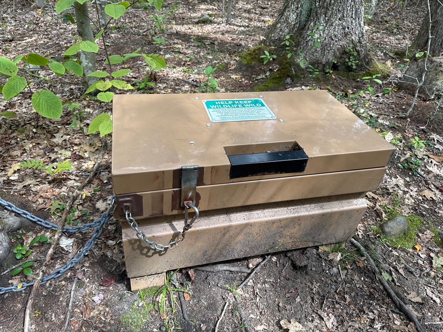
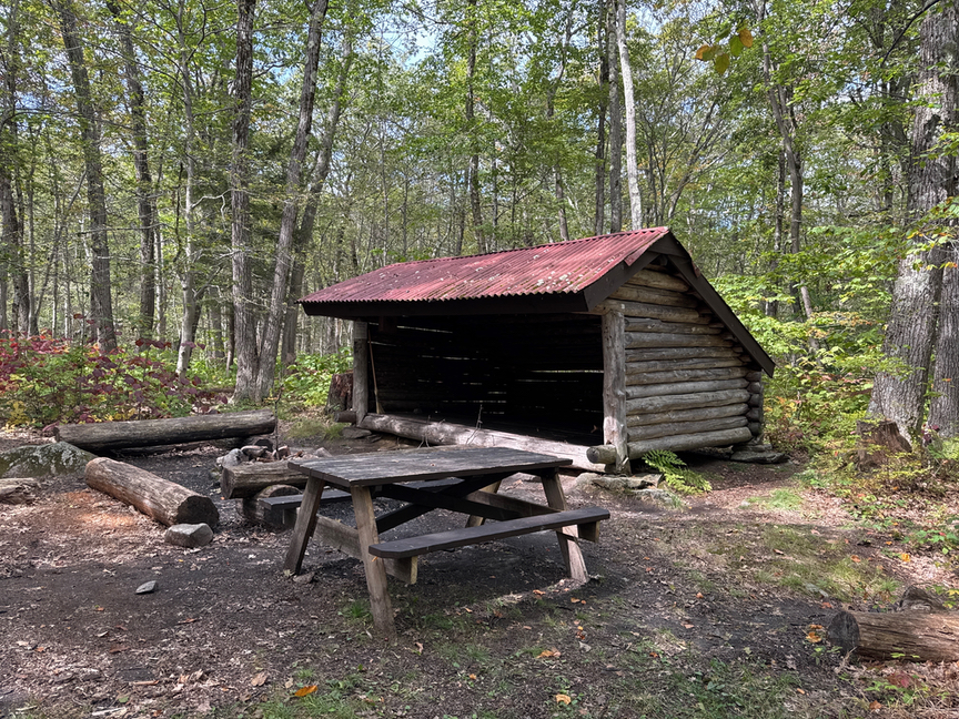
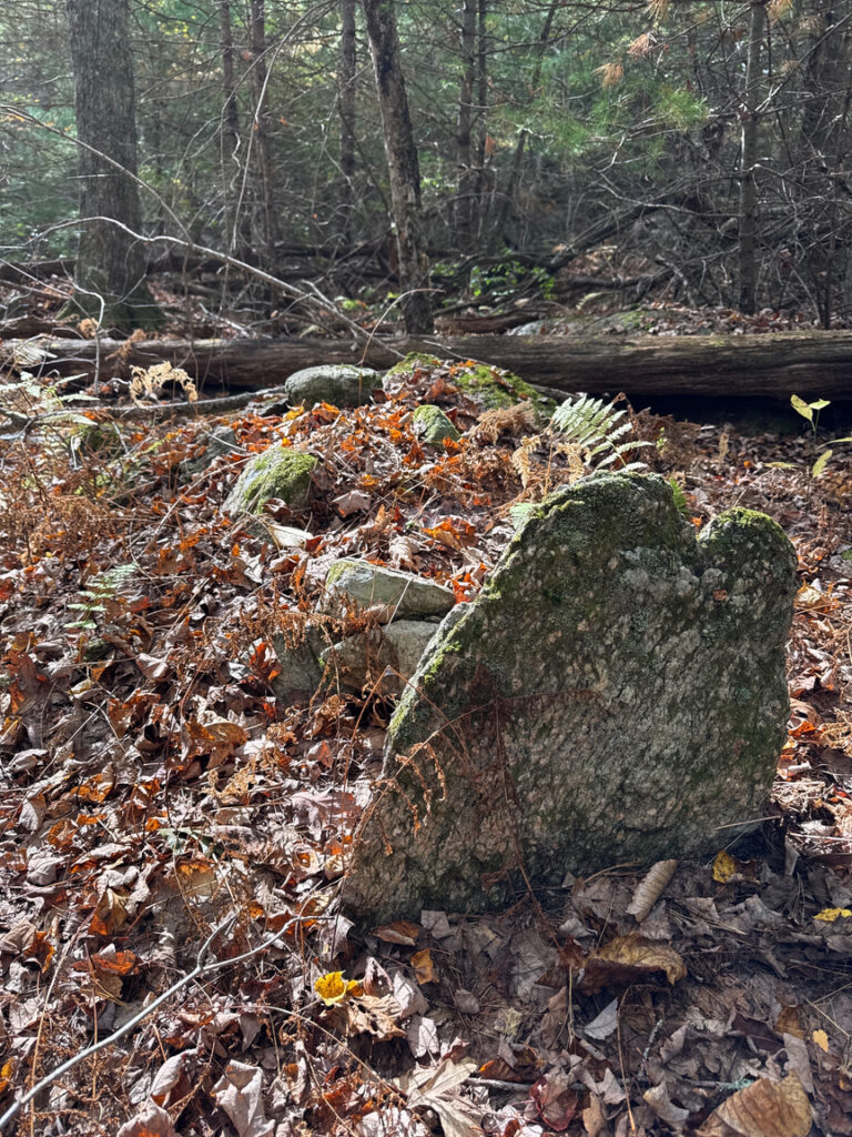
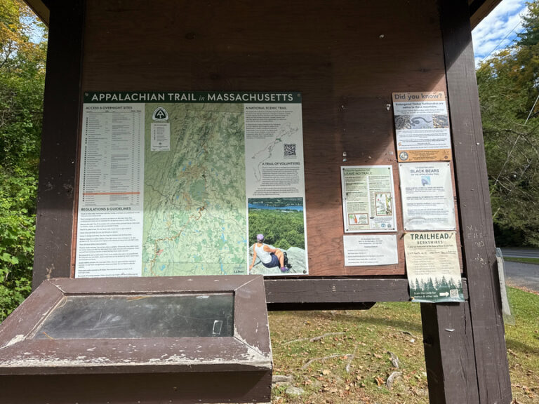
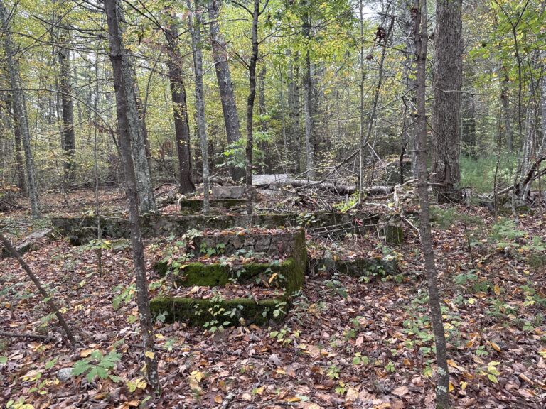
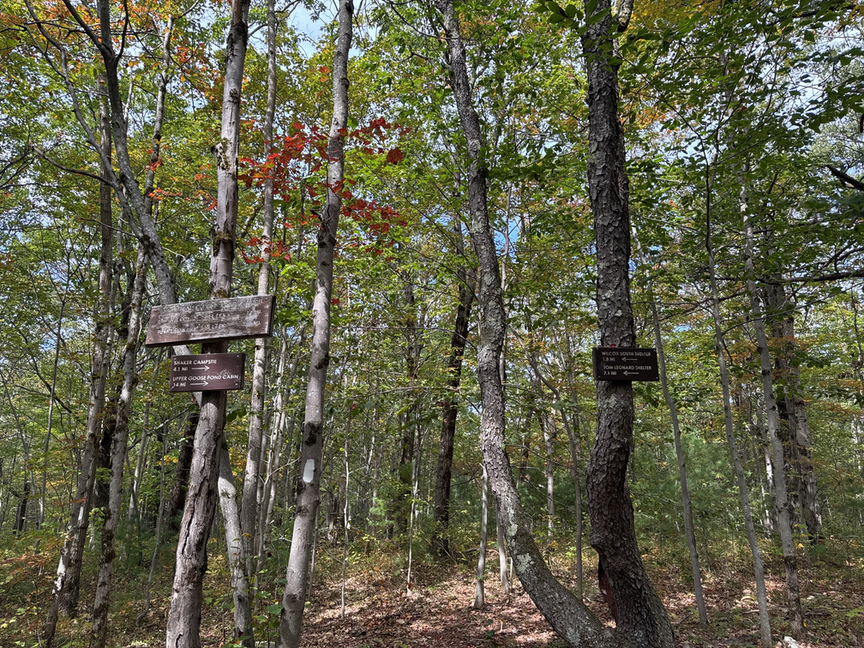
Every section of the AT that I’ve been on has its own personality. Here on the east side of Beartown I found quite a few AT campsites, some fancy like the shelter on the right, above, and some just a cleared area or a low platform. Many of these locations include a pit toilet and bear lockers (above, center) to store food in. As you might suspect given the name, black bears are frequent visitors to the campsites. At the trailhead kiosk there’s a sign-in sheet, and I noted that there were half a dozen hikers logged that day. As part of the AT, signage on the trail is frequent and helpful, and the trail itself is well-maintained here.
This was a bit of a warm-up hike for the following day on Mt. Everett, the second-highest peak in Massachusetts. I spent a lot of time looking at rocks and plants and just generally enjoying the end-of-summer weather, quite different than my frigid trip back in March. I didn’t mind at all that the AT seemed to be avoiding the summit, cautiously circling it to the south and west. SOTAGoat just shows the same distance to the summit while the bearing constantly changes. On the north side, though, you’ll run into Mt. Wilcox Trail, and that’ll lead you right up the path top the top.
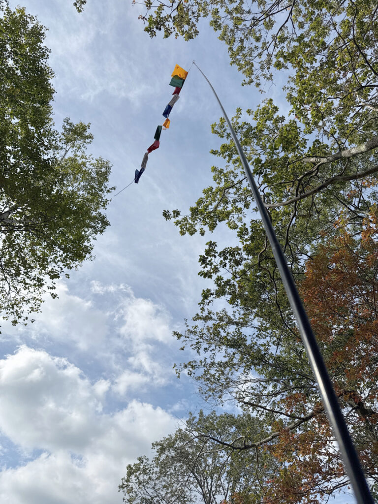
And what’s there when you reach the pinnacle? A few buildings and a picnic table.
In spite of the active comm equipment, on both trips the bands were in good shape and the noise level low, and the activations went by quickly, in both cases using a KX2 feeding a 17′ whip. I remember in March being really psyched to see that picnic table, and I used it again in September. The summit marker is over near the building on the left, unfortunately all that is left is the bolt, like many markers this one has been stolen.
I looped around to the north to get back to the car, following Mt. Wilcox Trail down to its intersection with Airplane Trail, which leads back to the parking area. It was a much more pleasant descent than the one in March! I should point out that late summer and early fall is peak mushrooming season…I spotted the Sulphur Shelf below on the way down. This is the season for sulphurs and hen-of-the-woods, both of which are delicious and neither look like any other mushroom you are likely to see.
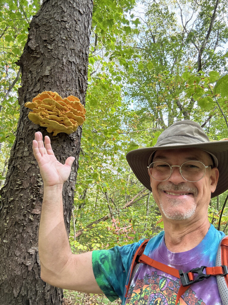
For sulphurs, trim the tips, about two inches or so back, and sauté them with butter until browned a bit. Toss some truffle salt on there and dig in! You’ll also find Hen-Of-the-Woods this time of year, they look like ruffled birds sitting at the base of oaks. Here’s one for reference from US-8383 Wrentham State Forest. There are three hens here.
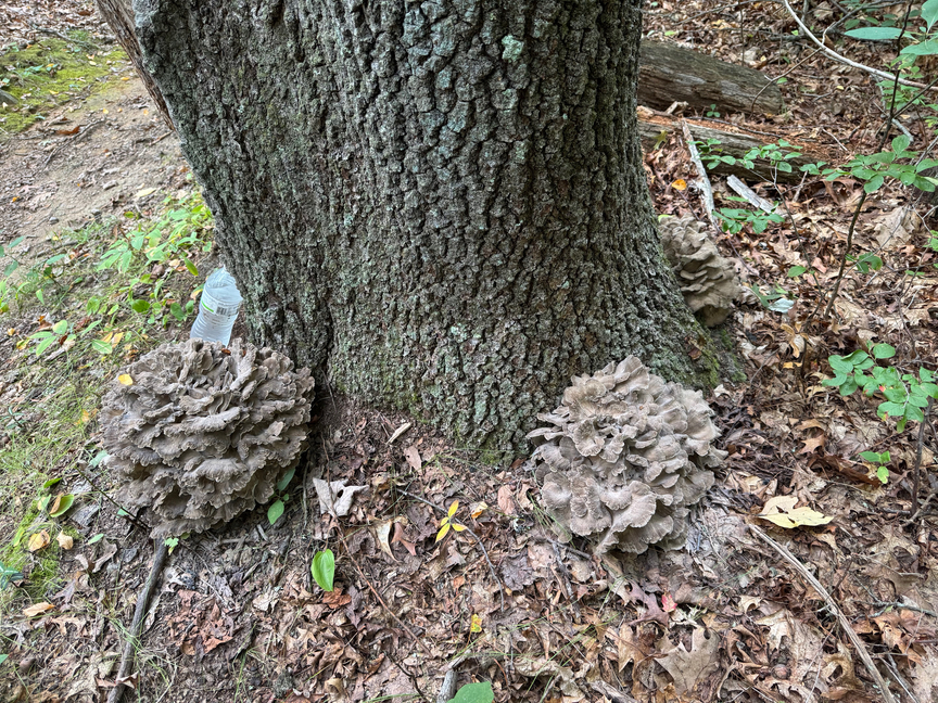
If you haven’t eaten these mushrooms before, just try a little bit and see how your body handles it. Some folks can mow through a plate of these with no problem, but I’ve know others who get bad stomach cramps after eating them. For the hens, you can trim the ends of the fronds and give them a quick saute, and then I typically will make a stew with them. Like sulphurs, there aren’t any mushrooms that mimic these, and the two varieties are really great mushrooms to start out with on your culinary adventures. It certainly gives those fall POTA activations another layer!
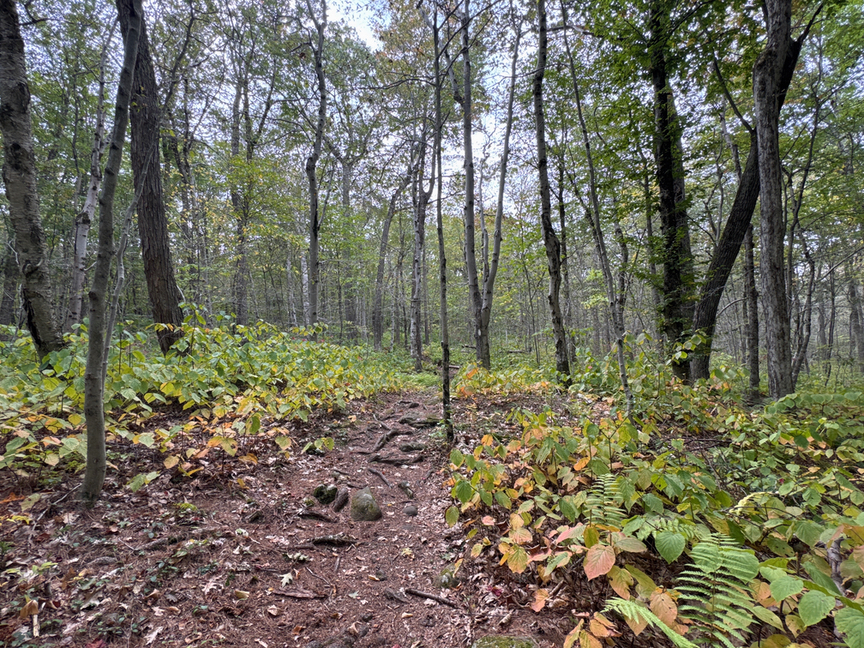
The path back down the hill and across Airplane Trail is pretty easy. It isn’t so steep that you have to worry about your shins, or use trekking poles, but there are plenty of interesting things to see. You are in the Berkshire range, so geologically you’ll be looking at primarily schists with milky quart veining. Airplane Trail was named for the crash of a Piper PA-32 Cherokee 6 in 2006 at around the 1,900 foot mark, near where the Mt. Wilcox Trail intersects with the AT. Three boys and their father survived, while the mother and two brothers did not.
It was a classic deteriorating-situation accident, the pilot had cancelled his instrument flight plan due to bad weather descending on his destination, and was flying visually in mist and increasing darkness. I doubt he saw the trees until just before he hit them. I’m a pilot, IFR rated, with decades of experience flying in this area, and I can see exactly how this would have unfolded. Hikers reported finding bits and pieces of the plane for several years afterward, but now the forest has swallowed up anything that was visible.
This was a great warmup for the next day’s hike up US-8416 Mt. Everett, the second-tallest peak in Massachusetts after MT. Greylock. Will I be back? You know, probably I will. I have a hunch that Beartown is more than meets the eye, and to be fair I’ve only seen a very small portion of the very large park. The inexpensive townhouse rental is a big draw, and from Lee you are 30 minutes away from some really great hiking in nearly any direction. I will likely do the same thing I did on the September trip — spend a day on Mt. Wilcox as a warmup, grab breakfast and a packed lunch at The Starving Artist, and then head out to my next adventure.