On Saturdays and Sundays you can drive right up Radio Road to the very top of US-1196 San Bruno Mountain State Park, just a few miles southeast of San Francisco and nearby Daly City in California. It was a Saturday, and I was on my way to the second night of the Grateful Dead 60th Anniversary celebration at the Polo Field in Golden Gate Park, but the opening act didn’t start until 4pm, and I decided I’d spend the morning hiking in San Bruno and then drive over to the Daly City BART station to take the train into town.
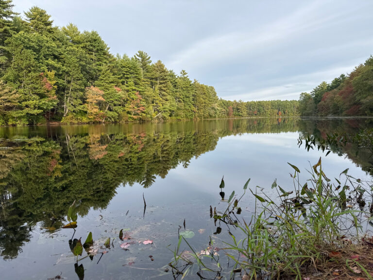
I’d spent the past five days hiking around the Santa Cruz mountain range near Los Gatos and Pescadero, activating on most days, although there were a few trips deep into the redwoods that yielded no contacts at all. San Bruno is the northernmost mountain in the range, and I found it to be quite different from its siblings in the south.
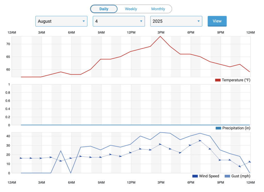
It was sunny and in the mid 70s when I left my hotel in San Mateo, twenty minutes to the south. I hadn’t intended to drive up the mountain, but hike it instead, but when I arrived at the park it was very windy and the wind was driving a cold fog. It just didn’t seem to be an ideal day for a hike, and so I figured I’d drive up to the top and set up my rig there for a quick activation.
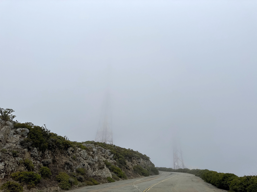
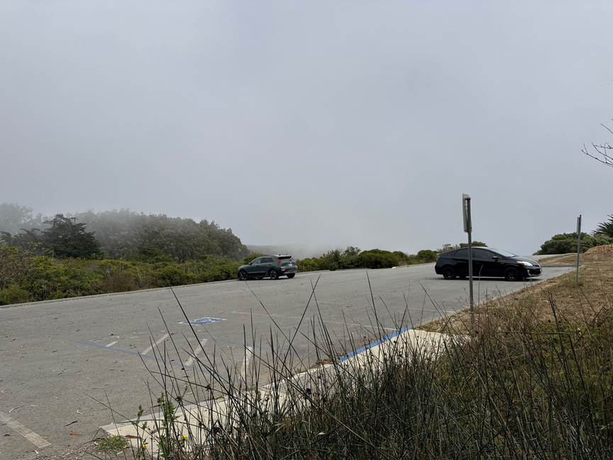
It was not a good place to be. The wind was absolutely howling over the top, so hard that I could barely stand up, let alone contemplate putting up an antenna. One or two other cars hunkered down in the parking lot, maybe those of workers in the transmitting shacks, since there was no other reason to be there!
Clearly I’d need another spot to set up the radio in. I took a look at the map and realized that there was a trail on the eastern, leeward slope which I thought might give me at least a little relief from the wind. From the top, drive down about a quarter of a mile until you come to a small parking area and a gate. The trailhead is on the south side of the parking lot and is well-marked.
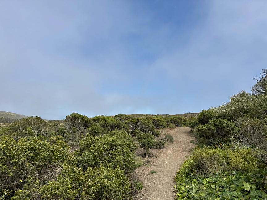
It was still pretty windy along the path, but at least there were breaks in the fog and it wasn’t as chilly. Fortunately I had several different clothing layers available since I was heading in to San Francisco for the show later, and it gets really cold out in Golden Gate Park when the fog is blowing in, which it did the first two nights of the festival. I was well-prepared for Bruno and added a few layers before heading up the hill.
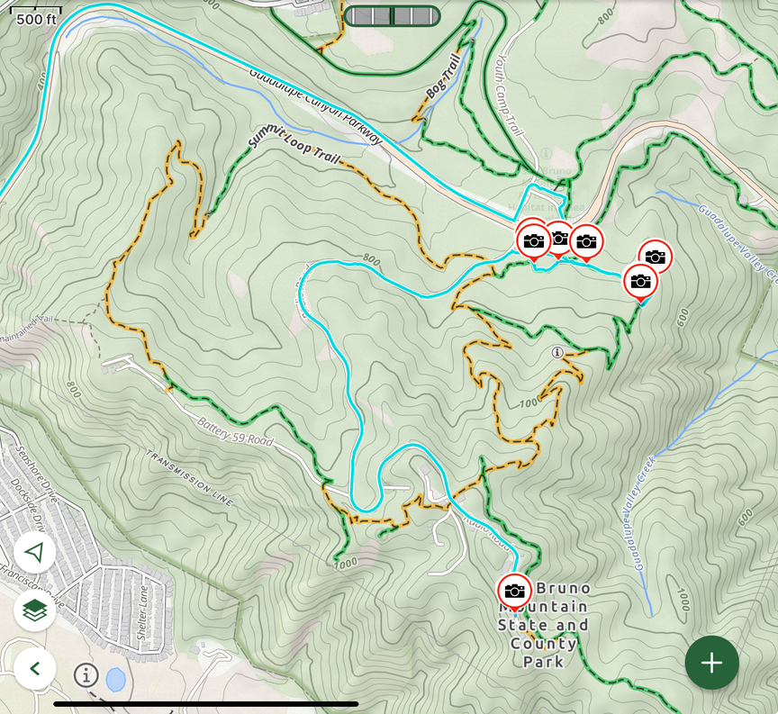
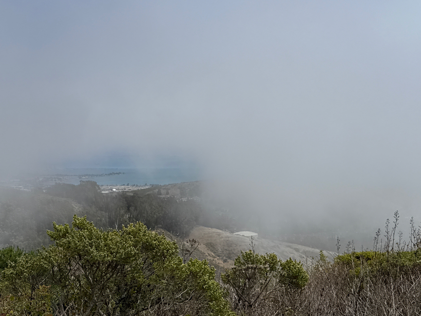
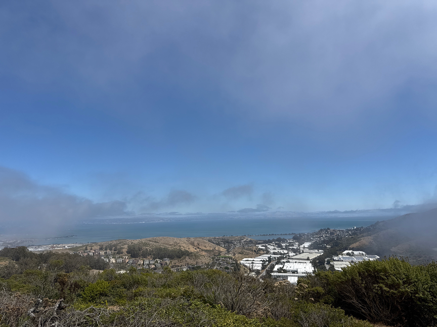
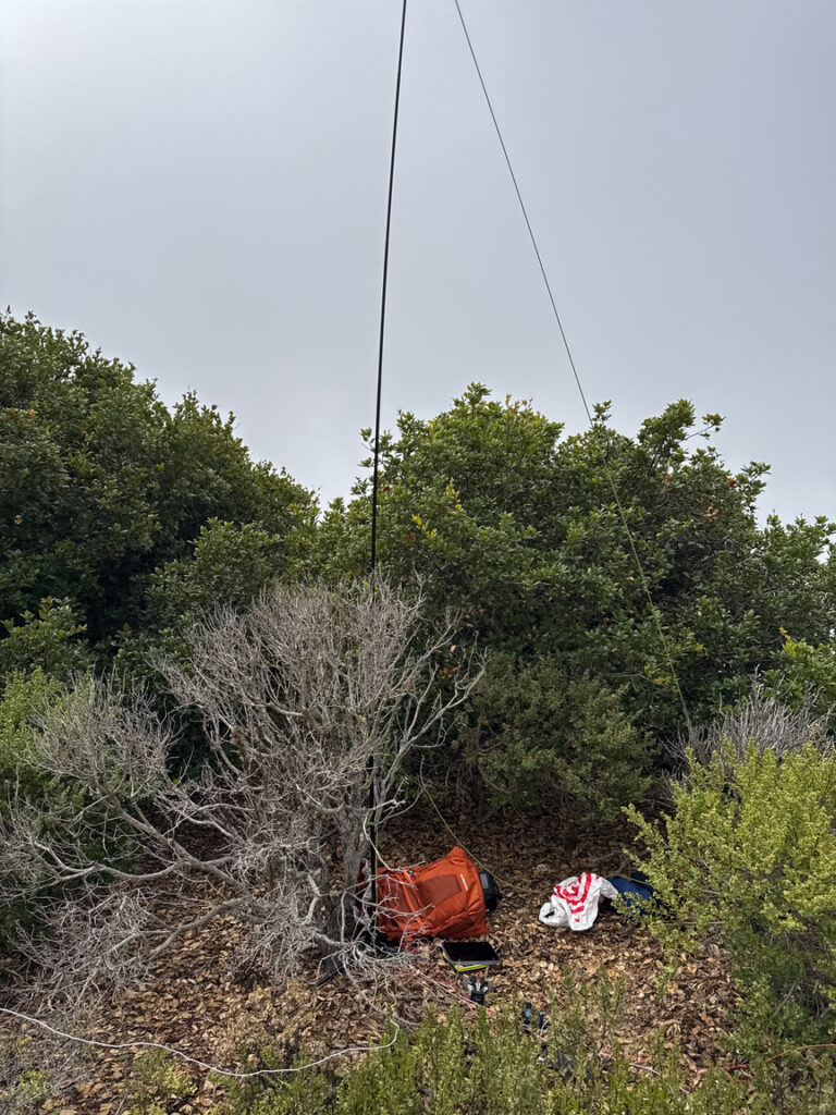
The trail here is a gradual incline along the northeast side of the mountain. I followed it down about 500 feet and found a spot where a large stand of coyote brush offered something of a windbreak. The view wasn’t great, mainly fog, but once in a while it would break and I’d get a nice look at the harbor and buildings in Brisbane. Once in a while I could even see out a bit farther to US-7493 Candlestick Point State Recreation Area.
I used a 17-foot whip on a Gabil GRA-ULT01 tripod and the KX2 for this activation. The wind was so strong at 15 feet that I had to tie down the top of the whip, but nestled in my coyote brush shelter it was calm, and I pulled off layers down to just shorts and a t-shirt.
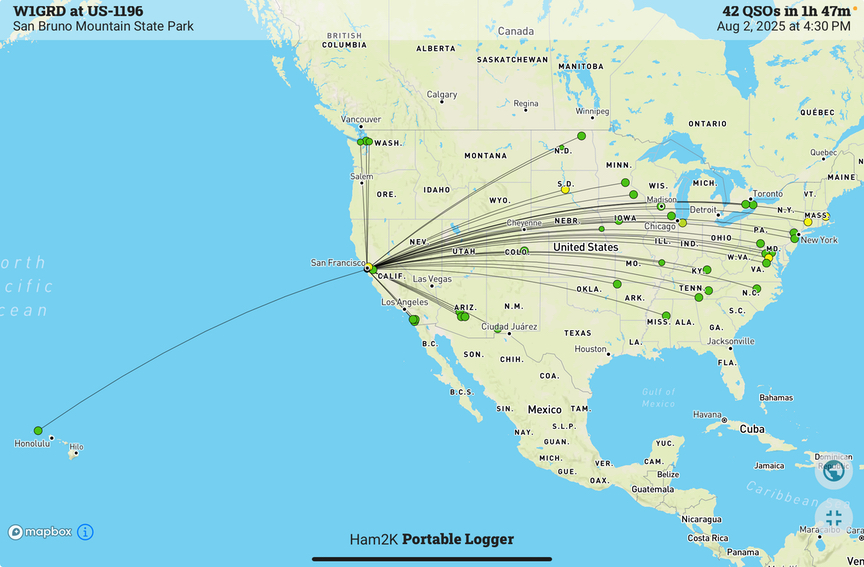
There happened to be a contest running, as I recall it was the North America CW contest, and so it didn’t take long to log 42 QSOs, including a few park-to-parks and regular POTA contacts mixed in with the contest Qs. When POTA slowed down I’d go sip on the contest. I’ve started to take a look at the upcoming contest calendar for opportunities to help with ‘challenging’ activations. After a few hikes that resulted in zero QSOs I was grateful to be busy at the key!
This was the final activation, though not the last hike, of my west-coast trip. It was really nice not to have to struggle for hours, pulling off a QSO every ten minutes to try to get to a dozen. I guess that’s the fate of a QRP operator, though, sometimes conditions just aren’t in your favor. I learned quickly in the first few activations that there was no way I was getting my signal through the 100- to 150-foot redwoods that surrounded me in several parks. I could barely hear anyone, let alone anyone hearing what was left of my tiny signal after the trees were done with it. Not even RBN was hearing me on some bands.
My advice on San Bruno is to plan your trip around the weather. It isn’t always a gale at the top, and there are plenty of clear days with great views. Don’t forget that the road is only open on weekends to the summit, but the closed gate that you come to is where the parking lot is for the trails on the east side of the hill, so all is not lost. And, of course, you can walk up the road to the top if you like.
Like most state parks in California, you’ll pay a day-use fee. For my visit in August of 2025 it was $8 at an electronic kiosk at the main entrance. The payment system was down, and all I had was a dollar bill, but I stuck it into a little registration envelope and dropped it into the payment bin next to the kiosk. There’s plenty of parking and you are just a few minutes from the Daly City BART, which can get you just about anywhere you want to go in the Bay area. It looks a bit bleak in my photos, but overall I thought it was a nice spot and I’d likely visit it often if I lived in the area.