Man, did Mt. Pisgah WMA get hosed by the copy writer over at the Massachusetts Department of Environmental Management. Here’s their official description of the property:
This property is comprised of a hardwood ridge with small rocky outcrops. Also, there is a small portion of this property that is upland habitat. There is no formal access to this property; informal access is located through the Town of Northborough Conservation Land. See WMA map.
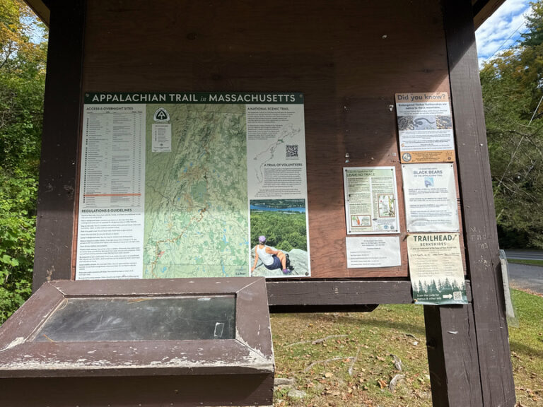
The park’s page on POTA.app noted only two prior activations (none on CW) and repeated the dire DEM warning about lack of access.
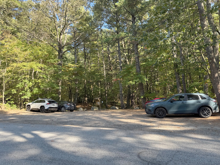
Guess what! It’s one of the most popular parks in Northoborough. When I got there on a stunning early fall New England Sunday afternoon, the fairly large parking area off of Smith Road was full and cars were parked along the side of the road. I met and chatted with more hikers in there than I’d seen in weeks of hiking in nearby state parks. And dogs! Lots of good dogs to pet. When I left late that afternoon things had calmed down a bit, but there was a small group of people heading to South Lookout to see the sunset.
The ad copy isn’t wrong, you really can’t get to the WMA directly. As is often the case with Wildlife Management Areas in Massachusetts, there are associated conservation set-asides that buffer the actual WMA. This isn’t always the case, but it’s a common pattern. Take a look at the DEM map:
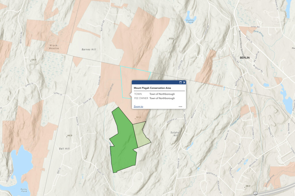
The WMA is the dark green area at the bottom. The light green area to the east is Mt. Pisgah Wildlife Conservation Easement (WCE), and the pink area to the north is the Mt. Pisgah Conservation Area. It’s clear that the WMA is landlocked, however the Conservation Area has multiple parking areas along Smith Road and is well-maintained with multiple trails.
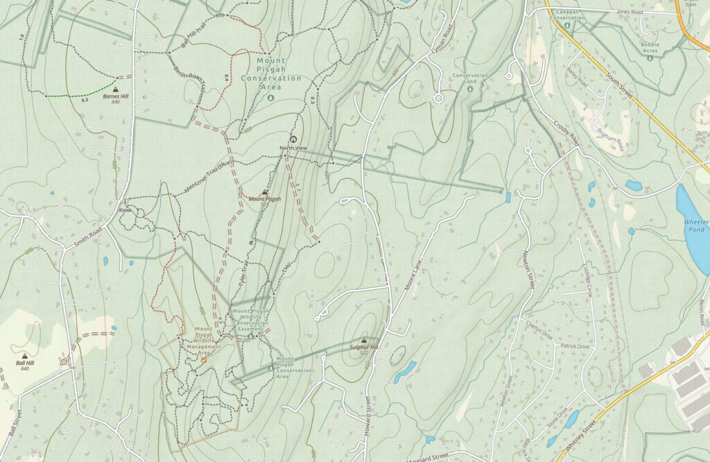
The north-south ridge is a great place to hike, from North View, down North Gorge Trail, and then over to South View, which is how I did it. Notice where the WMA is located, it’s on the south end of the Conservation Area, and it is pretty small, you’l want to consult a GPS map to make certain that you are within the boundaries. Here’s a handy map:
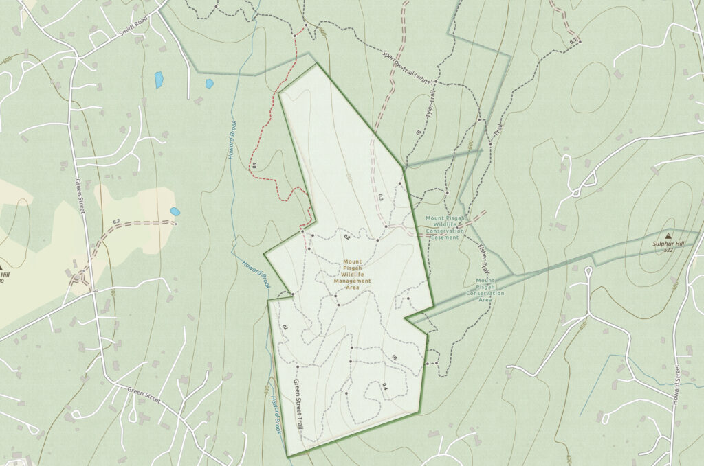
Note especially that the peak of the south ridge is not inside the WMA. You’ll see signs along the trail for South Lookout, which is the peak, so just follow them and head downhill a bit to the west when you get there to get inside the WMA.
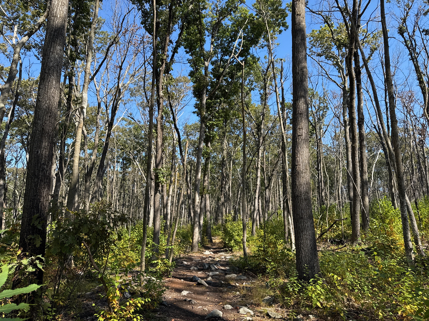
Despite the bleak description, this could easily be a state park. The trails are maintained by volunteers, and they are well-marked and well-maintained. Even though you are up on a ridge, there’s only a slight climb to get there, and I’d classify this as an easy hike, three miles that can be extended to five if you are feeling fresh.
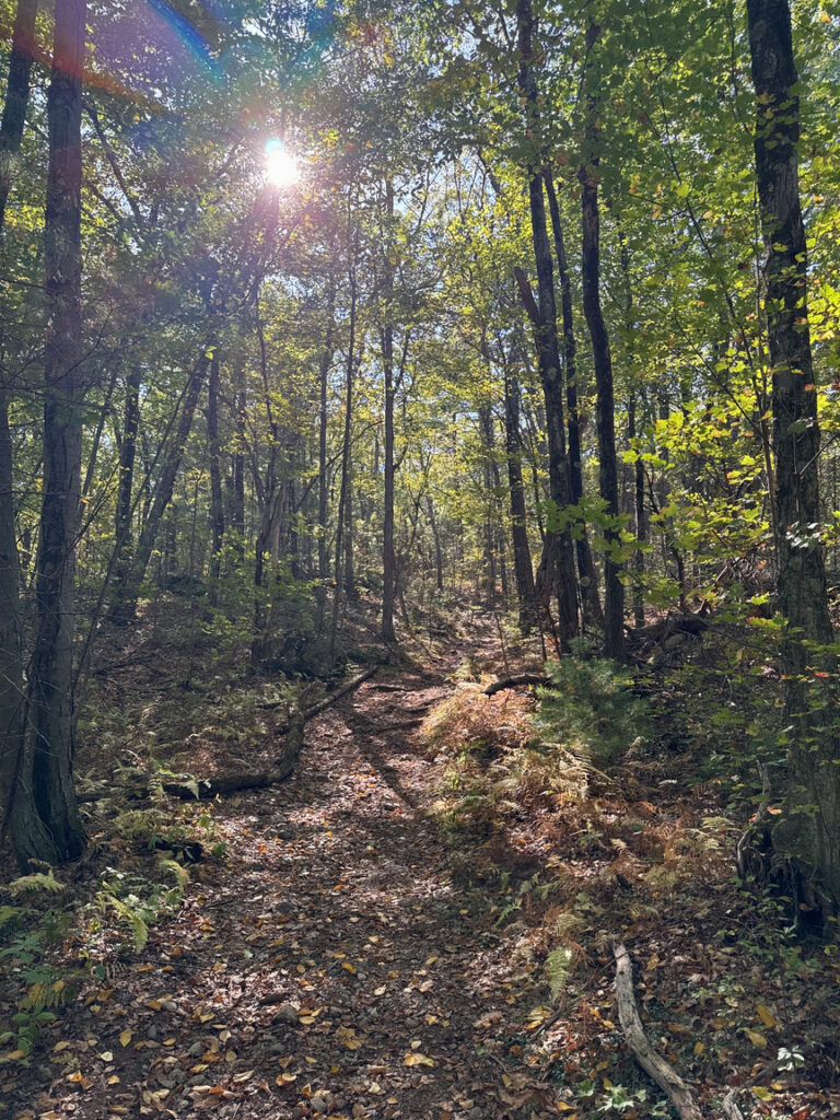
The story here at Mt. Pisgah is one of forest succession, and it’s a drama, full of tragedy and eternal hope and the renewal of life. Something I like to do in the woods is to look around me at the forestation and figure out how the forest got to look the way it does now. There are some broad storylines that map human use of the land, such as agriculture, and there are natural stories too, of changing climate or localized disasters.
At Mt. Pisgah there are enormous stands of young oak, all the same size, studded by much older charred oaks and pines. The older oaks in the forest have narrow crowns, hinting that they were in a mixed stand of pine and oak. The understory, the low sapling layer, is mainly birch here. The uniformity of the oak canopy is a strong clue that the surrounding land had been disturbed in the past.
You can estimate the age of a tree in New England by taking its diameter in inches and multiplying that by a growth factor between 4 and 6 depending on the species. Birches grow quickly, so you’d use 4 for them, and 6 for a slow-growing sycamore. Oaks and maples are roughly in between. So, if you are standing in front of an oak with a 12-inch diameter, the tree is likely 50-60 years old.
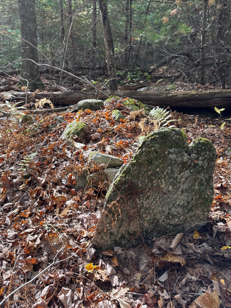
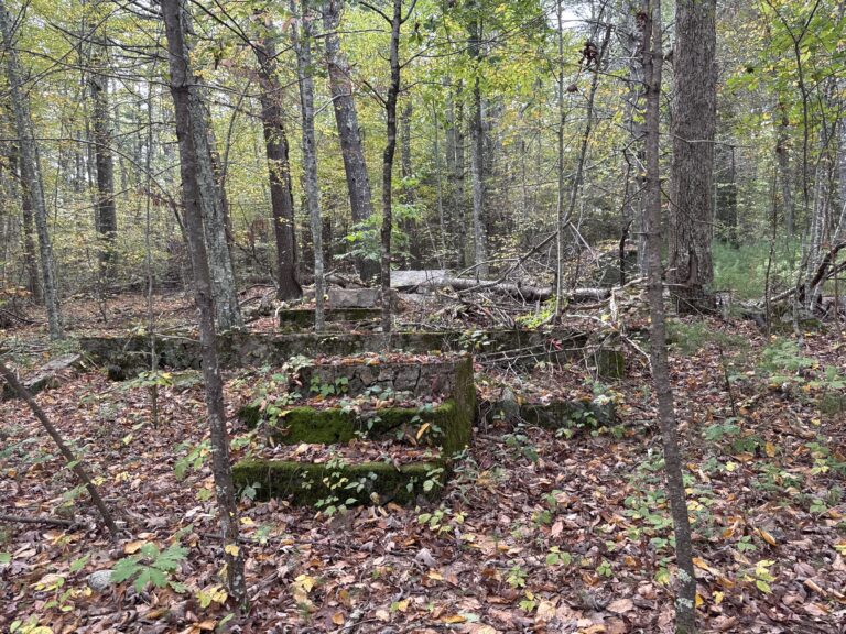
In the Mt. Pisgah forestation we’re seeing an area that was previously cleared, likely for pasture. There are very large rotted stumps, covered in moss, that were probably pasture trees, big oaks and maples that provided shade to livestock. The size and condition indicate that they are very old. When a pasture is abandoned, there’s typically a period of a few decades where the landscape is shrubby — that’ll be black huckleberry and friends here in New England — with large numbers of opportunistic saplings, either birch or oaks.
Part of the story, then, at Pisgah, is land cleared for pasture in the late 1800s, then abandoned. Oak took over, but spread out enough that pine could also thrive. About 60 years ago, fire swept across the hill and took out quite a bit of the forest, leaving some of the larger pines and oaks, the latter being adapted to be fire-resistant. Many of these are now standing dead. The mature oaks and pines we’re seeing now at Pisgah are roughly 60 years old, the reforestation after the fire of the 1900s.
There was another fire! Around 15 to 20 years ago another fire swept across the hilltop. The trunks of the older oaks are charred, but they are built to withstand fire, and they are living. I chipped a chunk of charcoal off of a trunk and broke a fresh surface: No odor at all. It takes a few decades of weathering to lose that creosote/sap/char smell. The sea of young oak in the photos are from that forestation. There’s also an understory of birch waiting its turn — it appears to be very young, so I wonder if there was yet another blaze, as it likes ashy soil.
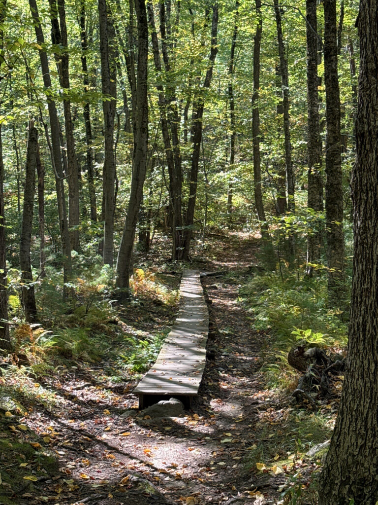
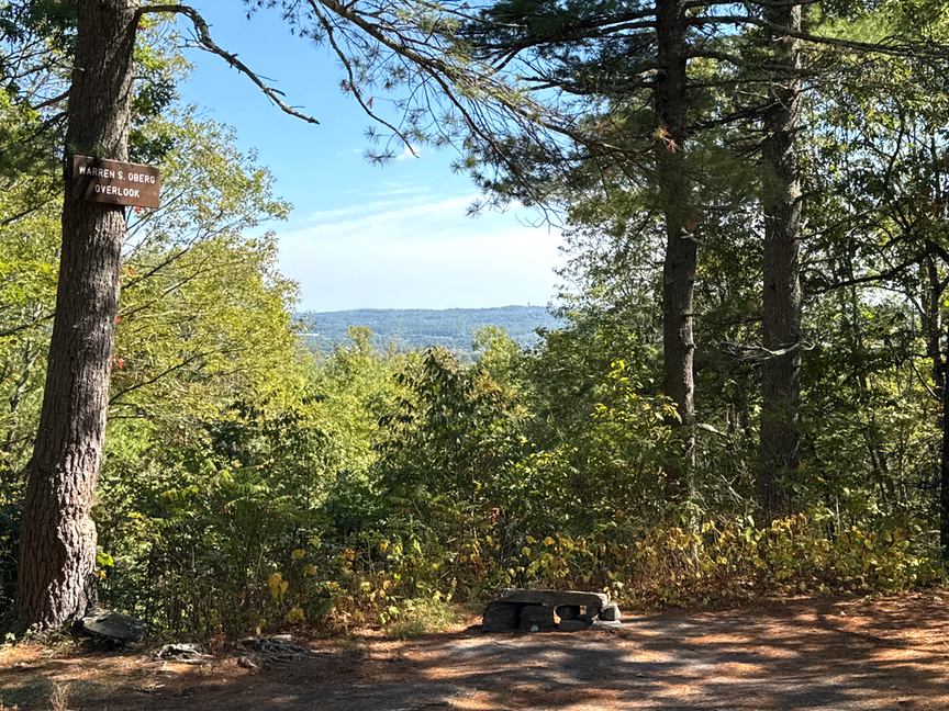
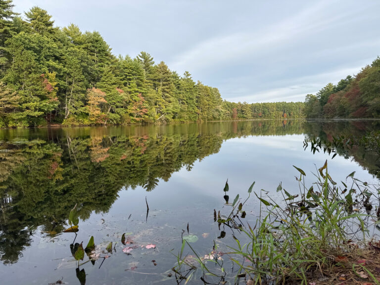
The trails themselves are lovely and easy to walk. The two views above are from the north, on the way to the Oberg Overlook at North View:
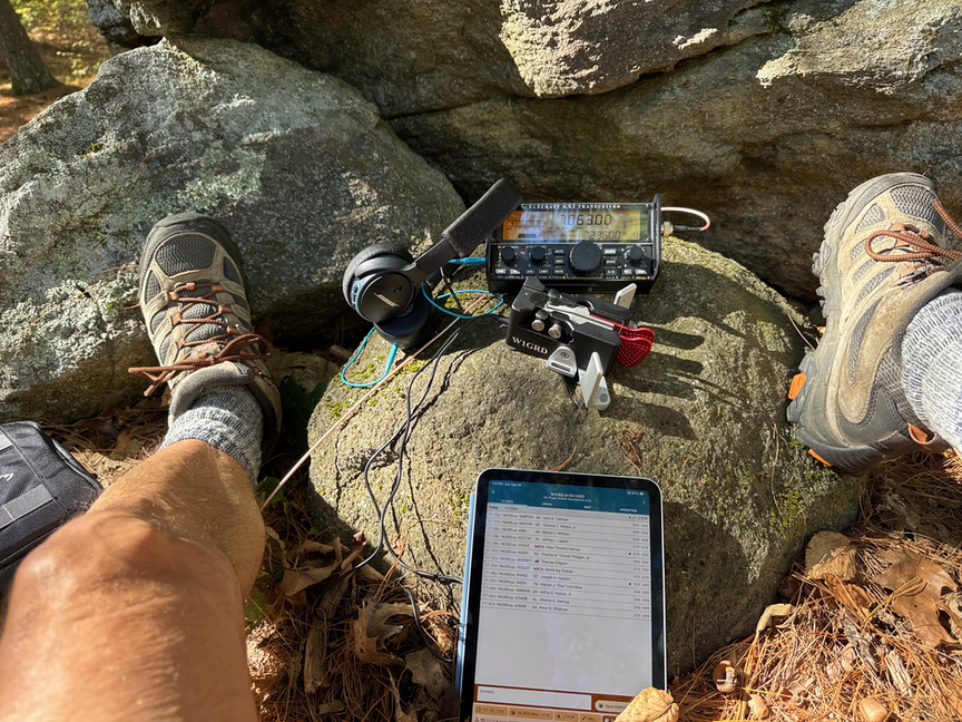
I picked a nice spot just inside the WMA to set up. Conditions were fair, and I spent about 20 minutes working 13 hunters, including Thomas SM3NRY who seems to always show up. It’s really great hearing from POTA friends on the bands.
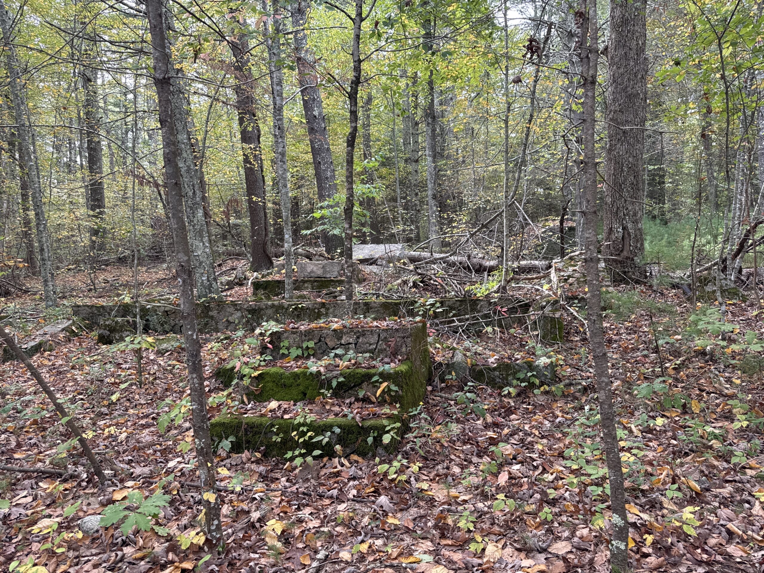
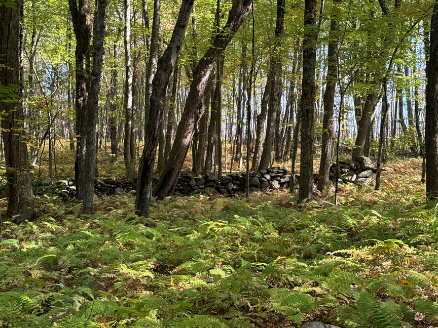
The return to the car provided yet another story, with low stone walls defining what used to be pastures. These are some of the last warm days of the season, and I’m going to miss walking down paths like these, listening to their stories.
This isn’t the first time that I’ve thought twice about going to a park based on its description on POTA.app. What I’ve learned, though, is that if something is marked ‘inaccessible’, it probably isn’t, it’s just either not obvious how to get in, or that whoever wrote that has never been there. I’m a big fan of just going out to take a look, and that’s led to some really fun operations in parks that were supposedly ‘inaccessible’.


2 Responses
Thank you for all the work you do. WC1N
Thanks, Bob! Pisgah is amazing, it could be a classroom for learning about forest succession. There are some nice views, too!