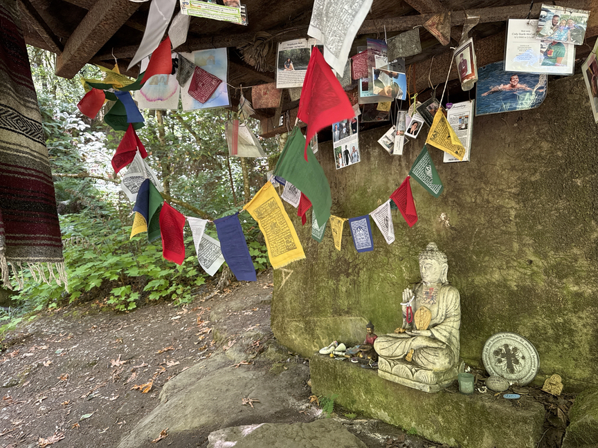
It was a hot summer day a few miles down the trail in The Forest of Nisene Marks, and I spotted a little bridge crossing Aptos Creek down a small side path. A perfect place to stop, adjust the pack, and splash some water on my face, I thought. In one of those delightful moments that we occasionally get out in the woods, I found a full-on Buddhist shrine tucked under the bridge!
It was such a California moment for me…as someone who grew up in the midwest and has lived his entire adult life east of the Mississippi River, California has always held this sheen of New Age spirituality for me. I’m an old hippie, a devoted Deadhead, and lived in a little commune during the Harmonic Convergence — anyone remember that? It’s been decades since the commune, but turning the corner and running into this unexpected shrine brought back so many wonderful memories.
From what I’ve gathered talking to folks in the area and reading accounts of hikes, the shrine started small, with just a small statue and a few beads. Most people would call the figure ‘Buddha’, but that’s something of a generic term. More specifically this is an image of Guanyin/Cannon, the bodhisattva of compassion, who embodies mercy and hears the cries of the world.
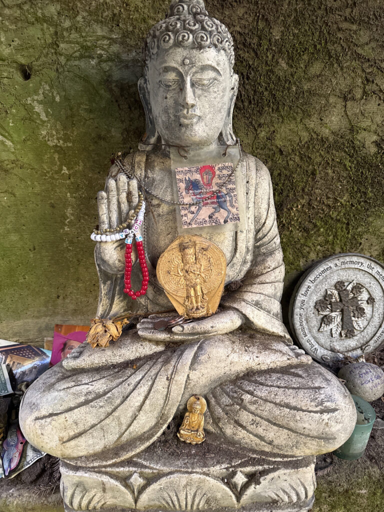
Over the years,s hikers ran across the shrine they added their own petitions, memories, and offerings. In one of those crazy ‘you gotta be kidding me’ moments, I happened to be carrying a set of Tibetan prayer flags in my backpack, and I added them to the shrine along with with a small offering and my own prayers for peace. I found this small connection to the divine, tucked away in 10,000 acres of redwood forest, to be incredibly moving. It is one of the joys of POTA — going into places you have never been and discovering all of the wonders there.
I’ll take a moment to point out that you won’t find my activation of the park on POTA.app. I tried mightily but was unable to make a single contact with my KX2 and small loaded vertical. It was the redwoods, I think, they are very large and very dense here, and seem to be sponges for RF. I had trouble even hearing anyone, and no one responded to my calls. While this goes down as an ‘unsuccessful’ activation, I think we need to look at that word and maybe come up with a different one. I like ‘incomplete’ and that’s what I use most of the time now, even though it implies that you can go back at some future date all WWFF-like and finish up then.
On the plus side, I learned that oxalis, also known as shamrock, is a common ground cover in this part of California. I like oxalis a lot and have several in my house (and once smuggled one back from France), so I was delighted to set up the station in a big patch of it. It didn’t improve conditions any but it improved my mood!
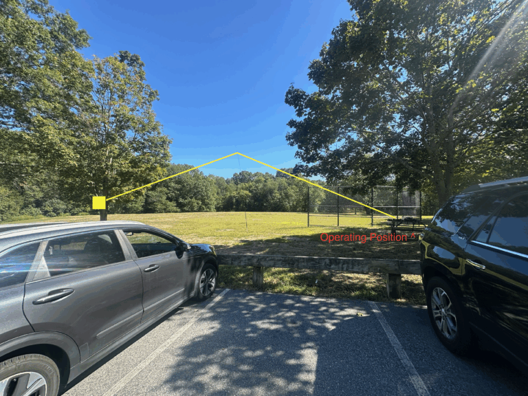
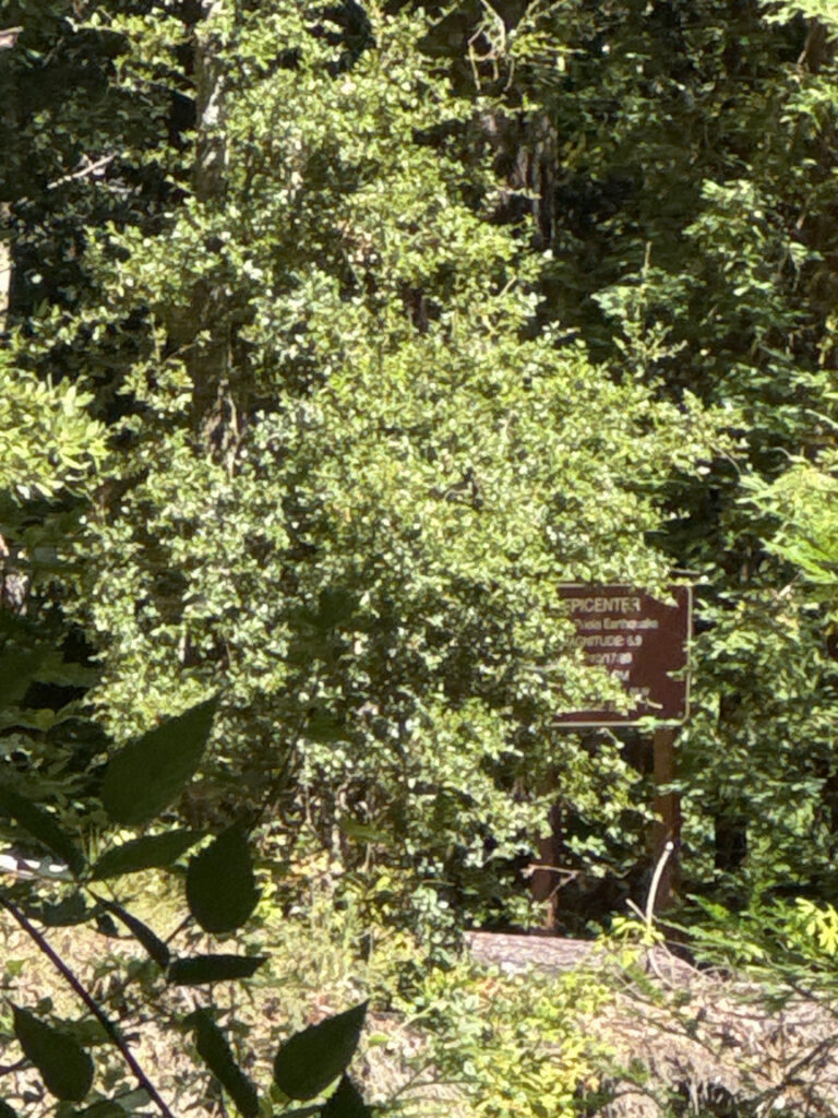
I usually try to pick something interesting to see when I visit a park, and here at Nisene Marks what interested me was a memorial at the site of the 1989 Loma Prieta earthquake’s 6.9 epicenter. The San Andreas fault runs just northeast of the park, and the Zayante spur crosses Aptos Creek. The site is about 6.5 miles from the park entrance.
If you are also interested in this feature, you’ll want to park further inside the park than the main lot at the entrance off of Rte 1. Keep driving up the dirt road for a few miles until you run into the Porter Family Picnic Area. There’s a good-sized lot there and you’ll save yourself 4-5 miles of hiking.
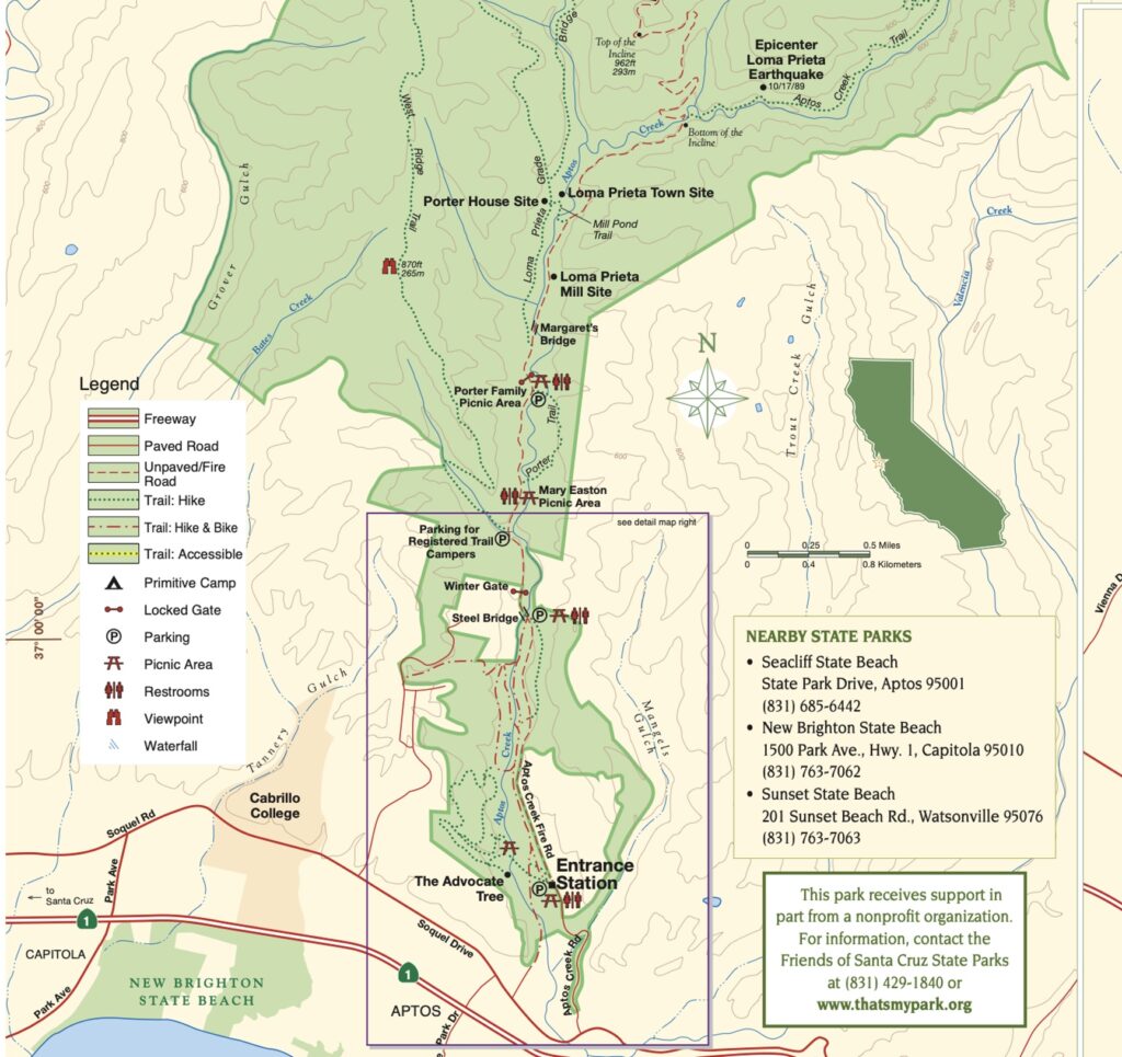
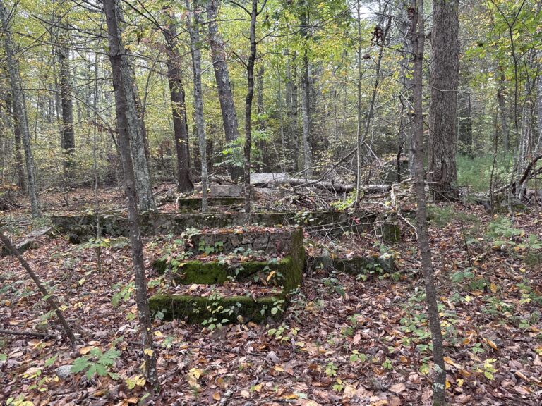
The major trails in the park are the remnants of the logging industry that came before. During the late 1800s and into the early 1900s a ‘Red Gold’ rush hit the area, the red gold being the enormous redwood trees that cover the coast. They were truly enormous then, and the best ones were up on ridges. A massive logging effort cut down most of the forest, and rail spurs and logging roads cut through what is now the park, a gift of the Marks family to the state in honor of their mother, Nisene Marks.
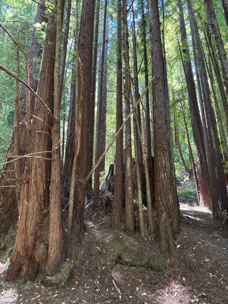
In our times we see mainly the second-growth forest, trees around 100 to 150 years old. They’re all the same size, unlike a mature forest, because they all sprouted at the same time from the stumps of the trees that were cut down. Uniformity of tree size and canopy height in a forest is a good indicator of a disturbance event such as a fire, or, in this case, human activity. The tree below was damaged by fire, not logging, but you can see the way that saplings sprout from the stump.
Since the primary trail through this part of the park is an old rail bed, it is quite flat and wide, and an easy walk. It’s dusty, though, and on the roads where cars are allowed, the plants along each side are covered in thick layers of it.
I was heading for the earthquake memorial, and the best way to get to it is by hiking Aptos Creek trail. Unfortunately, when I got to the spot where the trail cuts off the rail bed and becomes a ‘real’ trail through the forest, I was greeted with a sign stating that the trail was closed indefinitely.
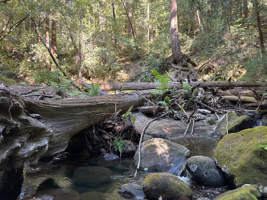
I later learned that there had been some small tectonic events — slippages — and also a few large storms that dumped enormous amounts of water in the hills, and these had made the area unstable and in many places impassable. The creek itself didn’t look too bad, though, and the water level was low, so I decided to just follow the creek up to the site.
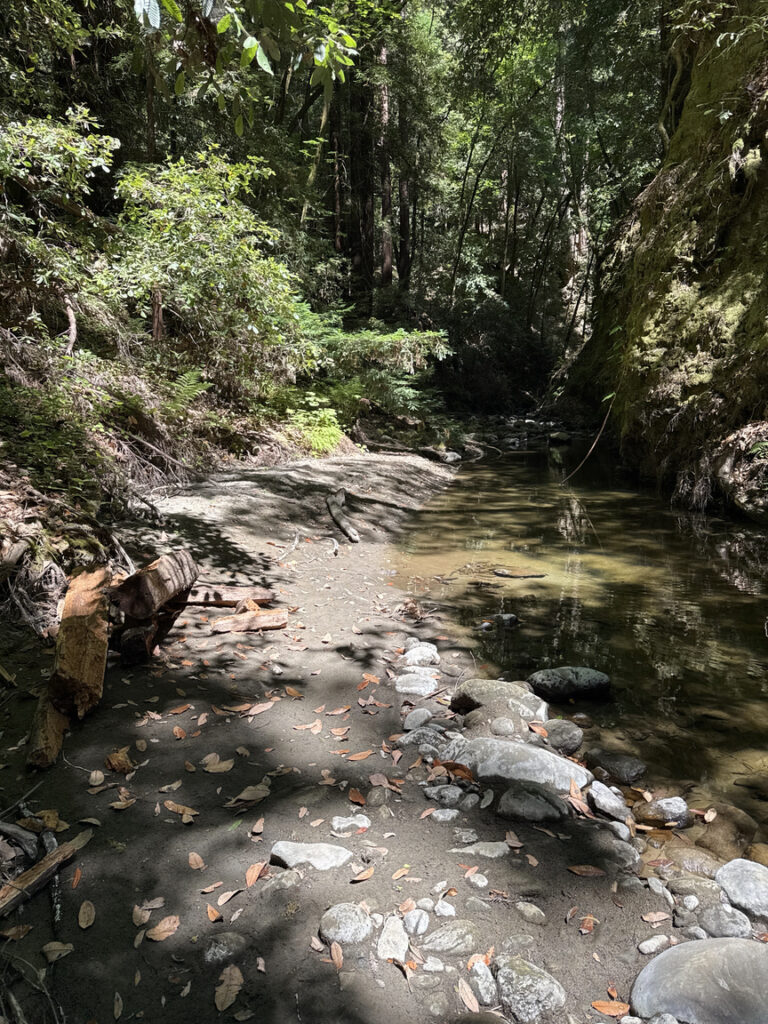
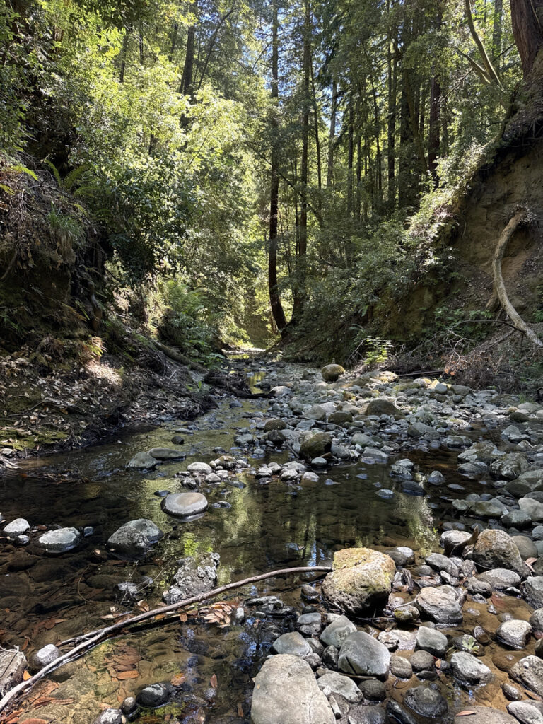
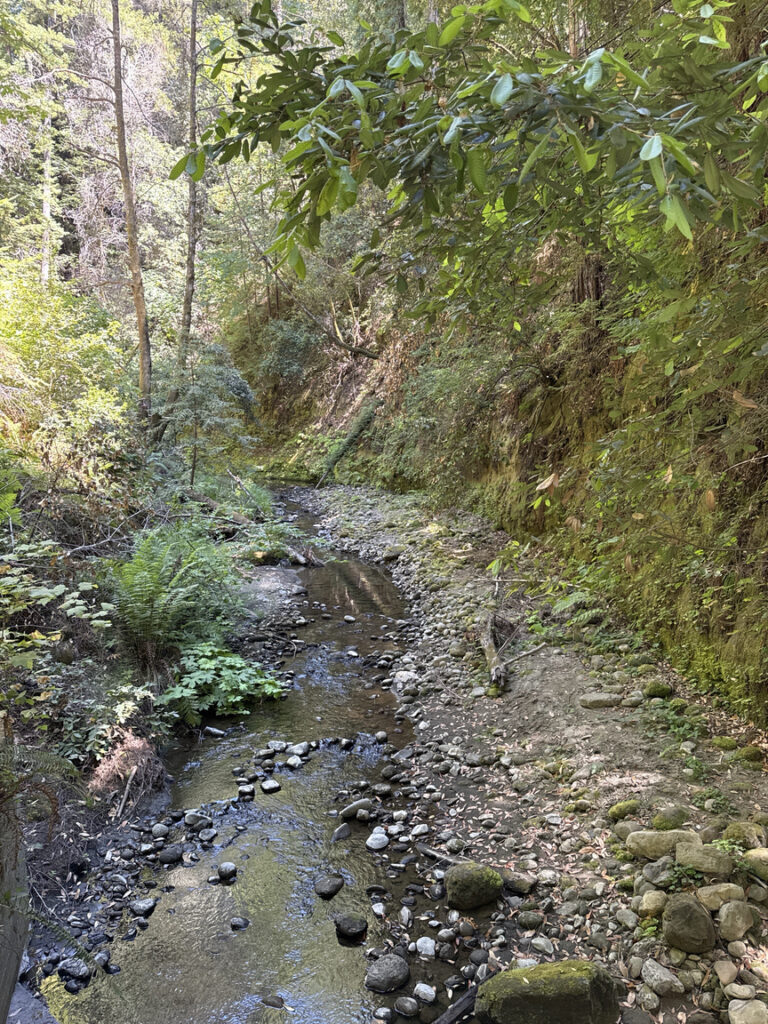
I’m not certain that this route would be possible during the rainy season. In all but a few areas the creek was low enough that I could walk along the bank. After a mile of this I finally came to a spot that I just wasn’t going to get around. But! I could see the sign marking the spot just a few hundred yards further on! I poked around and discovered that someone had tied off a nylon line to an anchor point at the top of the hill, about 30 feet. I tightened the straps on my pack and headed up the sandy slope, happy that I had climbing gloves in the pack.
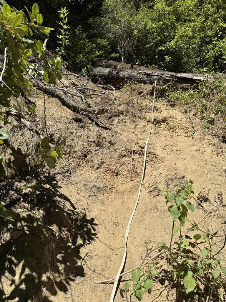
At the top I’d hoped to find a passage around the tangled mess to get to the marker, but it just wasn’t there. I had a bite of lunch and reluctantly headed back the way I’d come in, half-rappelling down the loose slope. I’d been close, though, and was able to see enough of the signage to grab a snapshot.
The hike out was one of quiet reflection. I hadn’t been in redwoods before this trip to California to be in the Grateful Dead 60th Anniversary festival at Golden Gate Park in San Francisco, and I found that they put me into a really contemplative mood. It was the same at US-1187 Portola Redwoods State Park, the trees are so large and so old that the ‘cathedral’ effect you read about really does happen, both visually as the trees arch up to the canopy, but in the feel of the place, too. Running into a Buddhist shrine in the middle of the woods added to that feel.
For an ‘unsuccessful’ activation I’d had quite the day, a really good hike, some crazy surprises, and even a moment of serenity. I call that a success, and I’ll take the incomplete for The Forest of Nisene Marks.