I was in California for the Grateful Dead’s 60th Anniversary celebration, three glorious shows at Golden Gate Park in San Francisco with some killer guests and openers, a bit of a pilgrimage for this longtime Deadhead. I live on the east coast, so I figured that if I was headed all the way to the other one, I might as well spend some time and do some west-coast POTA.
I ended up doing five significant hikes in two different flavors. One flavor was Redwood Forest, like US-1149 The Forest of Nisene Marks, and also US-1187 Portola Redwoods. These were long hikes, twelve miles in Portola, among dense, dark forest surround by towering redwoods with eucalyptus filler. I enjoyed these hikes — I’d never had the chance to be in the redwoods — but from a POTA perspective they were a bust, as the dense, towering trees turned out to be efficient RF absorption machines. In some spots I couldn’t even hear anyone, let alone work them.
This was not the case, though, for the other flavor of hike, Santa Cruz Ridge. In those parks, you start in the trees but then rapidly climb up onto ridgelines that offer clear views of the horizon and excellent RF environments, and Castle Rock is one of the highest ridges in this part of the Santa Cruz. This is my favorite kind of hike, and I enjoyed Castle Rock so much that I spent two days there hiking, one before and one after the festival in town.
The park sits along the Santa Cruz mountain range, about 45 miles southeast of San Francisco, an easy drive from my lodging in San Mateo. There’s a $10 day use fee that’s payable at the park headquarters, and when I visited (August 2025) there were electric vehicle charging stations being installed, though they were not quite ready for use.
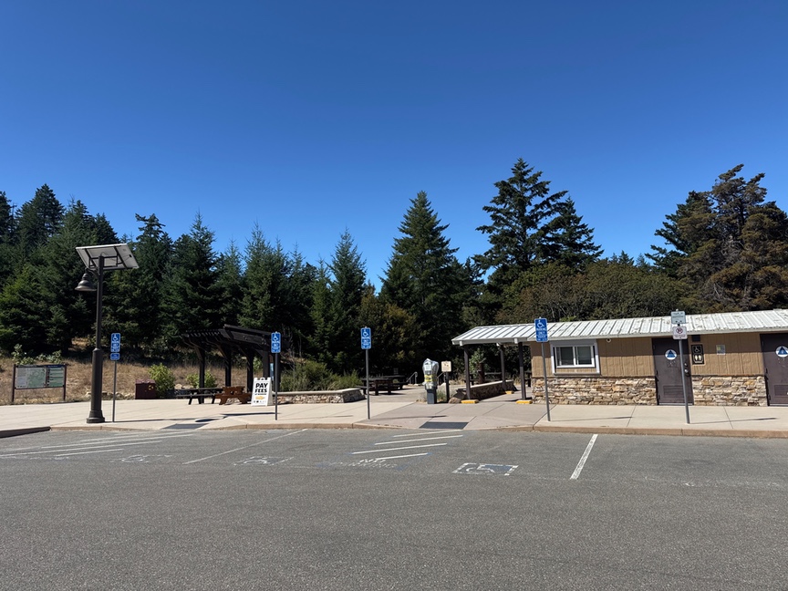
The headquarters is staffed during park hours, and you can get advice on trail conditions, maps, water, and even a sticker from the rangers. It looked like a payment kiosk was being installed, which would be a shame if it means that the park will reduce staff as a result. The rangers on the days I visited were really friendly and chill, and I actually walked a bit on the trail with a staff naturalist who was out and about.
But enough about the parking lot, let’s talk about the rocks.
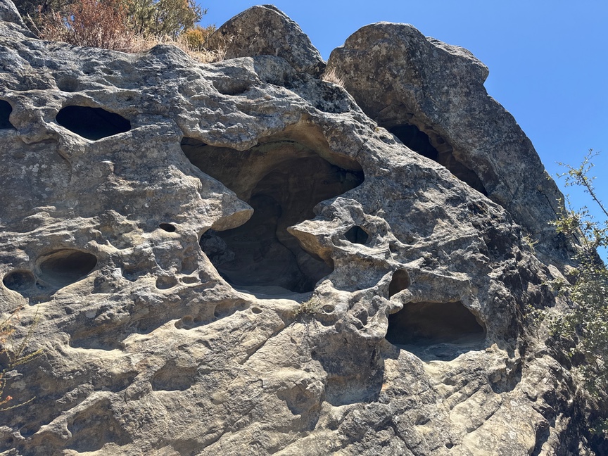
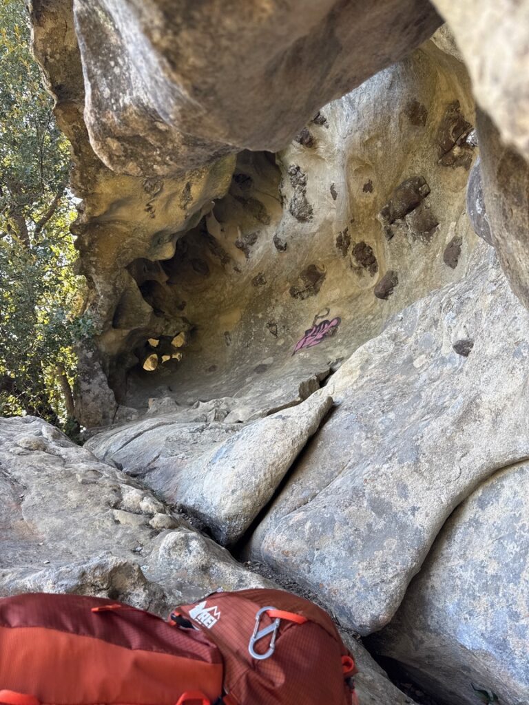
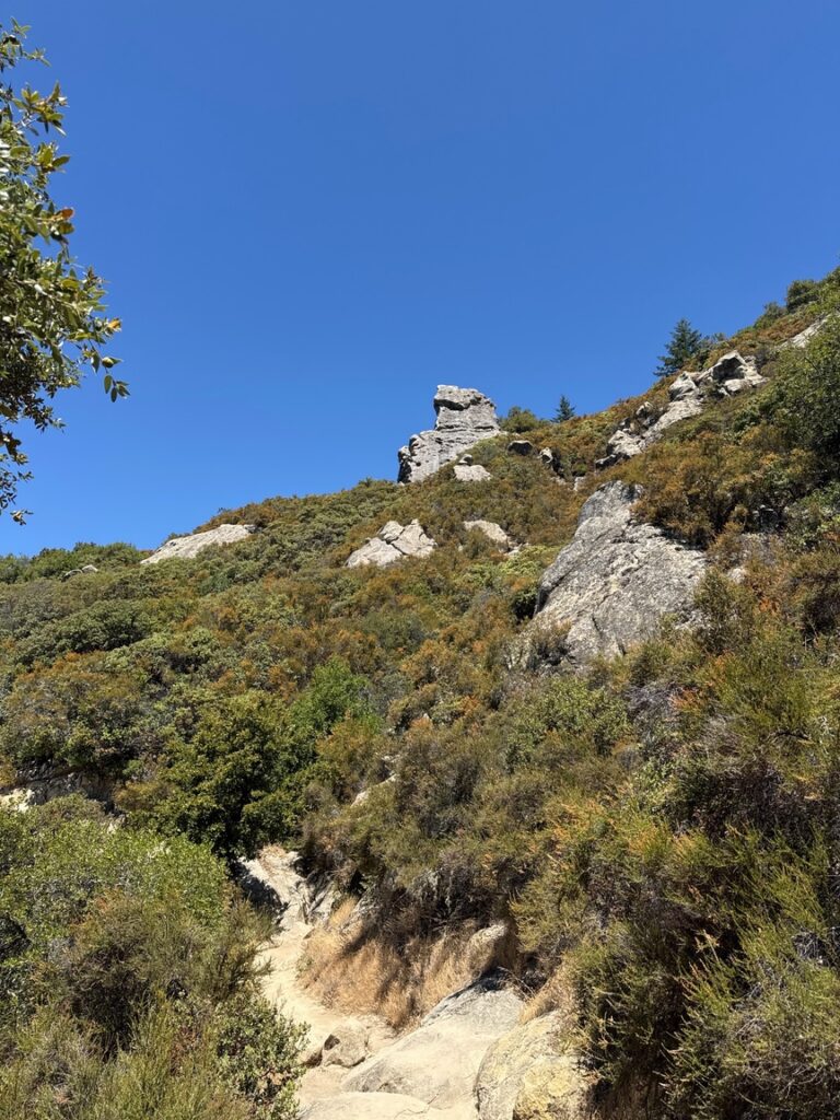
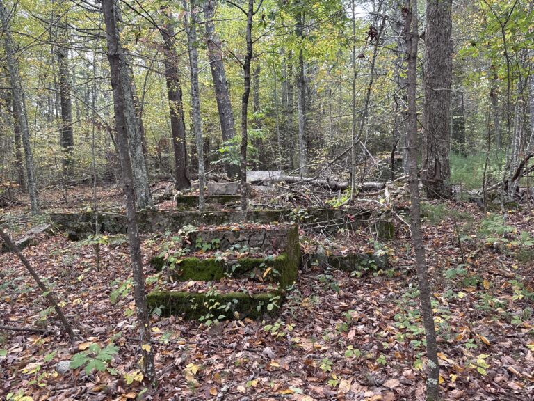
The rock here is primarily Vaqueros sandstone with a very high concentration of quartz, laid down as a seabed around 40 million years ago. The park sits along the Zayante Fault, a spur of the San Andreas Fault, and it has seen significant tectonic activity. The soft sandstone was uplifted and folded like taffy over millenia, and this type of deformation is known as taffeta. The swiss-cheese like holes that pock the rock is the result of salt crystals growing and dissolving, leaving pits that give the rock its name, tafone.
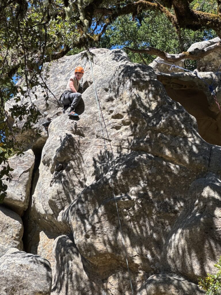
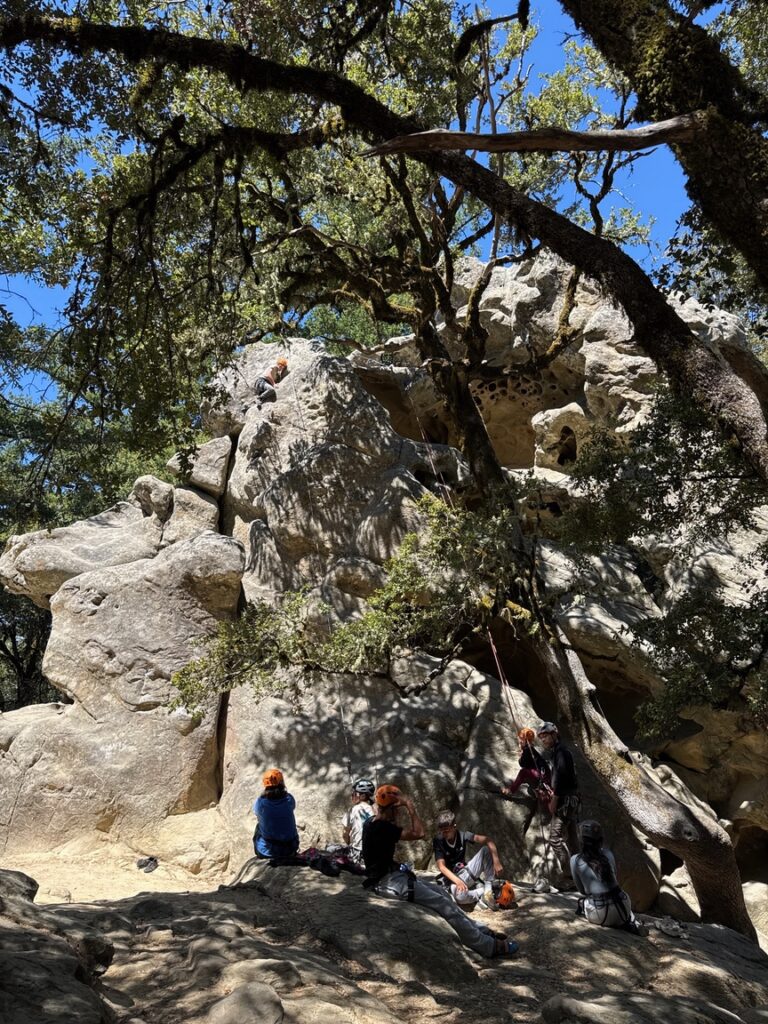
The park is named for a large outcropping of this stone, Castle Rock, on the north side of the park, a magnet for rock climbers. I saw quite a few up on the ropes during both of my visits, and it looked like group classes were being given in one area. Most of the routes I saw here require a top rope, although some of the smaller boulders can be climbed unaided.
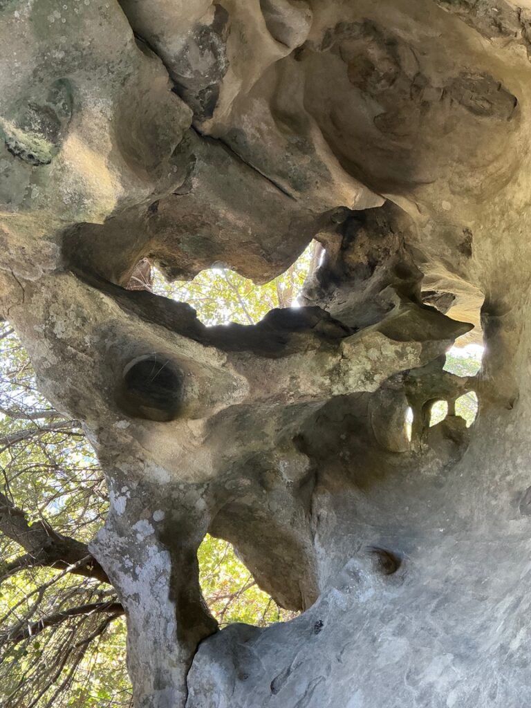
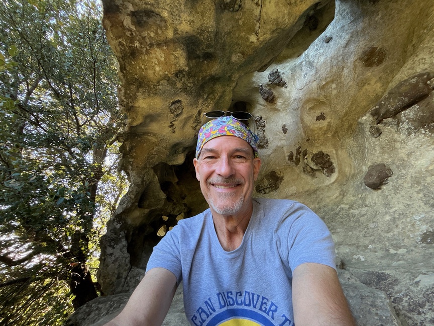
I ended up using one of those caves on my first hike. I was teaching an online software engineering course at Tufts which met once per week, and my plan was to hike in the morning, work my way back to my car and then drive 20 minutes to the Stanford campus to do my class from there. Typical of many of the parks in this area, there’s no cell phone service in most areas and I figured I’d be there in plenty of time.
Of course that didn’t happen. I realized at some point that there was no way I was going to make it back to my car before class started, let alone get down to Stanford. I was on the west side of the park finishing up my activation and remembered that I’d been able to get a cell signal on part of the eastern slope. I headed in that direction.
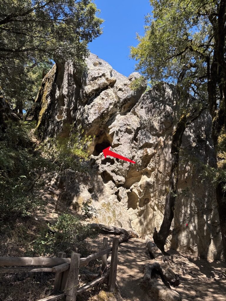
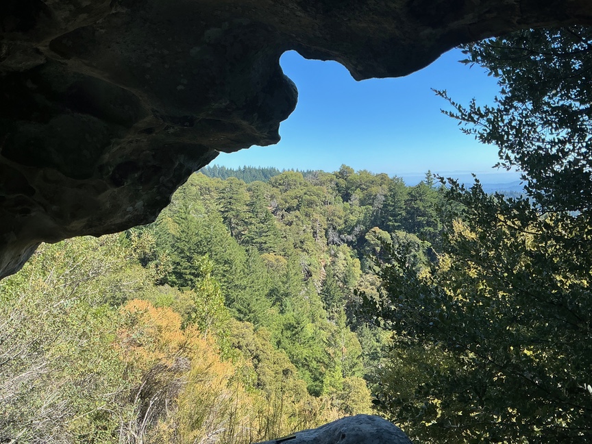
Walking across the trail on the east side I turned a corner and saw the perfect spot for my one-hour Zoom lecture, a cave up in the hills. It took a bit to get up into it, and I had to push my pack up ahead of me, but once I was in I could tell that it would be really fun, and I had a decent cell signal to boot. My students and I had a wonderful discussion of mutual exclusion and deadlocking, and I would occasionally turn the camera around and give them my view. It was a unique experience on both sides of the call!
There are plenty of places to do a POTA operation from in the park. I happen to like ridge hiking, and so I set up W1GRD on the west side of the ridge near Varian Peak. There was plenty of room for my EFHW and I was able to get it up high into the pines for a leisurely CW session, 12 QSOs and back on the trail. As I’ve said in other articles, I’m mainly a hiker and added POTA to that activity, so I tend to set up the station, get the minimum in the log, and then get back on the trail. A Dozen and Done, I call it. Twelve in the log, I packed up the KX2 and antenna, and back to the ridge.
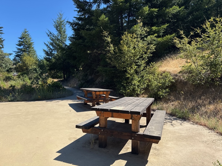
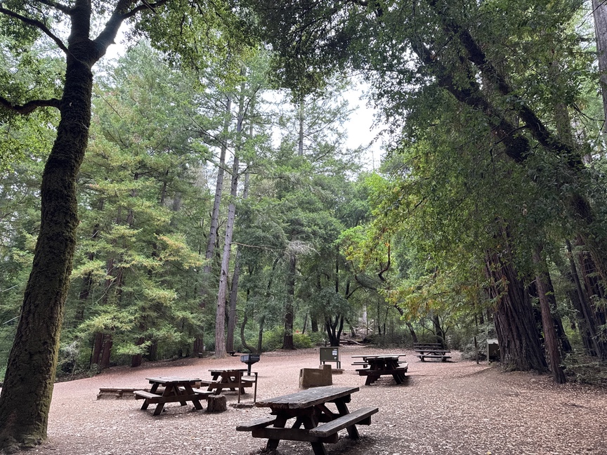
You also can operate comfortably from near the parking lot, which itself has significant elevation. There are comfortable tables set up in several areas near the headquarters building, and there are clean restrooms nearby.
Here’s the route I took for the second hike, about six miles in total, starting at Castle Rock itself on the right (near Pyramid Rock) and then looping along both sides of the ridge.
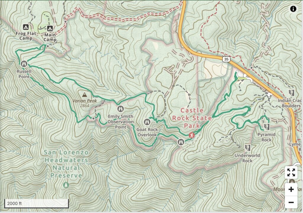
There’s about 1,000′ of ascent on the route, but much of that is just getting up onto the ridge itself. The west side is mainly in the trees, a mix of redwoods and some hardwoods, and then you break out to open air on the east side. Goat Rock, in the center of the map, is popular with climbers, though I didn’t see any on either hike. My lecture cave was just a few hundreds yards from there.
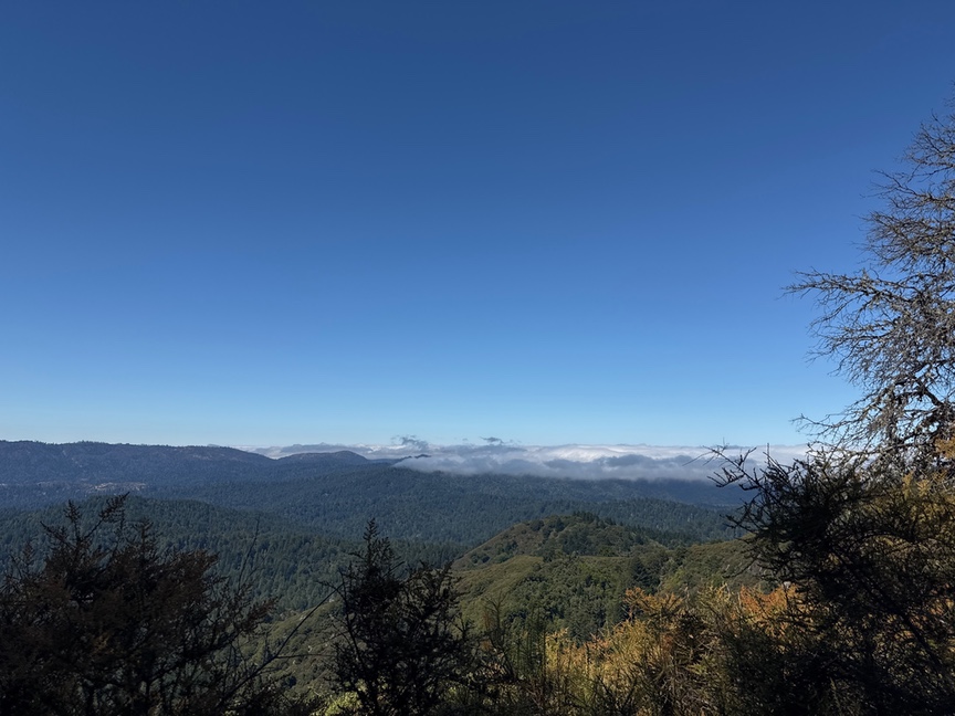
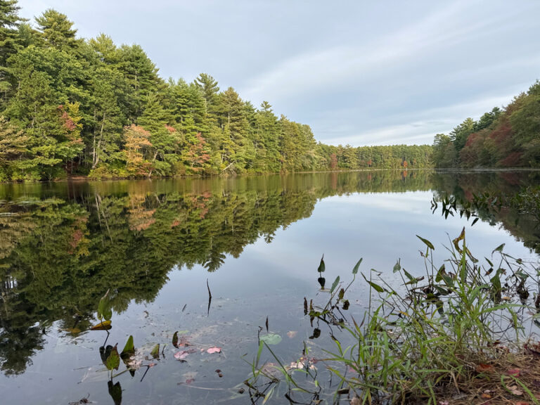
If you turn to the east at this spot on the trail you’ll be rewarded with an unencumbered view as far as you can see.
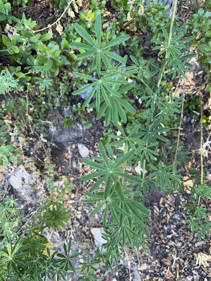
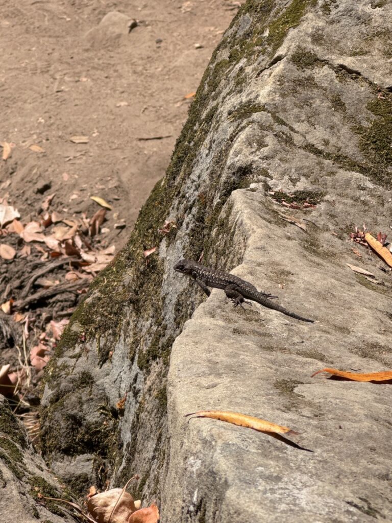
As you walk along the eastern slope, keep an eye out for some of the native flora and fauna. The wind is not as severe on this side and scrubby plants thrive here. You’ll find a bushy variety of lupine (below, left), and I smelled the mountain sage (center) before I saw it, as it warmed up in the sun. There are critters, too, like the western fence post lizards that were my constant companion (below, right).

I recall eating lunch one day, looking out at yet another beautiful vista, and thinking that Castle Rock had been everything that I’d hoped for when I was planning my California hikes. It helped that the weather was perfect each visit, even though San Francisco proper was a good 20 degrees cooler (and downright cold at night!). It’s the views, really, but also the geology, and you can spend several hours hiking, like I did, and still see something new and delightful around every corner.
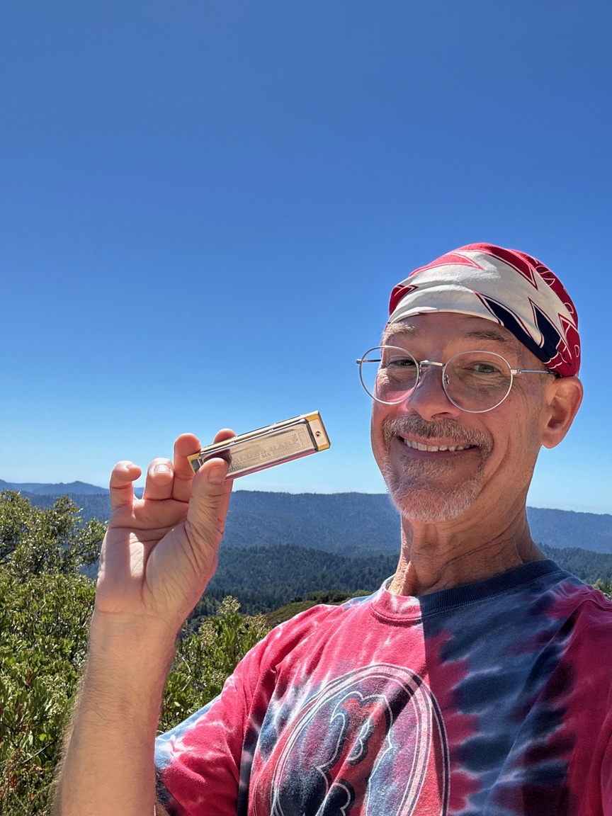
On my last hike there I worked my way over to the Emily Smith Observation point, had a snack, then whipped out my harmonica and belted out some Dylan and some Dead tunes for the circling hawks. They seemed to enjoy it almost as much as I did.


2 Responses
I figured that’s why I saw your spot out here (West Coast) Glad you had the chance to enjoy the wonders of nature….
I ended up doing five hikes – one weird part was being without a cell signal most of the time, which is pretty rare on the east coat. I truly enjoyed FINALLY being able to get into a space where I couldn’t hear any human activity at all.