

The POTAmap here at POTA News & Reviews includes a feature that identifies potential n-fers for a give park. You can see it in the image above, US-6909 Harris State Game Land is a possible n-fer with eleven different parks. Does that mean that you can sit in US-6909 and log it as a twelve-fer? Almost certainly not, and a bit of explanation about how that list is generated might help you to understand how to use it.
Once each quarter, a PN&R script runs against the data at POTA.app. It takes the top 100 activators and examines the recent activations for each of them. The script is looking for activations that happen on the same date with exactly the same number of QSOs in each category, CW, voice, and data. The idea here is that one way to the top 100 list is to activate a good number of n-fers, and there’s a strong correlation (though not perfect) with activations that have the same contact count on the same day.
Is it perfect? Absolutely not. It ignores the activity of the other ten or so thousand activators who don’t happen to be on the list at the moment, and there will also be false positives. I’m a perfect example of that: If I am roving, I typically set up, make twelve contacts, and then tear down and head for the next park. My personal data, then, has a good number of parks activated on the same day with the same counts, but they are totally unrelated.
This is one reason why the POTAmap lists these as Possible n-fers. Practically speaking it means that you need to personally verify that a listed n-fer really is one before logging it that way. Or not…and here’s where it gets interesting.
N-fers are inherently unfair
It doesn’t take more than a casual glance at the POTAmap to realize that there are vast swaths of the United States where the density of POTA references is low. There’s just a lot of space in the midwest and west, and the parks are spread out. Now take a look at the eastern seaboard, from, say, North Carolina up the coast. POTA references are thick on the ground. It is much easier to bag a Warthog in coastal Virginia, for example, than it is in Wyoming. In Virginia you can park your butt in on spot and generate a Warthog without moving. I’ve done it, logging US-1299, US-4567, US-9907, US-9933, and US-9935 simultaneously as a five-fer. As I recall I did around 50 CW QSOs in about an hour and a half.
The vagueness of the trails makes it work
Four of those references are trails, and you might recall from the POTA rules that you need to be within 100 feet of a trail reference in order to log it. Fortunately or not, the actual boundaries of most state and national trails are very, very vague. You often won’t even find a map of one. A good example is US-2430 Dighton Rock State Park (MA) and the associated n-fer with US-0891 Taunton National Wild and Scenic River. Let’s take a look at the official description for that one:
On March 30, 2009, the Taunton was designated as a Partnership Wild and Scenic River. Located in southeastern Massachusetts, the Taunton river flows for approximately 40 miles. The Taunton drainage area is the second largest in the Commonwealth of Massachusetts and contains twenty cities and towns, with portions of twenty-three others. Within this area is a variety of land types including wetlands, estuaries, and agricultural use leading to a vast amount of biodiversity within the river and watershed.
That narrows it down! The Park Service page for this site (https://www.nps.gov/articles/000/taunton-wild-and-scenic-river.htm) offers a link to the Partnership Wild and Scenic Rivers page where you can start to drill down to look at maps. Good luck! I guess the idea that the river itself is the designated trail seemed enough to most folks, because I sure couldn’t find an actual map of the ‘trail’.
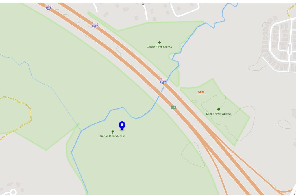
Instead, I know that Dighton sits on the Taunton. So, let’s flip it and start with a map of US-2430 Dighton Rock State Park, which is available:
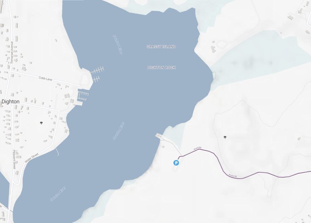
The Taunton River is the big dark blue blob on the left, and the park is the set of light blue bits on the east side. From this map it is clear that setting up within 100 feet of the water while in the bounds of the park qualifies for the two-fer.
It is exactly the same for the earlier reference to the five-fer at Virginia Beach. Most of the trails associated are only ver vaguely described. Here at least is a fair description with a bit of a map for US-4567 Captain John Smith Chesapeake National Historic Trail:
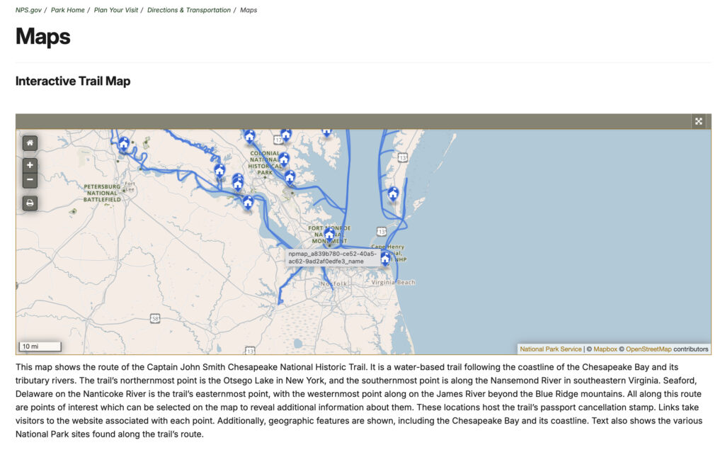
The trail is basically everywhere that Smith and his ship went. Let’s zoom in a touch.
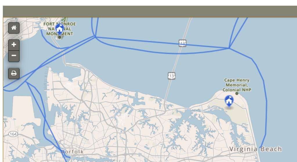
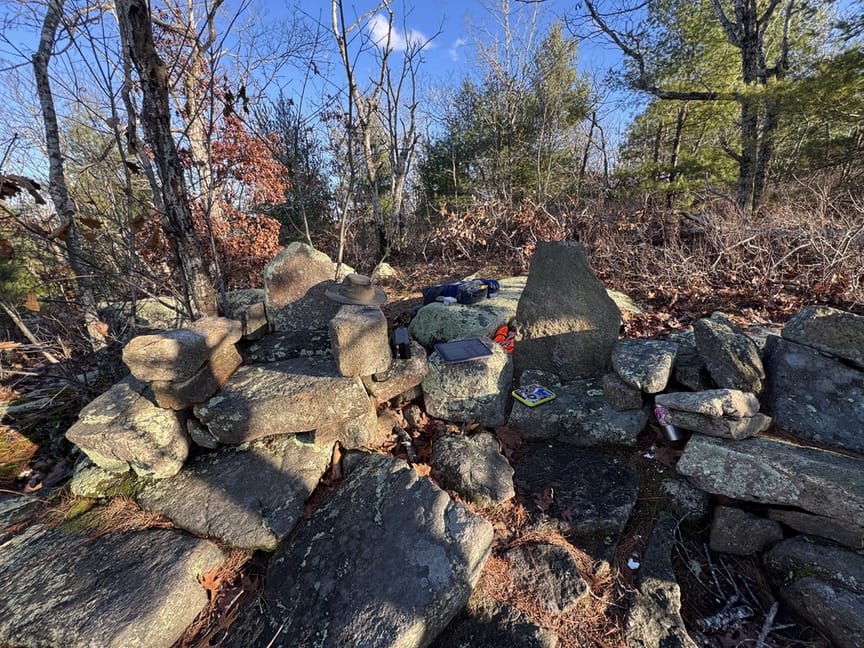
You’ll notice that the blue line that designates the trail comes nowhere near the park. But you know what is in the park? This plaque:
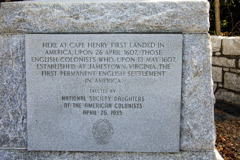
Obviously the ship touched down somewhere near “here”. The definition of “here”, I think, can be pretty loosely interpreted. But it’s an example of an n-fer component that isn’t immediately obvious from any single source.
Can I log it?
For this specific component, as long as you are roughly 100 feet from the northern or northeaster section of the shoreline, the definitive answer is, “probably”. Is it a given? I don’t think so. And this is where yet another interesting part of n-fers comes into play.
Many times the n-fer is obvious. US-2878 Lincoln Woods State Park is entirely contained in, and in fact shares exactly the same border, with US-5483 Lincoln Woods State Forest. This is a case where there is shared management of the property among two different entities, and the map coordinator for Massachusetts (who lives in the midwest, why is that?) decided that they were two distinct references. You can sit anywhere in the park and claim the forest.
A lot of the time, though, it isn’t so clear, and it is up to you, the activator, to decide whether you are in an n-fer or not. For some it’s a moral decision. For others it’s a little more practical. Most of the time we don’t have a tape measure in our kit and it won’t be obvious if you are within the required 100 feet of a trail. Or, as we’ve seen, the trail itself might be so vague that you can feel comfortable claiming it just about anywhere,
In the end it is your decision
POTA is self-governed, meaning that there are a set of published guidelines that you will use to decide if a set of parks are an n-fer. No one is going to check on you, if you say it is, it is.
That doesn’t mean that people are necessarily going to agree with you.
I’ve noticed a really awful trend lately of activators “passing the mic” at a park without really passing it, and these are very often at n-fer parks. The single exchange goes something like: “You are five-nine in all three parks and all four operators.” Everyone chuckles and logs ’em all. I’d really like to see an end to this practice, it isn’t doing anyone any favors, and honestly I wonder if it is even in compliance with FCC on-air reporting requirements in some cases. If you are currently activating like this, just know that there are quite a few of out here who don’t agree with you. I personally won’t work these stations.
But that is POTA, right? It is your own personal decision on what you think a valid activation is. It applies to this style of operating just as it does claiming an n-fer, which we just saw is really unfair to those who live in areas where parks are sparse. At the end of the day, POTA is all about getting out into a park and enjoying operating there, and whether you decide to gamify it or not is, again, your decision. We can grouse and nitpick all we want, but at the end of the day we can’t really control how others enjoy the hobby.
Views: 60


2 Responses
With “passing the mic” please note that it is ok to use a control operator per FCC. Some of us with mobility issues, autism, and other various scenarios make it imperative to do so. Please work us too. 73 W3AAX
I understand and agree with the reasoning, but I feel like that scenario is being abused by some groups… I’m sure you’ve heard “You are 5 by 9 all three parks all five operators” more than a few times. I won’t work those ops.