This is the mountain that inspired Henry David Thoreau to write, in 1858, “I think I could spend a year on the mountain, wandering over its table-lands or sitting on its peaks, and then I should be compelled to go down and begin a new life below.” He spent a lot of time on Mount Monadnock, hiking, exploring, and sleeping under a ledge now known as Thoreau’s Ledge. On occasion he would bring his friends Ralph Waldo Emerson or Bronson Alcott. These early Transcendentalists saw the mountain, rising singularly from the surrounding plain, as both a testament to strength in the face of time and also as a personal connection to the spiritual.
Today, between 100,000 and 125,000 visitors retrace Henry David’s footsteps every year, making 3,100-foot Monadnock one of the most-hiked mountains in the world. On a single day in early fall up to 6,000 visitors will attempt the ascent, according to Yankee Magazine. It’s a short hike, just two miles from the bottom to the top, but in that short distance you are ascending nearly 1800 feet, so that two mile walk is going to take a few hours.
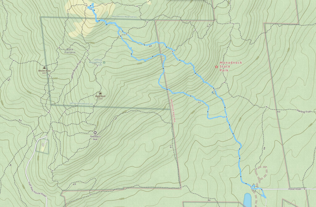
There are many ways to approach Monadnock, and you’ll find both official and unofficial parking areas ringing the park. The trails on the Dublin side (to the west) tend to be a bit longer, and the same coming in from the north. The Pumpelly Trail, an eight-mile roundtrip starting at Dublin Lake in the northeast, is I think one of the gentlest, running along a set of ridges up to the peak.
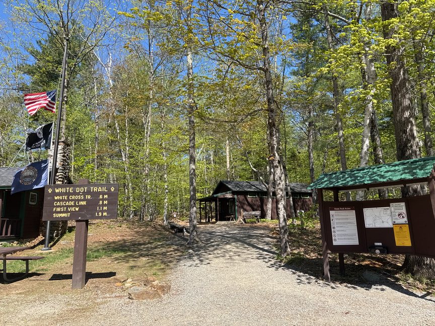
Most visitors start at Monadnock State Park Headquarters on the southern, Jaffrey, side of the hill. There are large parking areas here, a camp store with both trail and camping items, and rental sites for camping. There are restrooms and hookups and all of the things you might need for a few days.
We need to talk about parking. In June, July, August, and October (foliage season) you will often find a line at the summit of people waiting to take a selfie. The trails can get pretty crowded, as in you are not going to not see people. In the winter, snow and ice make it difficult but not impossible to summit, but you are going to need to plan carefully for the activity. This isn’t the White Mountains, but it is still a harsh environment with weather that can change rapidly, especially in the winter months. I noticed that the camp store has micro-spike rentals in case you get there and realize that there’s ice you need to cross.
Because of the crowds, there’s now a parking reservation system in place. In 2025 the fee is $15, and your best bet is to grab a reservation online. NH State Parks uses ReserveAmerica at https://newhampshirestateparks.reserveamerica.com. My visit was in mid-May, and the parking area was maybe a quarter full. In another month I wouldn’t have found a spot without a prior reservation. If you are parking in the HQ lots, check in at the camp store before you head up the hill. It appears to me that the park is open 24/7, which surprised me — a note on the wall of the camp store points out that if you are going up in the dark you should carry a flashlight.
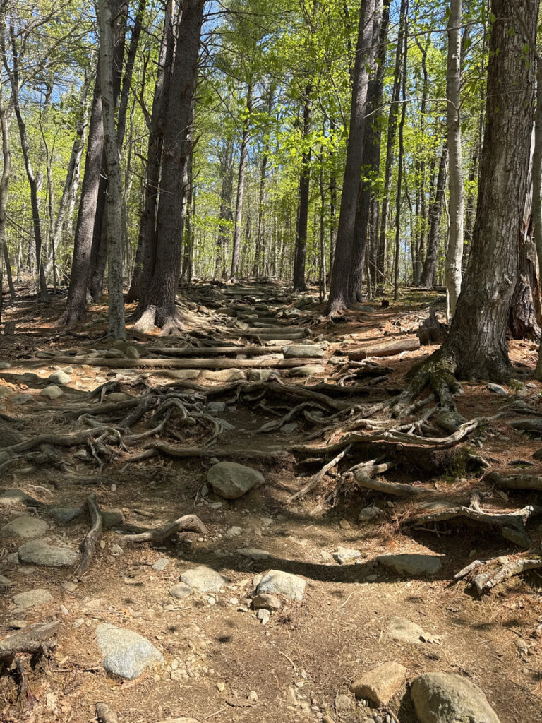
The trail starts out as a rocky, steady upslope for about a mile, and then you’ll climb a series of rock faces until you pop above the tree line. In mid-May the trail was for the most part dry, with a few areas of moving water. The snow and ice have been gone for a while at this point, so this is just normal flow. I didn’t run into any truly muddy or impassible areas.
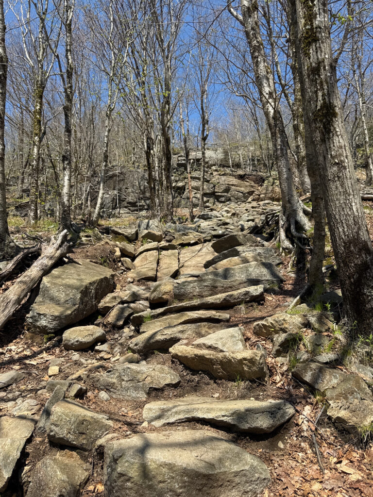

You’ll be in the trees for most of the hike. In fact, the hill was originally completely forested. Early settlers had started to clear areas around the summit for grazing, and apparently there were quite a few wolves who lived on the mountain and were thrilled to have this early meal delivery service. The settlers, in an attempt to get rid of the wolves, set fire to the summit. The fire was so fierce that it removed the soil from the peak, and that’s exactly the situation today, trees on the bottom, then an abrupt transition to no trees. It’s something of a unique environment and the top of the mountain supports alpine plants that you would find on much taller hills in the Whites.
In both directions, going up and coming down, I was surprised at the large number of people who were literally not carrying anything. No food, no water, no bag, just gym shorts and a t-shirt. Very casual. It took me six hours to get to the top and back and I drank nearly two liters of water and ate twice! To be fair, most of these folks were in their twenties and many of them were summiting in an hour. I even watched people RUNNING up and down the hill. I tend to give way for folks who are faster than me, and I did several times on this hike, I’m wondering what it looks like on a busy day!
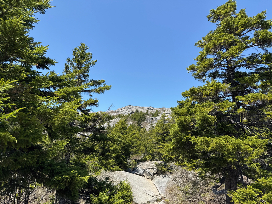
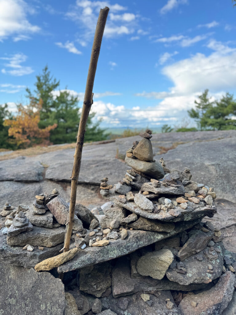
Once you get above the tree line the trails are marked with paint and cairns. You can see the destination for a good half an hour, and you certainly can just walk up to the top by whatever route you want at this point, but the trails have been laid out with the thought of making life a little easier for hikers, so try to avoid the temptation to just Leeroy Jenkins it to the top.
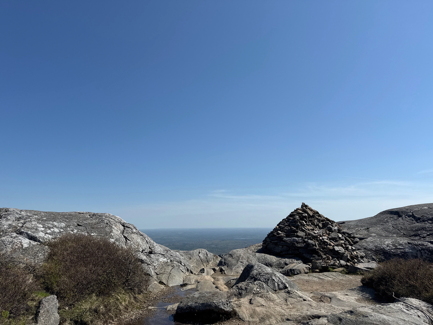
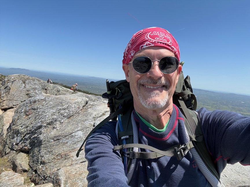
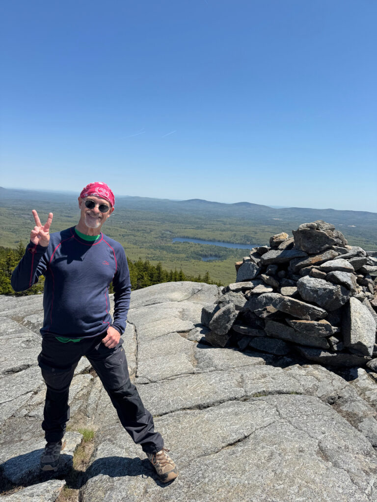
The summit was somewhat crowded when I reached it — nothing like the lines you’d expect in July, but at least 20 people enjoying the day. The top is fairly large and had a steady, strong wind with bigger gusts on the day I visited, so many were taking shelter behind some of the larger outcroppings where they could take in the rays and the views.
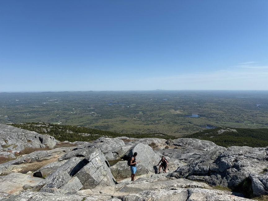
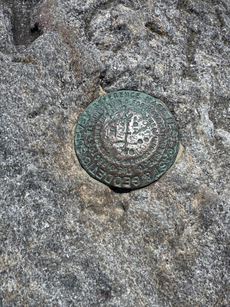
The view is so spectacular because of the way Mount Monadnock was formed. The rocks here are primarily schists and quartzites that were laid down almost 400 million years ago. These formations underwent intense pressure and heat over hundreds of millions of years and were very, very deep, resulting in extremely hard rock. The stone that makes up Monadnock is there because everything else around it was softer eroded away…limestones, sandstones, and so on. The name itself, MONADnock, indicates that it is a singular feature, and in fact other mountains around the world that were formed like this are called little-m monadnocks.
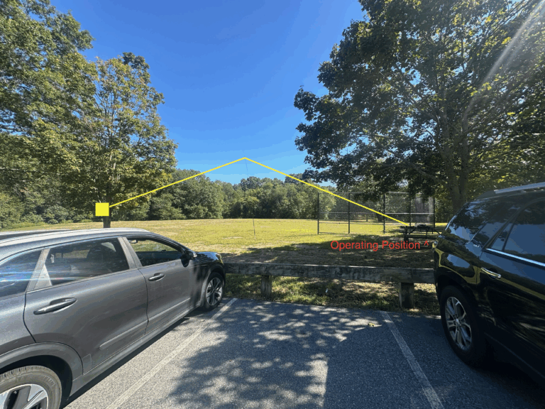
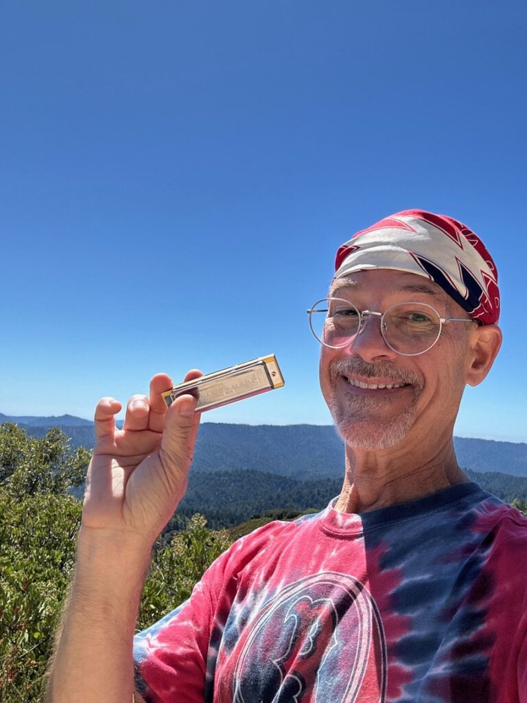
I spent some time just enjoying the view, and then set up the station: Elecraft KX2 feeding a Gabil GRA7350T loaded vertical. I’d brought a 17′ whip with me as well, but the wind was steady enough and the gusts high enough that I opted for the shorter, 10′ loaded vertical with four 15′ radials. The wind was from the south, so I set up on the north side of the peak in the lee, about 50′ down on a level spot, using SOTAGoat to make sure I was still in the SOTA activation zone.
It was a weird activation. A good one, and a successful one with 18 QSOs on 20m CW, but a long one as folks would wander down from their perch upslope, where they’d been trying to guess what I was doing, to ask what I was doing. Doug N1OGS stopped by with a few friends to say hello and talk rigs, and not long after a guy who looked like Hippie Jesus, all tie-dye and dreds, came over with his lady friend to chat. He was pretty out there but I’d lived that life, too, many decades ago, and so we spent a quite a bit of time talking about lots of New Age sorts of things, energy and spirits and the soul of the mountain and connecting with the earth.
At one point his eyes brightened and he said, “Hey! Wanna juggle?” and pulled out juggling bags. Why yes, I do like to juggle, and we juggled together on top of the mountain for ten or fifteen minutes while we chatted some more. I think it’s really good to live your life in a way that you are open to this kind of completely random interaction — we actually discussed this very point — as you just never know what cool and fascinating person or thing you’re going to run into, even 3,000 feet in the air! As I was packing up the station I saw that he and his lady friend were flying a kite in the 30-mph breeze directly off of the summit.
Coming down is tougher than going up, as experienced climbers will quickly tell you. Going up it’s a simple matter to just keep falling forward, but going down the fall is much more perilous! The advice is to summit on the White Dot trail, which is relatively steep and direct, and then come down on the White Cross trail, which is more forgiving. Don’t get me wrong, you still have to descend 2,000 feet and it is rocky at the top, but as I came down White Cross I remembered what I’d climbed on White Dot and was happy to not have to go down that direction.
I lived in nearby Rindge NH when I was Editor of 73 Magazine, based in nearby Peterborough, and climbed Monadnock several times back then, usually coming up the Dublin trail. I’d rate Dublin and White Dot to be of similar difficulty, but Dublin is a little longer hike. If it’s your first time, and nearly everyone I spoke with said that it was theirs, stick with the HQ trails.
In terms of prep, be sure to take water. You also are going to want some good bug spray, because the gnats and black flies come out around the beginning of May and will be there all summer. They can get pretty fierce. On my May 15 hike I was happy to have spray below the tree line. Also, there aren’t any trees on top, and so you won’t have any natural supports for a wire. It’s also very windy, all the time. I chose a short vertical and brought a guy line which I didn’t need, but I also was doing the SOTA activation (W1/HA-009) in addition to POTA, and it required me to be within 75 meters of the peak elevation, so I had to be out in the open. If I was just going to do a POTA activation I might do it from below the tree line and use an EFHW. There are blueberries later in the summer that you can snack on all over the mountain, and they are delicious!
It was so nice to be back in an area that I’d spent significant time in earlier in life. There’s a beauty about New Hampshire that I’ve not seen anywhere else, and it was really good to reconnect with a mountain that I’d also spent a fair amount of time on but hadn’t visited since the 2000s. It’s only two hours from my home QTH — two hours from several big cities, too, which is why it is so popular — and I’ll likely come back a lot sooner than it ended up being the last time.

One Response
Fantastic report as usual Perry, and the WX is lovely also