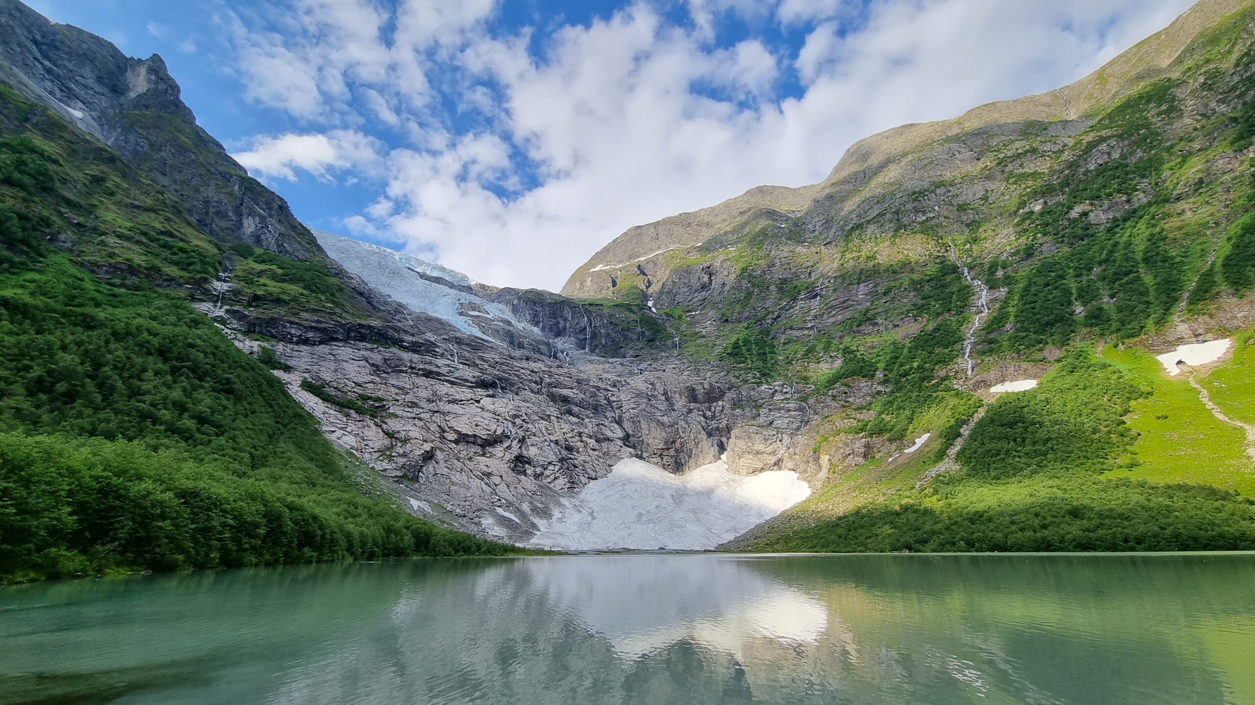
Jostedalsbreen national park is the home Europe’s largest remaining ice cap, the Jostedal glacier. With it’s 1310 square kilometers (323 k acres) it’s set up to protect some of the most amazing scenery in Western Norway. The park is one of the largest intact wilderness areas in the country, and as with all nature it’s freely accessible by everyone. In this article I’ll cover one of the easiest ways to get to the reserve, although it’s not the best if you want to walk on the glacier itself.
My hike started at the parking lot at Breavatnet (translated: the glacier lake), which lies below the part of the glacier known as Bøyabreen. From the parking lot it was about half a kilometer to walk, passing a hotel and restaurant, before I met the amazing view above. The boundary to the national park is clearly marked with signposts along the trail, so there should be no doubt when you are able to activate. Immediately after passing the signposts, you’ll find a nice seating area with benches and views up to the remainder of the glacier.
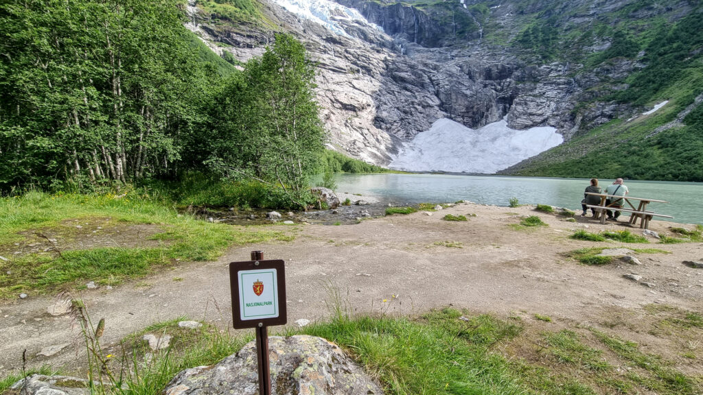
At this point the valley soars 1000-1500 meters (3-5000 feet) almost directly up around you, except for the valley you entered through. Not too many years ago the glacier reached the lake, now it’s barely visible over the top.
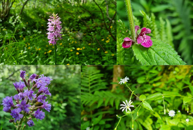
My visit was in early July, so the forest was lush and full of wildflowers, which made for a beautiful hike. The summer heat also meant that the glacier was calving, and while I was there two large chunks fell down the cliff face at the end of the lake. I set up my gear at a safe distance, at a place I had a beautiful view of the lake and mountains around it.
I hiked further in past this point; along the forest you see on the left side of the lake. Sadly, my activating spot had very bad cellphone coverage, so I had issues spotting. Using SOTAmat would probably solve this, but I didn’t have that set up at the time.
The valley faces directly south, meaning it’s easy to reach mainland Europe from there. I also managed to reach US stations, so DX contacts are also possible. My rig of the day was a Kenwood TS-480SAT with 100W and a linked dipole set up as an inverted vee. Due to the spotting issues mentioned earlier I struggled to get 10 in the log, but I managed to activate after a while. Of course, the location and band conditions may also have affected this.

The park is accessible from many other locations. There are three official visitor centers, but you may also hike on your own from many other locations. Only about half of the park is covered by ice, so most of it is safely accessible without specialist gear or a glacier guide. If you plan to visit the glacier, it’s strongly advised to stay with a guide, or someone experienced in glacier travel. Updated travel information can be found on the National park’s official website. Some of these places are accessible by car, like the Bøyabreen location, but it’s important to note that all motorized traffic is illegal within the park boundaries, including the use of drones. Other locations require significant hikes, giving you wide range of options for your visit.
If you want to see more of this activation I have a short video with more views of the area and hike.


One Response
another great review, Bob, your pics are spectacular, well done again 73 Tony de G1JPV